The Outdoors Journal
Field-tested guides and trail stories.
Trip reports, gear reviews, and how-tos from the Outdoors team. Plan smarter, explore further.
Subscribe via RSS
Featured story
The South Kaibab Trail in the Grand Canyon: Ooh Aah Point, Skeleton Point and the Tipoff
The South Kaibab Trail drops down a ridge from the South Rim with no water and very little shade. What each stop is like from Ooh Aah Point to the Tipoff, why the Tipoff is as far as you can go after the August flood, and how to get to a trailhead with no parking.

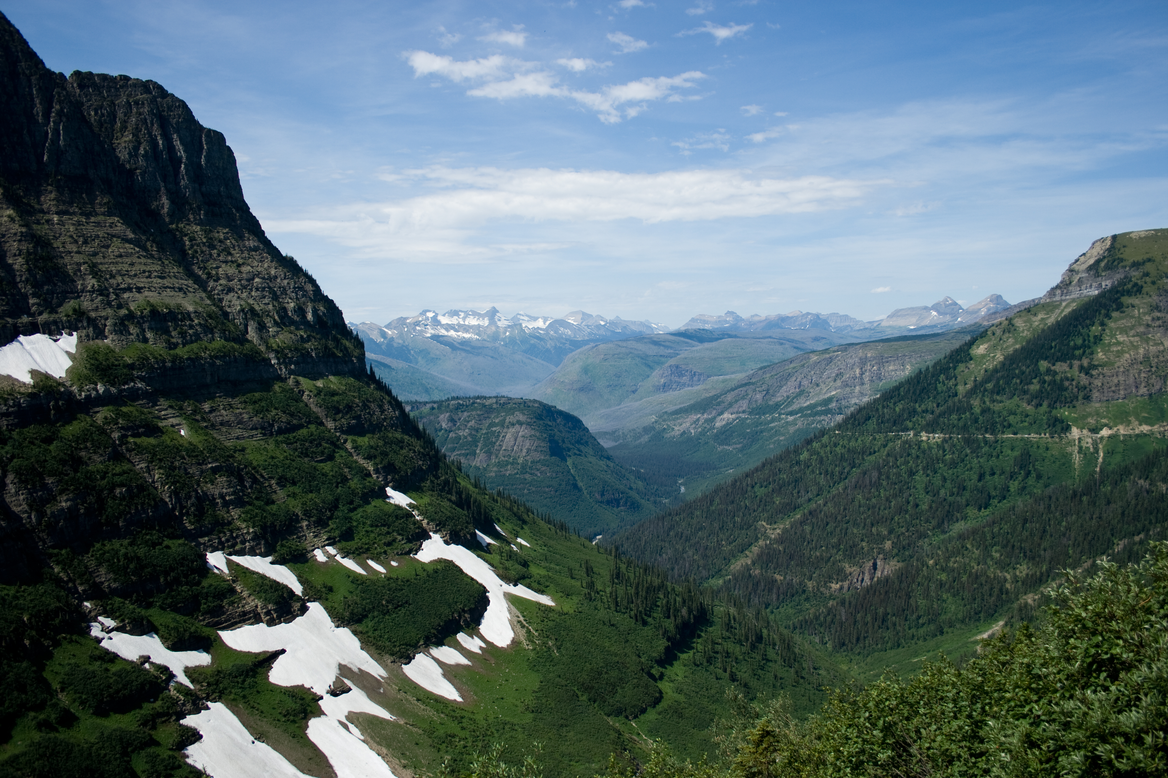
The Highline Trail in Glacier: the ledge, Haystack Pass and Granite Park Chalet
The Highline Trail starts on a shelf cut into the Garden Wall above Going-to-the-Sun Road, then runs north along the wall to Granite Park Chalet, 7.6 miles from Logan Pass. What each stretch is like, how to get back from The Loop, and when the snow is usually gone.

Cactus to Clouds: the Skyline Trail from Palm Springs to the tram, and when to try it
There is a ten-minute tram up Mount San Jacinto. The Skyline Trail climbs the same 7,900 feet on foot, from behind the Palm Springs Art Museum to Long Valley, with no reliable water and no shade on the lower mountain. Here is when to go, how to get back down, and where to park.

Blood Mountain in autumn: when the colour actually peaks, and what changed on the trail this year
Blood Mountain is the highest the Appalachian Trail gets in Georgia, at 4,458 feet. North Georgia was 2% turned on October 1 and peaks late in the month, the connector trail was rebuilt in June so most published mileage is out of date, the lot holds 38 cars, and there is no water anywhere on the mountain.

A Dam Broke Above This Trail in 1982
The Ypsilon Lake Trail climbs the Roaring River out of the Lawn Lake Trailhead, up the path the 1982 Lawn Lake Dam failure scoured. Four and a half miles in it reaches Ypsilon Lake, under the east face of a mountain named in 1889 by a woman who never climbed it.

The Cavalry Cut This Trail in the 1890s
Troop K of the 4th Cavalry built Old Army Pass while stationed in Owens Valley. The earliest written record of it, from 1926, says it was sometimes difficult of passage on account of snow. That has not changed.

Mount Tallac Trail: the whole of Lake Tahoe from a summit you can walk up
Mount Tallac rises straight off the west shore of Lake Tahoe, and the trail to the top runs 4.75 miles one way by our measurement, climbing 3,304 feet past Floating Island Lake and Cathedral Lake to a 9,738 foot summit. What each stretch is like, what the permit rules say, and what you can see from the top.

South Sister Climber Trail: the highest peak in Oregon you can hike to the top of
South Sister is the third-highest mountain in Oregon and the highest you can reach on a trail. The climber trail runs from Devils Lake past Moraine Lake and up loose red cinder to the crater rim and Teardrop Pool. What each stretch is like, the permit you need, and how to plan the day.

Cascade Pass and Sahale Arm: past the pass to the ridge above Doubtful Lake
The Cascade Pass Trail in North Cascades National Park climbs switchbacks through old forest to Cascade Pass, and the Sahale Arm Trail keeps going up an open ridge above Doubtful Lake toward the Sahale Glacier. Here is what the Park Service says about the distances, the drive in, snow into July, and staying on the trail.

Humphreys Peak Trail near Flagstaff: aspens, a saddle and a rocky ridge to the highest point in Arizona
The Humphreys Trail climbs from the Arizona Snowbowl outside Flagstaff to Humphreys Peak, 12,633 feet, the highest point in Arizona. It goes through pine and aspen to treeline, onto the saddle above the Inner Basin, and up a rocky ridge with a few false summits. What each stretch is like, when the aspens turn, and why you stay on the trail above the trees.

The Knife's Edge: Snowgrass Flat to Old Snowy in the Goat Rocks Wilderness
Snowgrass Trail #96 climbs through forest and meadows to the Pacific Crest Trail on the rim of the Goat Rocks. Old Snowy Mountain is a short scramble off the trail, and north of it the crest narrows into the Knife's Edge. 9.51 miles, about 3,580 feet of climbing, and no shelter on the ridge when the weather turns.

Ice Lake Trail near Silverton: a waterfall, two basins and a headwall to a brilliant ice blue lake
The Ice Lake Trail runs 3.5 miles one way from South Mineral Road outside Silverton. It climbs through forest past a waterfall, crosses a lower basin full of wildflowers, and goes up a headwall to Ice Lake at 12,260 feet. What each stretch is like, why you should get to the trailhead early, and how to plan around the afternoon storms.