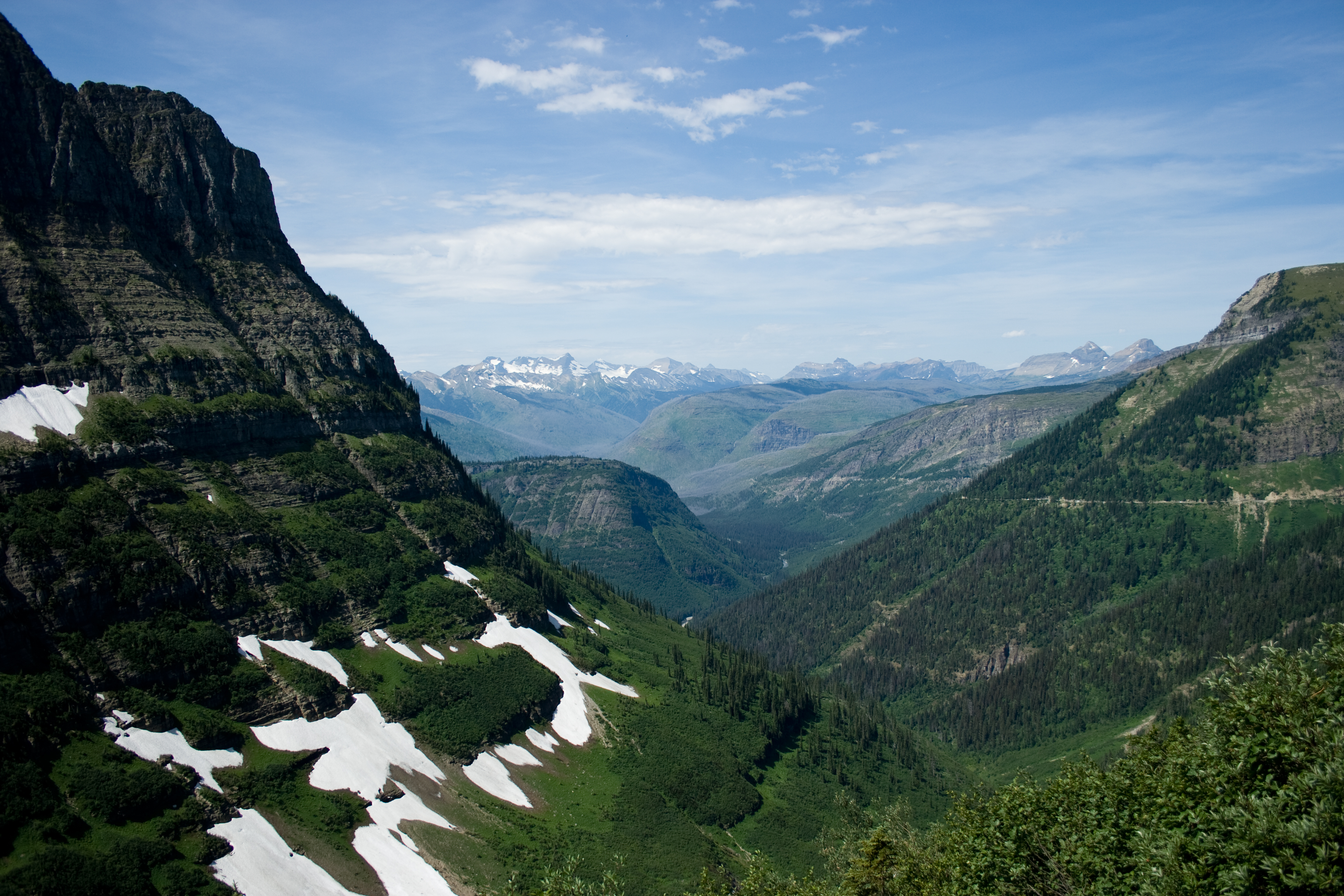
The Highline Trail in Glacier: the ledge, Haystack Pass and Granite Park Chalet
The Highline Trail starts on a shelf cut into the Garden Wall above Going-to-the-Sun Road, then runs north along the wall to Granite Park Chalet, 7.6 miles from Logan Pass. What each stretch is like, how to get back from The Loop, and when the snow is usually gone.

The Highline Trail starts across Going-to-the-Sun Road from the Continental Divide sign at Logan Pass, and within the first half mile it is a shelf cut into the Garden Wall. The road is right below you. On the lidar we used for the reel, the trail runs about 100 to 180 feet above the pavement for most of that first stretch. After that the trail opens up and contours north along the wall for miles, with the McDonald Valley on your left the whole way.
The National Park Service calls it "the very popular Highline Trail," and most people hike it one way: start at Logan Pass, finish at The Loop on Going-to-the-Sun Road.
The route, in order
The ledge. The exposed section comes almost immediately. The drop is on your left, so keep to the rock side and take your time.
Along the Garden Wall. Past the ledge the grade is gentle. The trail crosses open green slopes below the wall, mostly level, with the valley falling away beside it.
Haystack Pass. About three and a half miles in, the trail climbs to the saddle beside Haystack Butte. It is the one sustained climb on the way to the chalet, and the high point of the route sits just past it, a little under 7,300 feet on our measurement.
The Grinnell Glacier Overlook spur. Around 6.7 miles from Logan Pass, the Garden Wall Trail branches off uphill toward the Grinnell Glacier Overlook. Published figures for its length and climb vary, so check a current park map before you add it to a long day.
Granite Park Chalet. The NPS puts the chalet at 7.6 miles from Logan Pass, with about 800 feet of climbing. The Great Northern Railway built it in 1914 and 1915. It is a National Historic Landmark, and you can still only reach it by trail. Since 2026 Belton Chalets has run it under a park concession, so book an overnight stay through the chalet directly.
Getting back
From the chalet, most hikers drop down to The Loop. The NPS lists the whole one-way hike, Logan Pass to The Loop, at 11.8 miles with 2,388 feet of climbing and 4,773 feet of descent. You will need a ride or a shuttle between The Loop and your car.
In 2026 the park required a Logan Pass Shuttle ticket for longer day hikes, and it named Highline Trail to Granite Park Chalet as one of them. Tickets were sold only on Recreation.gov, and everyone age 2 and older needed one. Vehicle reservations were not required anywhere in the park in 2026, but Logan Pass parking had a three-hour limit from July 1 to September 7. Rules change from year to year, so check the park's page for the season you are going.
When to go
The NPS says the park's higher trails are "typically snow free by late July." Early in the season the Highline can stay closed for hazardous snow, so late July and August are the safest bets.
The short version
- Start: Logan Pass, across the road from the Continental Divide sign, about 6,650 feet.
- To Granite Park Chalet: 7.6 miles one way, about 800 feet of climbing (NPS).
- To The Loop: 11.8 miles one way, 2,388 feet up and 4,773 feet down (NPS).
- The ledge: along the Garden Wall, right at the start.
- Season: late July and August, once the snow is gone.
- Logistics: plan the shuttle back from The Loop before you start.
Image credits
Lead image: the McDonald Valley from the Highline Trail, by Katie Brady for Glacier Park on Flickr, CC BY 2.0, via Wikimedia Commons.


