Wheeler Peak: Hiking New Mexico's Highest Point from Taos Ski Valley via Williams Lake
The most direct trail to the highest point in New Mexico starts at a ski area. The Williams Lake route in order, from the chairlift to the lake to the summit switchbacks, plus distance, parking, and the annual summer closure.
Wheeler Peak is the highest point in New Mexico, and the most direct trail to it starts at a ski area. You park at the Williams Lake trailhead in Taos Ski Valley, walk past the chairlift, and climb about 3,000 feet to the summit.
The route, in order
The ski area. From the Williams Lake trailhead lot, walk south on the broad trail past the restaurants and the ski area buildings. The Forest Service route passes the Bavarian Lodge at the bottom of the Kachina chairlift, Lift 4. After the chairlift, follow the signs for Williams Lake Trail #62. The first stretch crosses private land, so stay on the trail.
The spruce. The trail enters the Wheeler Peak Wilderness within half a mile and climbs gently through Engelmann spruce. Several avalanche chutes cross this stretch, and the Forest Service suggests taking a look at what they've done to the forest.
Williams Lake. After nearly 2 miles you reach the junction with Wheeler Peak Summit Trail #67, on your left. The lake is a short walk farther along #62. The Forest Service says it has no fish because it freezes in winter. Camping and campfires are not allowed along the shore.
The summit trail. Trail #67 climbs about 2 miles from the lake to the top, and the grade gets steeper. It switchbacks up through several scree fields on a narrow, uneven tread, and you climb out above the trees. The Forest Service asks hikers to stay on the trail here to keep rock from falling. Horses are not allowed on #67.
The ridge and the summit. The trail tops out on the ridge just south of Mount Walter, and the summit is a short walk south along it. Most published sources give Wheeler Peak's height as 13,161 feet. The National Geodetic Survey's current figure is 13,167. From the top, look west and down: Williams Lake is in the basin you just climbed out of.
How far it is
On the OpenStreetMap line we used for the video, it's 4.1 miles from the trailhead lot to the summit, with about 3,000 feet of climbing. The junction with the summit trail comes at about 1.8 miles. Plan on the same distance back down.
Getting there
From Taos, take US 64 north about 4 miles to NM 150, then follow NM 150 to Taos Ski Valley. Drive through the ski area parking lot and up Twining Road, then follow the signs for the Williams Lake trailhead and the Bavarian. Park in the large lot on the right where the road levels off. The Forest Service says the road is fine for most cars in summer and fall, and needs four-wheel drive in winter.
The annual closure
The Carson National Forest closes the Wheeler Peak and Williams Lake area for about a week every summer for local community and traditional purposes. The closure has usually fallen in mid to late August, and the dates are set each summer. Check the Forest Service's closure page before you plan a summer trip.
The short version
- Start: the Williams Lake trailhead lot in Taos Ski Valley, past the Kachina chairlift.
- First stretch: Williams Lake Trail #62, a gentle climb through spruce to the lake.
- Then: left onto Wheeler Peak Summit Trail #67, about 2 miles of switchbacks through scree, above the trees.
- Summit: 13,161 feet in most sources, the highest point in New Mexico.
- Distance: 4.1 miles one way and about 3,000 feet of climbing, by our measurement.
- Closure: about a week each summer. Check the Forest Service before you go.
Before you go
- How to choose the right trail difficulty
- Leave No Trace, in one minute. Camp at least 300 feet from the lake.
Looking for more? Browse New Mexico trails on Outdoors.
If you liked this peak
- Humphreys Peak, the highest point in Arizona
- Guadalupe Peak, the highest point in Texas
- Mount Elbert, the highest point in Colorado
Image credits
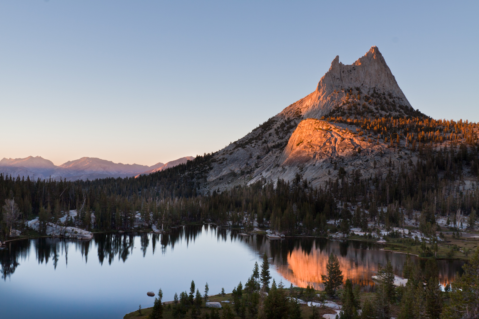
Lead image: Wheeler Peak, by the Southwestern Region, USDA Forest Service, CC BY 2.0, via Wikimedia Commons.