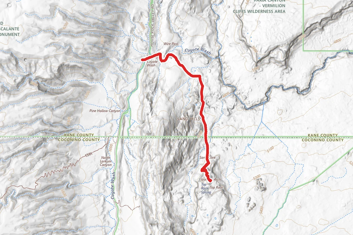
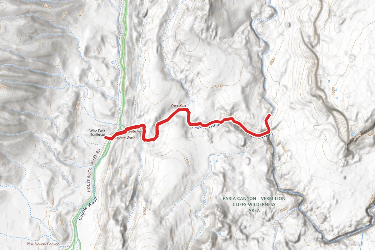
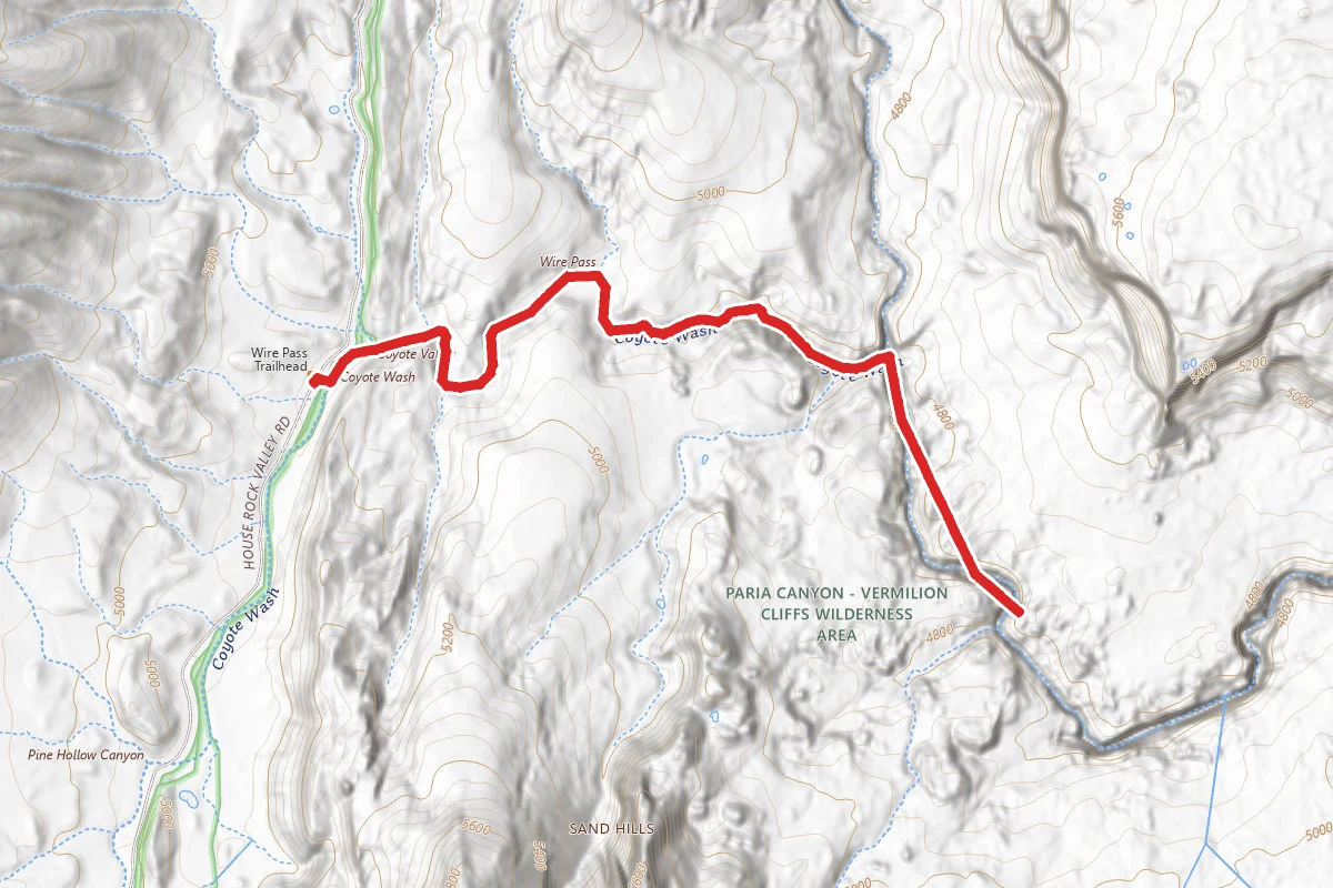
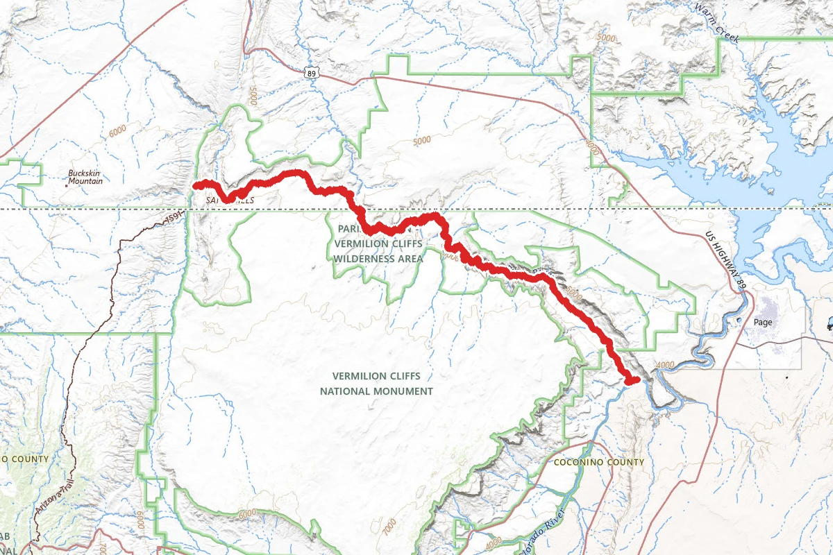
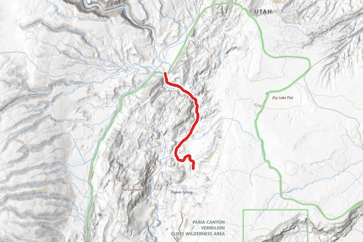
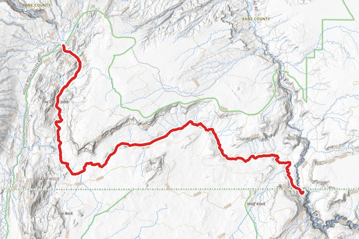
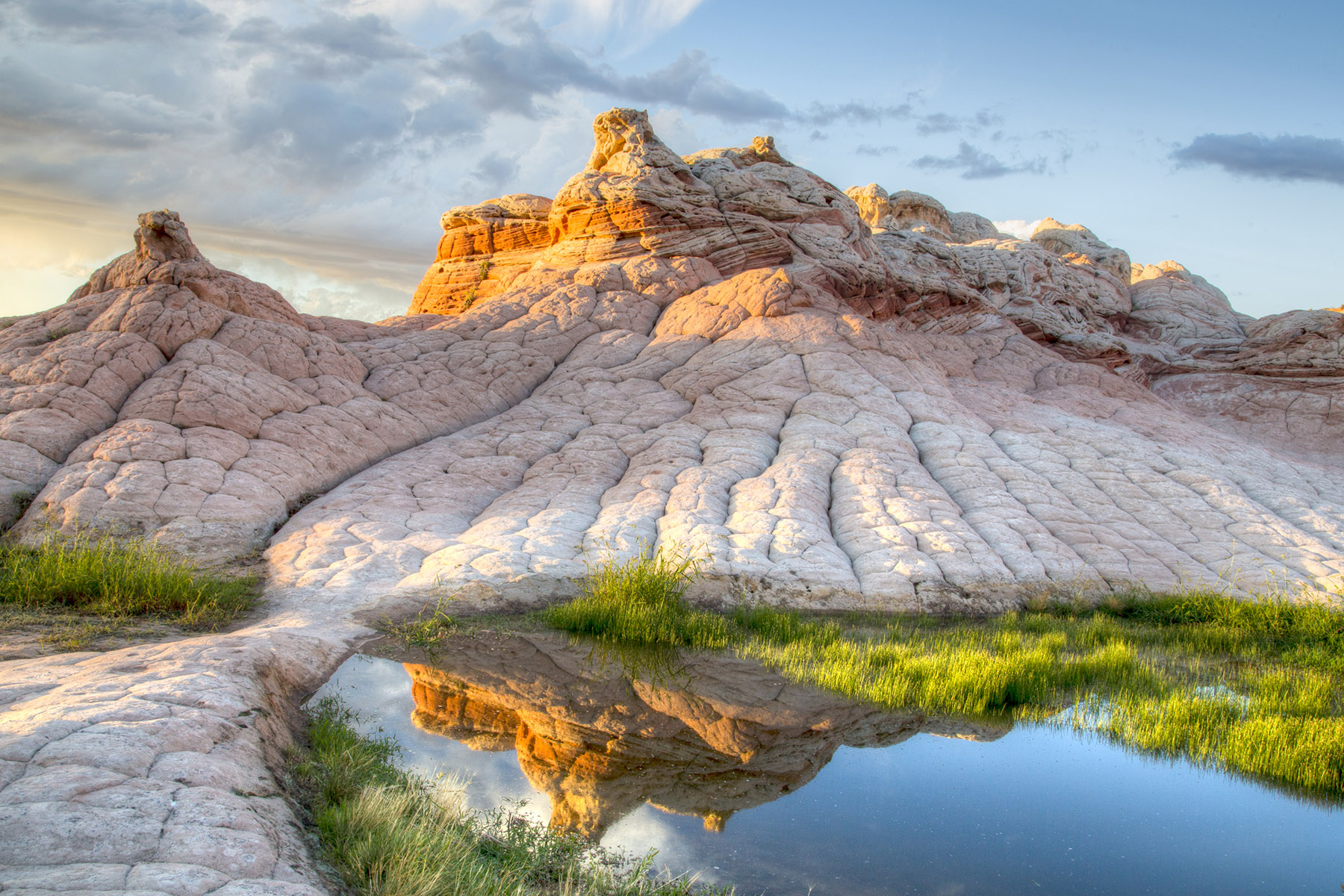
NOTE: A permit is required for this hike. To attain the permit you must win it through the permit lottery. For information about The Wave and the permit process, call the Ranger Station at (435) 688-3230 Walk across the road, to the east, and locate the hikers path. Sign in at the register box and read pertinent information. Soon the path drops into a wash. Walk down the wash (east) for .6 miles. Look for the signed path of use on the right side, above the wash, exiting Wire Pass Wash. Hiking becomes steep for the next few hundred yards, as an old 4WD road is followed to the top of the ridge and to the second register box. Once again, stop and sign in at the register. Shortly after leaving the register box, there may be an indication that the trail splits. Taking the left-hand fork is easier traveling. It continues east and passes large rock domes on the flats below. After passing the domes, the trail soon drops into a wash. It will be necessary to cross the wash and approach the slickrock ridge to the east of the wash. Continue to the east, up and over the slickrock ridge. Once on top, work down the east side (backside) of the ridge, but start bearing to the south (hikers right), and stay as high as it is comfortable, on the steep slopes of the ridge on the right. Landmarks to locate the Wave Vertical Crack or Notch Looking south, a large slickrock mountain comes into view. There is a long, vertical crack in the mountain. This crack becomes the landmark to steer toward for the next mile. The Wave is located beneath the mountain with the crack. On the way, remember to stay as high as comfort allows, hugging the sandstone slabs on hikers right. The Wave landmark - Notch Twin Buttes As travel continues south, two large buttes come into view. These are called the Twin Buttes, and come almost halfway through the hike. They are easier passed by walking up the slickrock bowl and going around the right side. A wash is encountered .5 miles after rounding the Twin Buttes. Multi-colored Domes Peer across the wash and notice the multicolored domes on the opposite side of the wash. These and the less obvious sandstone formations to the right are the Wave. Walk down into the wash, locate the dead juniper tree and the sandy path that leads up to the Wave. The Wave The area called Top Rock, is a collection of white Navajo sandstone formations. The south end of Top Rock divides North and South Coyote Buttes. The Wave is a chasm located on the northwest edge of Top Rock. The Wave is about .04 miles south of the Arizona and Utah state line. Top Arch Most hikers never venture this far past the Wave. This section involves third class scrambling. Only those experienced in slickrock scrambling should attempt to go to the arch and beyond. Continue up the sandstone, heading toward the right. Locate the arch at the top of the mountain. Find the easiest path to travel up the steep slickrock. The arch is approached from the backside of the mountain. From the arch, the red cones of South Coyote Butte are visible. Alcove This hidden treasure is rarely found by hikers. To locate the alcove, return the way you approached the arch. This time stay to the left, hiking over crossbedded sandstone. In the alcove, fine grains of sand have been tossed and turned, wielded by wind, leaving a sculptured creation carefully piled in its bowels. Melody Arch - Grotto - Window From the alcove, scramble up and left of the alcove to attain the top. Once on top, travel southeast, following the maze of ridges and desert tanks, staying as high as possible. Steer toward the eastern edge of the cap rock. Soon a chasm appears in front. Look down and into the grotto that contains the window and Melody Arch. Backtrack far enough to find an easy route down into one of the tanks, scramble out the backside and slide down into the Melody Arch Grotto. Dinosaur Tracks From the Wave: The small reptile tracks are on the other side of the wash, opposite of the Wave. To locate them, cross back over the wash and travel up to the level ground on the north side of the wash. Rather than retracing the return path back to Wire Pass parking, hike to the west. Stay against the steep slickrock mountain, as high as possible. The Wave can actually be seen from the tracks. The GPS coordinates given are to one track. Look around to locate many more, within 100 yards. Many of the tracks are found at the base of the steep slickrock slab to the north, and are in pinkish colored rock, just before the slabs become seemingly impossible to ascend. The footprints appear to be from small bipedal dinosaurs, most likely Grallator (Megapnosaurus) and Anomoepus.
Trail Conditions
Trail Conditions
Unknown
We have no current condition data for this trail. Check with the operator before you go, and submit a report below if you've been recently.
No recent condition reports. Be the first to share what you see on the trail.
We don't have curated agency sources for this trail in our cache yet. Outdoors is not the permitting authority — confirm conditions, permits, and access with the managing agency before you go. If you know who manages this trail, please tell us.
Reviews
No reviews yet
Be the first to share your experience and help others plan their visit.
Legacy import — verify before navigating
Path geometry came from our pre-launch legacy database. Routes have not yet been re-verified against the operator and may differ from the actual trail.

.jpg/1280px-Zion_Subway_Hike_(8014446382).jpg)