Torreys Peak: The classic 14er double partner — and Kelso Ridge if you want a real day
Torreys is named for John Torrey, the mentor to Asa Gray. Fifty feet shorter than its twin and a saddle traverse away. The Kelso Ridge knife-edge is many a Colorado climber's first taste of exposed ridge scrambling.

For most folks, Torreys is the side trip from Grays. The two summits sit on the same ridge, fifty feet apart in elevation and one saddle traverse apart in distance — the easiest 14er double in Colorado, and the most common way folks bag two on the same morning. But Torreys has its own classic line: Kelso Ridge, a Class 3 east-ridge scramble with a famous "knife-edge" step that is a whole lot of Colorado climbers' first taste of real exposed alpine ridge work.
So if Grays is the walk-up, Torreys is the walk-up plus the option to do something harder when you're ready. Heck of a peak to grow up on.
The peak at a glance
- Elevation: 14,275 ft (4,351 m)
- Rank in Colorado: 12th of 56 peaks above 14,000 ft
- Range: Front Range
- County: Clear Creek County / Summit County
- Coordinates: 39.6428° N, 105.8211° W
- Standard route: Saddle traverse from Grays (Class 2) — combine with Grays for 8.3 mi day
- Public land: Arapaho National Forest
How Torreys Peak got its name
John Torrey (1796–1873) was the most important American botanist of the early nineteenth century — a Columbia professor, the eventual official botanist for the late Lewis and Clark plant reports, and the mentor and collaborator of Asa Gray. Charles Parry climbed both peaks in 1861 and tagged them in tribute, giving the slightly higher summit to Gray (his closer collaborator and personal friend) and the slightly shorter one to Torrey, the elder figure of the pair.
It's a rare American mountain pair where the relative elevations actually mirror the academic genealogy. Heck of a footnote in mountain naming.
The standard route
For most folks, Torreys is the second half of a Grays-Torreys round trip out of Stevens Gulch. The full day is 8.3 miles round-trip with about 3,600 feet of gain. From the top of Grays, drop 600 feet to the saddle on a Class 2 talus path and climb back out to Torreys — usually less than an hour of extra time. That's the move.
If you're climbing Torreys solo, the same Stevens Gulch trail works: branch left at the saddle instead of continuing up Grays. Round trip is 6.5 miles with about 3,000 feet of gain.
Other ways up
The classic alternate is Kelso Ridge, the east ridge of Torreys rising out of the Kelso Mountain area. Class 3, with one famously exposed quartzite "knife-edge" step at about 13,800 feet. The exposure is real and the holds are good — but y'all, this is not the day to be hungover. About 7 miles round-trip with 3,400 feet of gain. Most parties climb Kelso up and descend the standard saddle route.
Kelso is the gateway scramble for a lot of Colorado climbers. If you cruise Kelso comfortably, you've got the technical foundation for Crestone Needle, Wetterhorn, or the Sawtooth between Bierstadt and Blue Sky. It's the line that promotes you to the next class of 14ers.
When to climb
The Colorado fourteener climbing season is short. The standard window runs from late June through mid-September — after the snow has melted off the trail and before the first serious autumn storm. Outside that window, you're committing to a winter ascent: snow travel, avalanche assessment, post-holing through drifts, and route-finding without a visible trail.
Inside the window, the rule that has saved more Colorado lives than any other is be off the summit by noon. Afternoon convective storms build over the high peaks almost daily in July and August. Lightning is the leading weather killer in the Rockies. Plan for a pre-dawn start — most experienced climbers leave the trailhead between 4:00 and 5:30 AM.
Where it sits
Torreys shares all of Grays' geography — both peaks rise off the Continental Divide just north of I-70, sixty miles west of Denver. Same Stevens Gulch trailhead, same rough Forest Service road, same small upper lot that fills before sunrise on summer weekends, and the same long walk up from the lower turnouts when it doesn't. That last part is real. Plan for it.
What climbers wish they'd known
If Kelso's on your card, climb it up, not down. The knife-edge is psychologically way easier going up. Down-climbing exposed Class 3 is technically the same difficulty but routinely produces stuck climbers and an awkward call to Alpine Rescue Team.
The saddle is where weather catches people. That exposed traverse between Grays and Torreys is the longest above-treeline section on the route with no clean retreat. If you see lightning building, descend straight back to the main trail and skip the second summit. Y'all, it'll still be there next weekend.
Before you go
A 14er is a long, exposed day at altitude. Read these first if you haven't already:
- Planning your first multi-day backpacking trip — same logistics apply to a long single-day summit push.
- How to choose the right trail difficulty — converting class ratings into honest fitness estimates.
- Leave No Trace, in one minute — alpine tundra heals on a geological clock. Stay on the trail.
Looking for the standard route on the map? Browse Colorado trails on the Outdoors App or jump to the Near Me view if you're already in-state.
If you liked this peak
- Grays Peak — the partner summit
- Longs Peak — the next step up in Front Range climbing
- Mount Blue Sky — the drivable 14er nearby
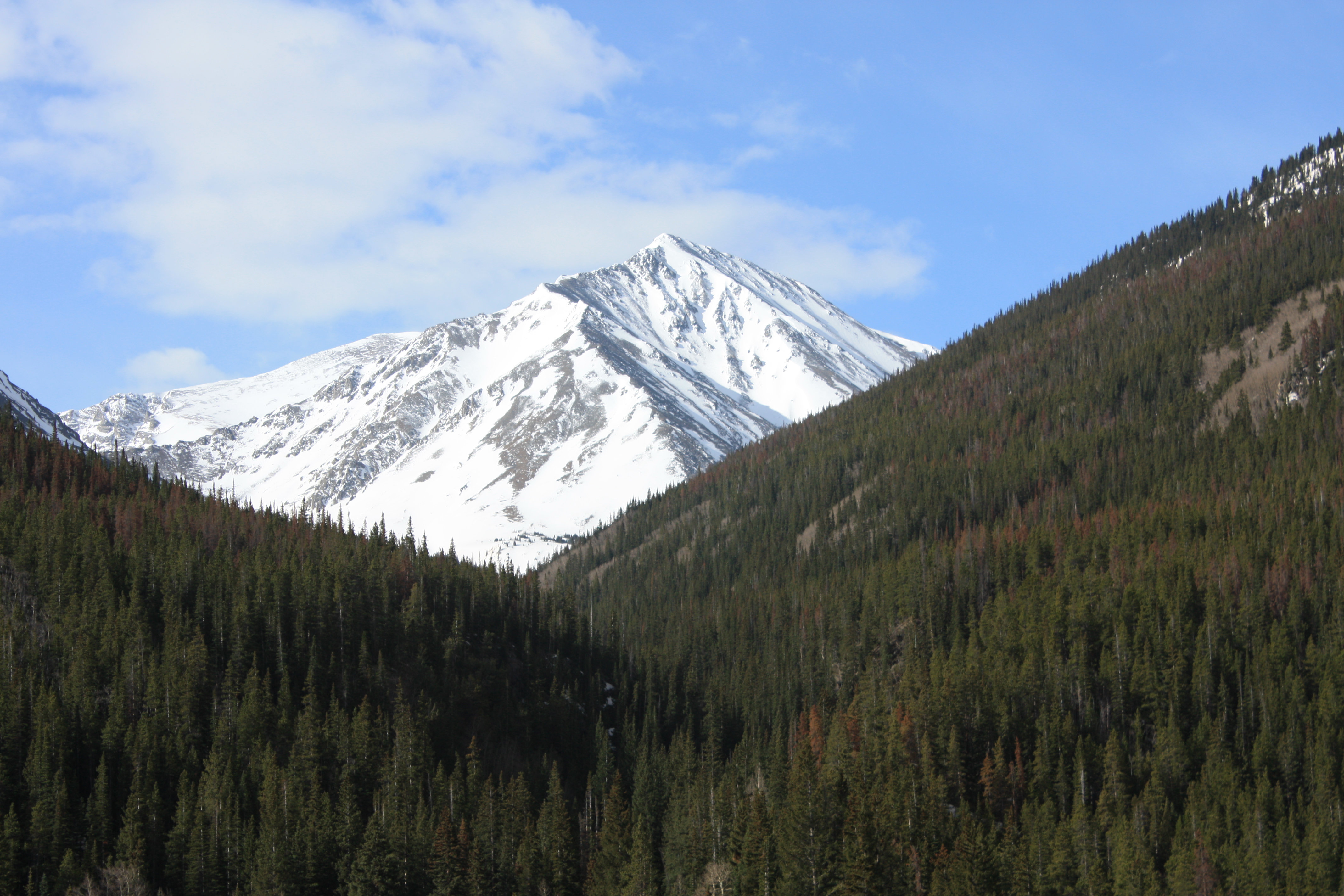
Hero photograph: Torreys Peak photographed from the I-70 / Bakerville interchange, Front Range, Colorado. by David Herrera, licensed under CC BY 2.0.


