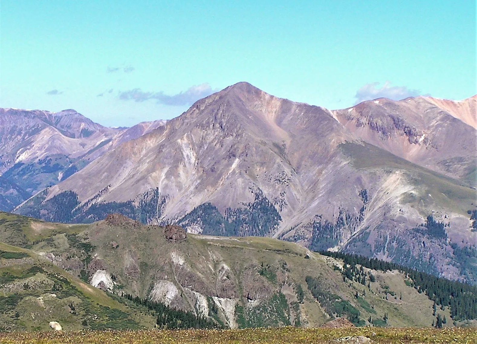
Sunshine Peak: The lowest fourteener in Colorado
Sunshine Peak is the shortest summit on the Colorado 14er list at 14,007 feet — just 7 feet over the threshold. The peak is climbed almost always as a side-trip from neighboring Redcloud.

Sunshine Peak is the lowest 14er on the Colorado list — its 14,007-foot summit clears the 14,000-foot threshold by just 7 feet. The peak is climbed almost always as a Class 2 side-trip from Redcloud Peak, a one-mile ridge traverse from the higher summit.
The peak at a glance
- Elevation: 14,007 ft (4,269 m)
- Rank in Colorado: 56th of 56 peaks above 14,000 ft
- Range: San Juan Mountains
- County: Hinsdale County
- Coordinates: 37.9292° N, 107.4256° W
- Standard route: Traverse from Redcloud (Class 2) — adds 1 mi to the Redcloud day
- Public land: BLM (Hinsdale County)
How Sunshine Peak got its name
Named descriptively in the mining era for the bright, sun-catching south face of the upper mountain. The name appears in mining-district records from the 1880s.
The standard route
From the summit of Redcloud, walk south along the connecting ridge on Class 2 terrain to Sunshine — about a mile each way, easy walking on stable talus. Most parties tag Sunshine on the way out and return over Redcloud on the way back.
When to climb
The Colorado fourteener climbing season is short. The standard window runs from late June through mid-September — after the snow has melted off the trail and before the first serious autumn storm. Outside that window, you're committing to a winter ascent: snow travel, avalanche assessment, post-holing through drifts, and route-finding without a visible trail.
Inside the window, the rule that has saved more Colorado lives than any other is be off the summit by noon. Afternoon convective storms build over the high peaks almost daily in July and August. Lightning is the leading weather killer in the Rockies. Plan for a pre-dawn start — most experienced climbers leave the trailhead between 4:00 and 5:30 AM.
Where it sits
What climbers wish they'd known
The return over Redcloud. The Sunshine-to-trailhead descent retraces the Redcloud climb — meaning a second 700-foot uphill at the end of the day.
Before you go
A 14er is a long, exposed day at altitude. Read these first if you haven't already:
- Planning your first multi-day backpacking trip — same logistics apply to a long single-day summit push.
- How to choose the right trail difficulty — converting class ratings into honest fitness estimates.
- Leave No Trace, in one minute — alpine tundra heals on a geological clock. Stay on the trail.
Looking for the standard route on the map? Browse Colorado trails on Outdoors or jump to the Near Me view if you're already in-state.
If you liked this peak
- Redcloud Peak — the traverse partner
- Handies Peak — the easy San Juan
- Uncompahgre Peak — the San Juans' highest
Hero photograph: Sunshine Peak in the San Juan Mountains, Colorado. by Jane Nearing, licensed under CC BY 2.0.


