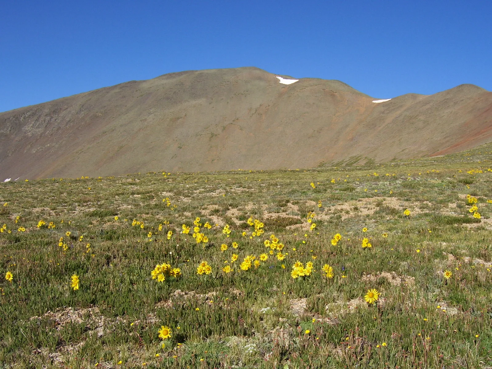
San Luis Peak: The most remote 14er in Colorado
San Luis Peak rises in the heart of the La Garita Wilderness — one of the largest wilderness areas in Colorado, with no high-clearance road access. The standard route is a 13.5-mile day with the longest approach of any standard-list 14er.
San Luis Peak is the most remote standard-list 14er in Colorado. The peak sits in the heart of the La Garita Wilderness — 130,000 acres of high alpine terrain with no internal roads, no developed trailhead, and a 6.5-mile-each-way approach to the summit. The peak gets fewer ascents per year than any other 14er in the state.
The peak at a glance
- Elevation: 14,022 ft (4,274 m)
- Rank in Colorado: 51th of 56 peaks above 14,000 ft
- Range: La Garita Mountains / San Juan Mountains
- County: Saguache County / Mineral County
- Coordinates: 37.9869° N, 106.9311° W
- Standard route: Stewart Creek (Class 1) — 13.5 mi RT, ~3,700 ft gain
- Public land: La Garita Wilderness, Rio Grande National Forest
How San Luis Peak got its name
Named for the San Luis Valley to the south — the high-altitude valley that the peak overlooks. The Spanish name predates American settlement.
The standard route
The standard Stewart Creek route ascends from the West Willow Creek trailhead — a Forest Service road from the historic mining town of Creede. About 13.5 miles round-trip with 3,700 feet of gain. The grade is gentle (Class 1) but the distance and the remoteness make the day longer than the elevation gain suggests.
When to climb
The Colorado fourteener climbing season is short. The standard window runs from late June through mid-September — after the snow has melted off the trail and before the first serious autumn storm. Outside that window, you're committing to a winter ascent: snow travel, avalanche assessment, post-holing through drifts, and route-finding without a visible trail.
Inside the window, the rule that has saved more Colorado lives than any other is be off the summit by noon. Afternoon convective storms build over the high peaks almost daily in July and August. Lightning is the leading weather killer in the Rockies. Plan for a pre-dawn start — most experienced climbers leave the trailhead between 4:00 and 5:30 AM.
Where it sits
What climbers wish they'd known
Tell someone where you're going. The peak's remoteness means cell service is limited and rescue response times are long. File a plan.
Combine with Creede. The historic mining town of Creede — staging point for the climb — is a worthy stop in its own right.
Before you go
A 14er is a long, exposed day at altitude. Read these first if you haven't already:
- Planning your first multi-day backpacking trip — same logistics apply to a long single-day summit push.
- How to choose the right trail difficulty — converting class ratings into honest fitness estimates.
- Leave No Trace, in one minute — alpine tundra heals on a geological clock. Stay on the trail.
Looking for the standard route on the map? Browse Colorado trails on Outdoors or jump to the Near Me view if you're already in-state.
If you liked this peak
- Uncompahgre Peak — the San Juans' highest
- Wetterhorn Peak — the Swiss-named Class 3
- Handies Peak — the easy San Juan
Hero photograph: San Luis Peak in the San Juan Mountains, Saguache County, Colorado. by John Sowell, licensed under CC BY-SA 4.0.


