Difficult
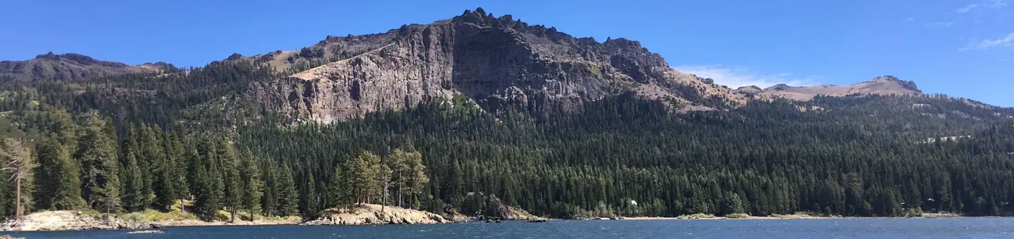
Grover Hot Springs to Sorensens via Charity Valley Trail to Burnside Lake Trail [CLOSED]
Markleeville, California
9.6 mi
Distance
2,995 ft
Elev. Gain
4h 26m
Est. Time
0.0
0 Reviews
About This Trail
There is no vehicle access to this trail in the park. See here for more information.
Trail Details
Point to Point
Route Type
Dirt
Surface
Dogs Allowed (Leash Required)
Dog Policy
Yes
Kid Friendly
No
Permit Required
Elevation Profile
Min:1,805 ft
Max:2,511 ft
913 ft
578 ft
Reviews
No reviews yet
Be the first to share your experience and help others plan their visit.
Trail Conditions
Trail Conditions
Unknown
Updated Unknown
No recent condition reports. Be the first to share what you see on the trail.
![Grover Hot Springs to Sorensens via Charity Valley Trail to Burnside Lake Trail [CLOSED]](https://www.nps.gov/common/uploads/structured_data/3C873CC3-1DD8-B71B-0B076FC2806DF140.jpg?width=800&quality=80)
Stay nearby
Campgrounds near this trail
Reservable
Grover Hot Springs State Park - TEMPORARILY CLOSED
0.1 mi away · CA
Turtle Rock Park
2.4 mi away · CA
 Reservable
Silver Lake East- Eldorado
3.2 mi away · CA
Markleeville Campground - Temporarily Closed
3.7 mi away · CA
 Reservable
Indian Creek Campground (ca)
4.4 mi away · NV
Toiyabe National Forest Crystal Springs Campground
4.4 mi away · NV
Similar length
Similar trails in California
.jpg/1280px-Lost_Horse_Mine_Loop_Trail_(16650877030).jpg)
Lost Horse Mine Loop
California
14.0 km152 mgain
Moderate
Potato Chip Rock via Mt. Woodson Trail
California
12.2 km1,108 mgain
Difficult
Iron Mountain Trail
California
8.4 km435 mgain
Moderate
Mission Peak Loop from Stanford Avenue Staging Area
California
9.3 km686 mgain
Difficult
Echo Mountain via Sam Merrill Trail
California
8.7 km1,194 mgain
Moderate
Echo Mountain via Sam Merrill Trail [CLOSED]
California
8.7 km1,194 mgain
Moderate