Status unknown — verify before visiting

We don't have current condition data for this trail. Check with the land manager before you go.

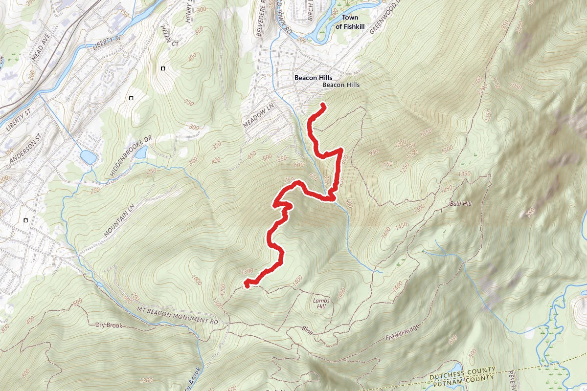
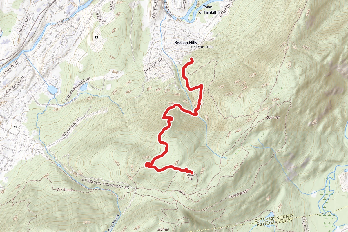
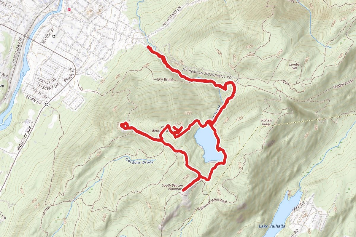
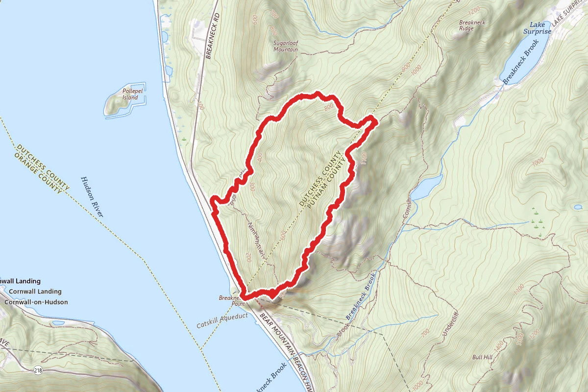
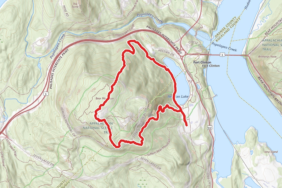
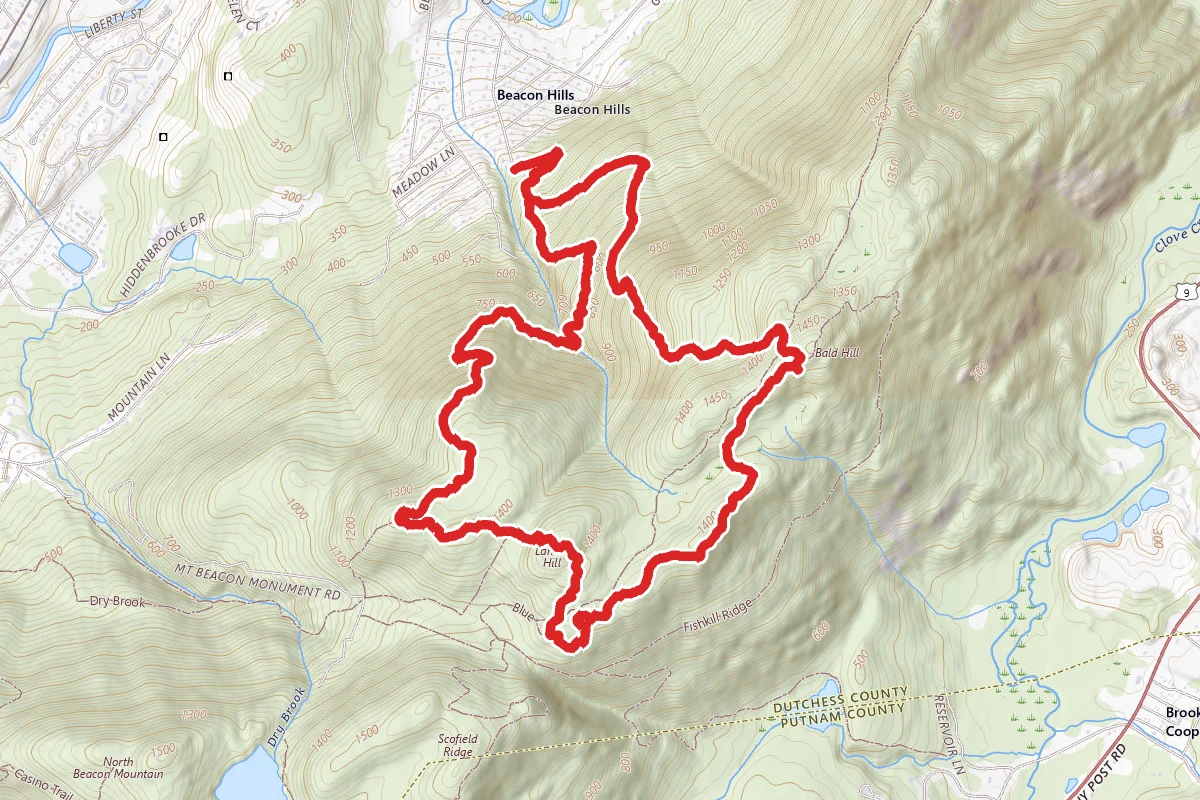
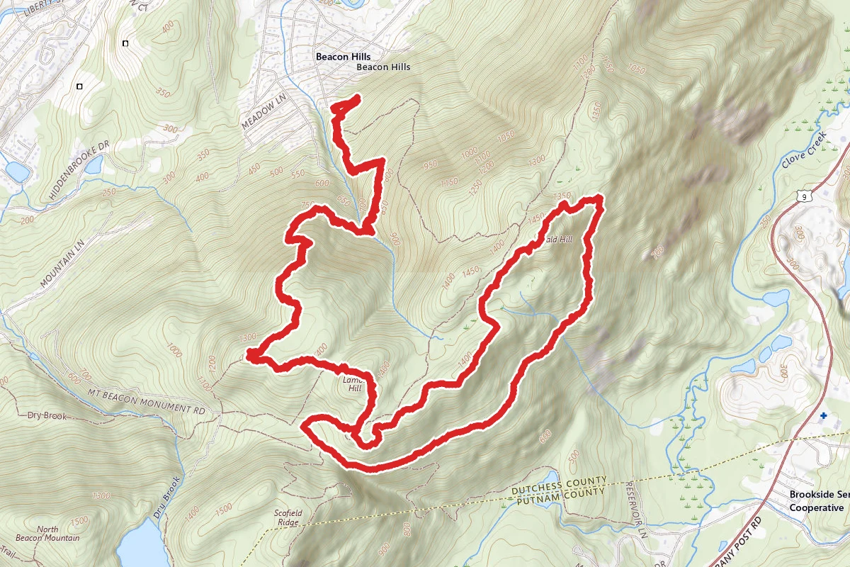
Fishkill Ridge Loop via Overlook and Fishkill Ridge Trail route map
DifficultLoop

Fishkill Ridge Loop via Overlook and Fishkill Ridge Trail

Beacon, New York

5.2 mi

Distance

1,821 ft

Elev. Gain

2h 30m

Est. Time

Loop

Route Type

Difficult

Difficulty

About This Trail

Imported description
This hike starts on the Overlook Trail, which ascends to the Fishkill Ridge Trail. You then follow the latter trail to Bald Hill, after which you descend by way of some woods roads, an unnamed white-blazed trail, and the Overlook Trail again. Along the initial part of the hike, there are good views to the north and west once you gain some elevation. The views from the Fishkill Ridge Trail are quite spectacular, with several spots where the New York City skyline is visible. On the way down, you pass the (marked) site of an airplane wreck. The terrain along the route varies from steep to relatively level. There is a parking area just off the end of Sunnyside Road in the Town of Fishkill. From the parking area, walk around a fence and past a bulletin board, then make a U-turn to the right to start on the Overlook Trail (red). At about 0.4 miles, stay straight where a white-blazed trail starts off to the left (leading to Malouf’s Mountain Camp, a private campground). At about 0.9 miles, you start to get a view to the northwest (leaves permitting), including the Fishkill Correctional Facility and the Hudson River. In a while there are a few more, unobstructed views to the northwest, now including the Mid-Hudson Bridge and the Catskill Mountains. There is a viewpoint to the west at about 1.2 miles from which you can see Beacon in the foreground, then the Newburgh-Beacon Bridge, Newburgh (including Stewart Airport), and the Shawangunk Ridge in the background. At about 1.8 miles the Overlook Trail ends, at which point (which also has a nice view) you should turn left onto the Fishkill Ridge Trail (white) which eventually begins a steep ascent leading, at about 2.2 miles to a clearing near the top of Lambs Hill, with not only views to the north, west, and southwest, but also plenty of low-bush blueberries in season. After a further short climb, you reach the top of Lambs Hill, after which you descend (with a pitch varying from mild to moderately steep) to reach Dozer Junction at 2.4 miles, where you cross a woods road (a blue-blazed trail starts to the right) at a spot where a bulldozer has been abandoned. Shortly thereafter there are a couple of limited views to the southeast. At about 2.6 miles you reach a point from which you get a good view to the south (Hudson River and the top of the New York City skyline). About 0.5 miles later you reach another spot with views to the south (now including Lake Valhalla in the foreground, the Hudson River, the Bear Mountain Bridge, and the New York City skyline). Continuing along, the trail reaches a clearing from which you get views to the east (Route 9, the various rock quarries along it, and the former IBM-East Fishkill plant to the northeast) and, shortly thereafter, a bit of the Hudson River to the west. After a series of ups and downs, you reach the top of Bald Hill, where there is a short detour to the right for a viewpoint to the south (including the New York City skyline) and the southeast. This makes a great rest stop. Returning to the main trail, continue north for a short distance, then, at 3.7 miles, turn left off the Fishkill Ridge Trail onto a woods road. In another very short while, turn right onto another woods road at a T-junction. In a few hundred yards, turn left onto yet another woods road, on which the descent is alternately moderately steep and just plain steep. At 4.2 miles you will notice some flags and a couple of posters to the left of the trail which relate the story of the 1945 crash of a plane piloted by a World War II hero (Dixie Kiefer). There are a few pieces of the plane still scattered around the area. In another 0.3 miles, stay straight at an intersection with an unnamed white-blazed trail. At 4.9 miles, you rejoin the Overlook Trail, and you'll be back at your starting point shortly after.

Trail Conditions

Trail Conditions

Unknown

We have no current condition data for this trail. Check with the operator before you go, and submit a report below if you've been recently.

No recent condition reports. Be the first to share what you see on the trail.

Elevation Profile

Min:122 ft
Max:455 ft
555 ft
555 ft
122 ft233 ft344 ft455 ft0.0 mi1.3 mi2.6 mi3.9 mi5.2 mi

Trail Details

Route Type
Loop
Surface
Dirt

Official sources & verification

We don't have curated agency sources for this trail in our cache yet. Outdoors is not the permitting authority — confirm conditions, permits, and access with the managing agency before you go. If you know who manages this trail, please tell us.

Reviews

No reviews yet

Be the first to share your experience and help others plan their visit.

Legacy import — verify before navigating

Path geometry came from our pre-launch legacy database. Routes have not yet been re-verified against the operator and may differ from the actual trail.
Spot an error in our data on Fishkill Ridge Loop via Overlook and Fishkill Ridge Trail?