Nat'l Recreation Area
Official sources & verification
Managed by National Recreation Area
Source of truth
- Agency source page
The page our published rules and notes are derived from.
Managing agency
- National Recreation Area
Find offices, alerts, and current orders for this agency.
Verify by phone or mail
- Operator:530-224-2100
- Email:blm_ca_web_re@blm.gov
- Address:OR
About
Imported descriptionOverview
The Sacramento River Bend Area is a valuable historic and natural resource that presents many recreational and educational opportunities. From the lush riparian areas surrounding the Sacramento River and it's tributaries to the expanse of the rolling hills of blue oak savannah, the Sacramento River Bend Area offers diverse habitat for bald eagles, osprey, migratory and song birds, deer, and salmon. The area also offers numerous recreation opportunities for hunting, camping, hiking, boating, picnicking, and wildlife viewing.
Trails
Most attractions along the river can be reached by foot, mountain bike or horseback.
Wildflowers
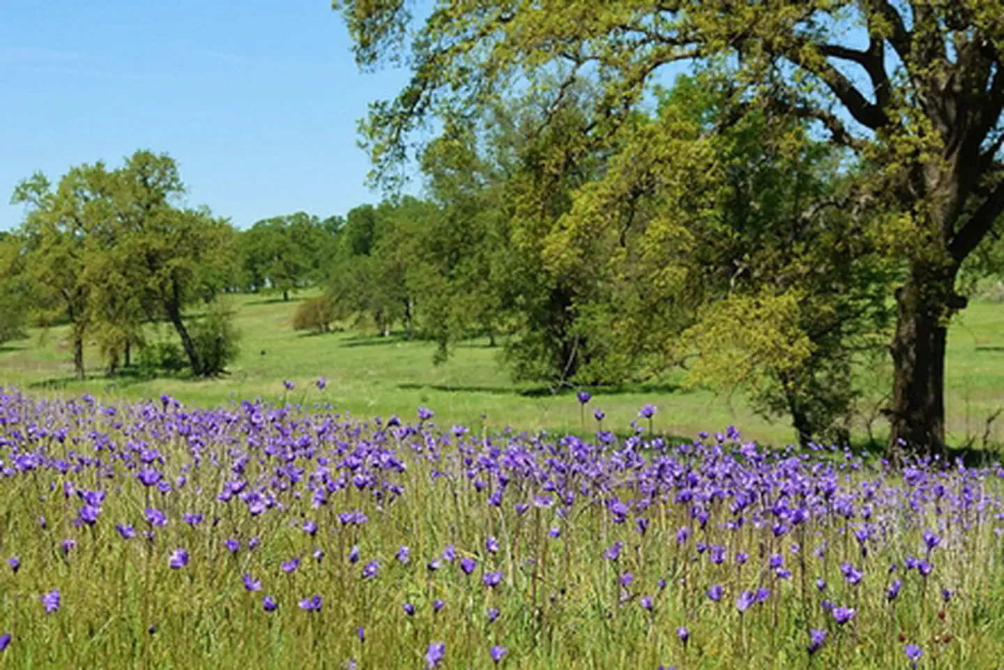
This area offers amazing wildflowers viewing in the spring. The rolling hills of this oak woodland are carpeted with purple and yellow in all directions.
Boating Access
The Sacramento River (from Balls Ferry to Red Bluff) is served by a variety of developed boat ramps and primitive river access sites. Public boat ramps are available at Balls Ferry, Bend Bridge Park, and Lake Red Bluff Recreation Area. Jelly's Ferry, Barge Hole, and Perry Riffle (walk in only) offer primitive launch sites. The boat ramp at Reading Island can be used by small watercraft, but is usually overgrown with vegetation during the summer months making it challenging for any watercraft. Please see the Sacramento River Bend Area map for specific locations and directions.
Paynes Creek Wetlands
Concerns have increased in recent years over population declines of migratory bird species that breed in North America and winter south of the United States - Neotropical Migratory Birds. The BLM recognizes this problem and has created the Payne's Creek Wetlands with the help of partners like California Fish and Game, Bureau of Reclamation, California Wildlife Conservation Board, and Ducks Unlimited in an effort to enhance populations of these birds and other species. The BLM manages this wetland area, located along the Pacific Flyway, to protect and enhance the existing riparian habitat and wildlife communities, as well as provide for recreational use, cultural and natural interpretation, and educational opportunities.
Download the Birds of Bend Brochure to discover all the birds that frequent the area.
Camping
Although there are no developed BLM campgrounds in this area, camping is allowed on most BLM lands for up to 14 days per calendar year. Day-use sites such as the Jelly's Ferry site, the mouth of Inks Creek, and the Bass Pond parking areas are closed to camping. Group camping is available at the Reading Island Group Campground, under a special use permit issued by the BLM. Massacre Flat is a popular primitive campsite for boaters. The state managed Battle Creek and Cottonwood Creek Wildlife Areas are closed to camping. There is no garbage collection in most of the area so if you PACK IT IN please PACK IT OUT.
Hunting
Most BLM lands are open to hunting under California Department of Fish and Game regulations. Some sites such as Reading Island and the state managed Battle Creek Wildlife Area are closed to hunting and shooting. Be courteous to private property owners adjacent to public land. Remember, it is against State law to discharge a weapon within 150 yards of a dwelling or outbuilding. Target shooting is prohibited with the exception of one designated target shooting area along Spring Branch Road. Please remove all shells and debris to keep your public lands clean and safe.
Safety Concerns
• The Sacramento River water is cold (45°-50°) year-round and is deceptively swift and powerful.
• Always wear an approved floatation device when on the river.
• The Yana Trail fords Inks Creek and is impassible at times of wet weather. Contact the BLM Redding Field Office prior to a wet weather hike on the Yana Trail.
• Rattlesnakes are a common sight on warm days. Watch your step.
• Summer temperatures in this area can exceed 100°F and there is no potable water available in the area, so bring plenty of drinking water.
Source: recreation.gov
Reviews
No reviews yet
Be the first to share your experience and help others plan their visit.
Hunting in this park
Hunting is generally prohibited in this National Park Service unit
Verify current park-specific rules with the National Park Service before planning any hunt. See NPS regulations
Within ~100 miles
Parks near Sacramento River Bend Area
Nat'l Recreation Area
Park
Sacramento River National Wildlife Refuge
Oregon
Wilderness Area
Park
Ishi Wilderness
Oregon
Nat'l Recreation Area
Park
Sacramento River Rail Trail
Oregon
Nat'l Recreation Area
Park
Eastside Keswick Trails
Oregon
Nat'l Recreation Area
Park
Whiskeytown National Recreation Area
California
recreation area
Park
Black Butte Lake
Oregon
Same state
More parks in Oregon
Featured
National Park
Park
Crater Lake National Park
Oregon
286 sq mi
Featured
National Forest
Park
Mt. Hood National Forest
Oregon
1,667 sq mi
Nat'l Recreation Area
Park
Agate Reservoir
Oregon
recreation area
Park
Agency Lake Ranch
Oregon
Nat'l Recreation Area
Park
Alvord Desert
Oregon

wildlife refuge
Park
Ankeny National Wildlife Refuge
Oregon
Nat'l Recreation Area
Park
Baker Cypress Trail
Oregon
Nat'l Recreation Area
Park
Bandon Marsh National Wildlife Refuge
Oregon
Spot an error in our data on Sacramento River Bend Area?