Mount Antero: The aquamarine-bearing 14er of the Sawatch
Mount Antero is the Sawatch peak with a 4WD road climbing nearly to its summit — a road built originally for the famous aquamarine and topaz mines on its upper face. It's the highest gem-mining locality in North America.

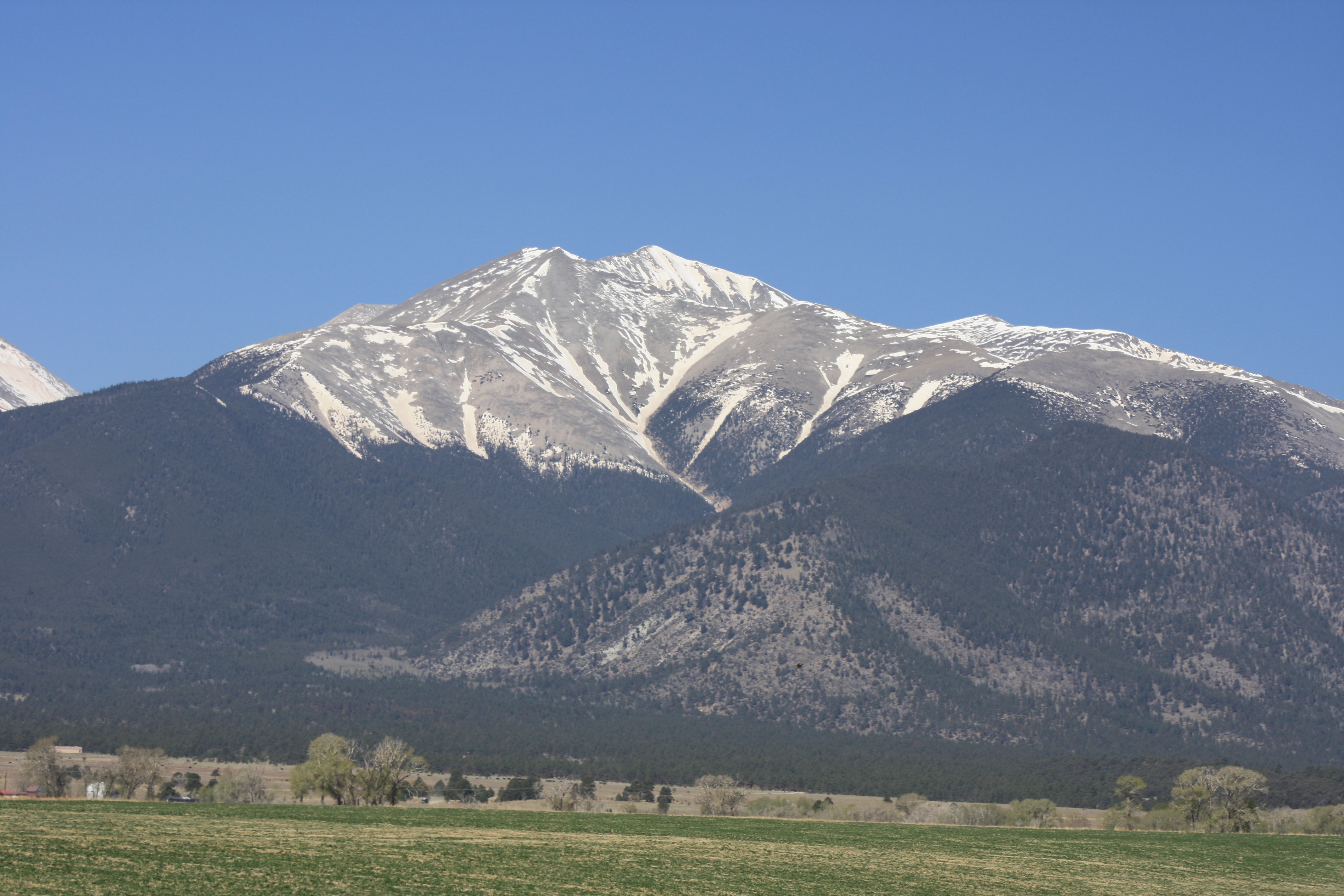
Mount Antero is unusual among Colorado 14ers for the road that climbs nearly to its summit — a 4WD jeep route that switchbacks up Baldwin Gulch to about 13,800 feet, just 500 vertical feet below the high point. The road exists because Antero is the most productive gem-mining 14er in Colorado: the upper face holds aquamarine, smoky quartz, and topaz crystals in mineralized pegmatite veins, and prospectors have worked the slopes since the 1880s. Antero is the highest gem-mining locality in North America.
The peak at a glance
- Elevation: 14,276 ft (4,351 m)
- Rank in Colorado: 11th of 56 peaks above 14,000 ft
- Range: Sawatch Range
- County: Chaffee County
- Coordinates: 38.6742° N, 106.2461° W
- Standard route: West Ridge from Baldwin Gulch (Class 2) — 16 mi round-trip from passenger-car parking, ~5,000 ft gain
- Public land: San Isabel National Forest
How Mount Antero got its name
The peak takes its name from Chief Antero, a leader of the Uintah Ute band in the late nineteenth century. Antero served as a primary Ute negotiator with U.S. authorities during the 1870s and was respected by both Indigenous and settler communities for his diplomatic role. The naming dates to the post-Meeker Incident era; the Hayden Survey applied the name in the late 1870s.
The standard route
The standard climb is the West Ridge from Baldwin Gulch. With a high-clearance 4WD vehicle, drivers reach about 13,800 feet and walk the final mile to the summit. Without 4WD, climbers park lower at the Baldwin Gulch trailhead and walk the full 8 miles up — making the standard climb a 16-mile round trip with 5,000 feet of gain.
The walking distance varies dramatically by vehicle. Without high clearance, plan a longer day than most Sawatch 14ers.
When to climb
The Colorado fourteener climbing season is short. The standard window runs from late June through mid-September — after the snow has melted off the trail and before the first serious autumn storm. Outside that window, you're committing to a winter ascent: snow travel, avalanche assessment, post-holing through drifts, and route-finding without a visible trail.
Inside the window, the rule that has saved more Colorado lives than any other is be off the summit by noon. Afternoon convective storms build over the high peaks almost daily in July and August. Lightning is the leading weather killer in the Rockies. Plan for a pre-dawn start — most experienced climbers leave the trailhead between 4:00 and 5:30 AM.
Where it sits
What climbers wish they'd known
Mineral-collecting requires a permit. The Forest Service permits casual rock-hounding on Antero but not commercial collecting. Mining claims still active on the upper slopes are private property.
The road is rough. Even with 4WD, Baldwin Gulch road has stretches that demand low gearing and good ground clearance. Drive carefully or hike.
Before you go
A 14er is a long, exposed day at altitude. Read these first if you haven't already:
- Planning your first multi-day backpacking trip — same logistics apply to a long single-day summit push.
- How to choose the right trail difficulty — converting class ratings into honest fitness estimates.
- Leave No Trace, in one minute — alpine tundra heals on a geological clock. Stay on the trail.
Looking for the standard route on the map? Browse Colorado trails on the Outdoors App or jump to the Near Me view if you're already in-state.
If you liked this peak
- Mount Shavano — the Angel of Shavano peak
- Tabeguache Peak — the Shavano traverse partner
- Mount Princeton — the Collegiate Peaks showpiece
Hero photograph: Mount Antero seen from U.S. 285 near Nathrop, Colorado. by David Herrera, licensed under CC BY 2.0.


