Half Dome Is A Thousand Feet Below You, And There Is No Lottery
Clouds Rest is the granite arete two and three-quarter miles behind Half Dome, and it stands 1,090 feet higher. Half Dome rations about 225 day-hiker permits a day for its cables. Clouds Rest asks for nothing, and the way up it is a walk — no chains, no cables, no scrambling. What it does have is a last half mile of crest with the ground falling roughly 270 feet to both sides.

Yosemite rations Half Dome. About 225 day-hiker permits go out per day when the cables are up, through a March lottery and a daily one, and people plan a year around getting one.
Two and three-quarter miles behind it, on a bearing of 238 degrees, is a granite fin called Clouds Rest. It is 1,090 feet higher than the top of Half Dome. It requires no permit of any kind. And the way up it is a hike — a long one, but a hike: a maintained walking trail from the trailhead to the summit, with no chains, no cables, no fixed protection and nothing you would call scrambling.
The catch, such as it is, sits in the last half mile. The trail crosses the top of an arete — a thin ridge of rock left standing when glaciers took away everything on either side of it — and for a while the ground falls away steeply on both sides at once. It is still a walk. It just stops being an ordinary one.
- Summit: Clouds Rest, 9,930 ft — 806 ft of prominence, in Yosemite National Park, Mariposa County, California
- Trailhead: Sunrise Lakes Trailhead on Tioga Road, at the west end of Tenaya Lake, about 8,155 ft
- Round trip: about 12 miles on the traced line; published figures run from 12.5 to 14.5 miles (see below)
- Gain: 1,773 ft net trailhead to summit, but roughly 2,560 ft of actual climbing one way and about 3,350 ft over the round trip, because the route drops into a basin in the middle
- Grade: Class 1 — a walking trail the whole way, no chains, no cables, no hands
- The crest: the final half mile is an open granite arete; at its narrowest the ground falls about 270 ft within 100 yards to both sides
- Permit: none for the day hike. A wilderness permit is required only if you stay out overnight; Half Dome's cables are the one Yosemite day hike that needs a permit of its own
- Half Dome: 2.77 miles away and 1,090 ft lower
- Season: whenever Tioga Road is open — usually late May or June into November, snow allowing
- Water: seasonal creek and tarn in the mid-route basin; nothing on the upper climb or the crest
The numbers, and why nobody agrees on them
Clouds Rest is one of those hikes where every source gives you a different distance. Rather than pick one and present it as fact, here is what each says, including us.
| Source | Round trip | Gain quoted |
|---|---|---|
| National Park Service, Sunrise Lakes Trailhead | 14 mi (22.5 km) | 2,300 ft |
| Wikipedia / yosemitehikes.com | 14.5 mi | 1,775 ft |
| Joe's Guide to Yosemite | 13 mi | about 2,000 ft, in two climbs |
| HikingGuy | 12.5 mi | 3,200 ft |
| Outdoors, measured | 12.06 mi | 2,564 ft one way |
Our figure comes from the polyline this page draws: two unmodified OpenStreetMap ways, both named Clouds Rest Trail, that join at a shared vertex and are cut at the summit — 9,701 m, or 6.03 miles, to the top. Elevations along it are read from USGS 3DEP one-metre lidar. It is not a guess and it is not an average of other people's numbers.
We cannot fully reconcile 12.06 with 14.5, and we are not going to pretend otherwise. What we can say is where the gap is not. It is not the trailhead: every source starts at the Sunrise Lakes Trailhead at the west end of Tenaya Lake, and the traced line begins at the far end of a 43-metre boardwalk leading in from the road. It is not a different summit: the line ends 4.6 metres from the OpenStreetMap peak node, which in turn sits within 1.5 metres of the highest pixel in the lidar. And it is not a missing junction — the traced line hits the Sunrise Lakes fork at 2.41 miles, against the “around 2.5 miles” the guidebooks describe. The pattern that does hold is that the newer, GPS-derived figures cluster at 12.1 to 12.5 miles and the older narrative and agency figures cluster at 13 to 14.5. Treat 14.5 as the conservative planning number and 12 as what your watch will probably say.
The gain figures scatter for a simpler and more interesting reason: they are measuring three different things. The trailhead is 8,155 ft and the summit is 9,928 ft, so the net gain is 1,773 ft — which is why you keep seeing 1,775. But the route climbs to a saddle, drops several hundred feet into a basin, and climbs again, so the cumulative gain one way is 2,564 ft, and the round trip totals roughly 3,350 ft because you re-climb that basin on the way home. All four published numbers are defensible. Only one of them is what your legs do.
The route, in order
From the Sunrise Lakes Trailhead the trail crosses a short boardwalk near the west end of Tenaya Lake and stays close to level for a mile and a half, which is the flattest walking you will do all day. Then it turns uphill into a long set of switchbacks and climbs to the Sunrise Lakes junction at 2.41 miles — the first fork, the one every guidebook puts at about two and a half miles.
Go right, for Clouds Rest. The trail immediately does the thing that breaks everyone's arithmetic: it descends, several hundred feet, into a shallow basin. This is where the water is — a small creek and a tarn beside the trail, both seasonal — and it is the last of it. Fill up here if you are going to.
Out of the basin the trail climbs again to the Forsyth Trail junction at 4.44 miles, which is 1.59 miles short of the summit and the last place the route is in trees. From there it works up onto open granite, and the character of the day changes completely: no shade, no water, a lot of sky, and the ridge ahead of you resolving into a fin.
The final 0.17 miles before the summit is the crest itself.
The last half mile
This is the part worth being precise about, because it is easy to oversell and easy to dismiss.
Measured perpendicular to the route line on USGS 3DEP one-metre lidar, at the narrowest point of the crest the ground falls 271 feet within 100 yards on both sides at once. Push the measurement out to 100 metres and it reaches 309 feet. The crest narrows to about 16 metres, roughly 50 feet, if you define the width as how far you can walk each way before the ground has dropped 25 feet. To the north and east the drop keeps going: the northwest face of Clouds Rest falls about 5,000 feet toward Tenaya Creek, which is what makes the peak so visible from the valley despite plenty of higher summits in the park behind it.
And yet: the trail is a trail. There is tread the whole way, it is generally several feet wide, and where the crest pinches hardest the line runs slightly down the gentler southwest side rather than along the very top. You do not use your hands. You do not step over a gap. The summit itself opens back out to something like fifty feet across, which is enough room for a lot of people to eat lunch without anybody feeling crowded toward an edge.
What the exposure does is make a normal-difficulty mistake feel expensive, and that is worth respecting on a windy day or with an anxious member of the party. It is the same instinct that makes people turn round on Angels Landing or the Knife Edge — with the difference that here there is nothing to hold on to, because there is nothing you need to hold on to.
The most honest evidence that some people want no part of it is not a story, it is the map. OpenStreetMap carries two ways, both tagged Clouds Rest Bypass Trail, that together leave the route 273 metres before the summit and rejoin it 875 metres beyond — 894 metres of trail whose entire purpose is to get around the crest and the summit without going over them. Someone walked that line enough times for it to become a mapped path.
A thousand feet above Half Dome
Half Dome is on the money. The 2005 California state quarter shows John Muir looking at Yosemite Valley's granite headwall — Half Dome — with a California condor overhead.
From the summit of Clouds Rest you look down on it. Not metaphorically: USGS 3DEP reads 9,929.7 ft at Clouds Rest and 8,840.0 ft at Half Dome — both measured the same way, off the same data — for a difference of 1,090 feet. That is the only pairing worth quoting to the foot, because it is the only one where both numbers come from the same instrument and the same datum.
Pair the published elevations instead and the answer moves around: Clouds Rest is variously 9,926 or 9,930 ft, and Half Dome is variously 8,839, 8,842 or — as Wikipedia now has it, on NAVD 88 — 8,846 ft. Mix and match those and you get somewhere between 1,080 and 1,091 feet. The honest summary is that Clouds Rest stands a little over a thousand feet above Half Dome, and that no combination of published figures puts it below a thousand.
We also checked that you can actually see it, rather than assuming. Running a line-of-sight profile between the two summits, 2.77 miles apart, the sightline clears the intervening terrain by at least 251 feet at its tightest. There is nothing in the way. Half Dome really is below you and in front of you, with the cables, the subdome, the queue and the whole apparatus of a rationed, permitted climb spread out underneath, and you got there by walking.
The two mountains are the same geology telling the story twice. Both are what glaciers left behind — Clouds Rest as an arete, a thin ridge with the rock quarried away from both sides, and Half Dome as a face where the ice took one side and left the other.
Permits, the road, and what you actually need
You do not need a permit to day hike Clouds Rest. Yosemite requires a wilderness permit year-round for any overnight stay in the wilderness, and the park's own wording is that a wilderness permit is not required for day hikes unless you are hiking to Half Dome. Clouds Rest is not Half Dome. If you sleep out there, that is a different trip and it needs a permit.
Park entry is the part worth checking rather than assuming. Yosemite ran a timed entry reservation system in several recent summers, and the National Park Service announced in February 2026 that it will not use one in 2026. That is the current position as we publish, and it is exactly the kind of thing that changes between seasons — the park's own reservations page is linked in the sources below and it is the only authority worth trusting on the day.
The road is the real gate. The trailhead is only reachable when Tioga Road is open, which is typically late May or June through sometime in November and is entirely at the mercy of the snowpack; in 2026 it opened on 15 May. There is no way to reach this trailhead when the road is closed. Overnight parking at the trailhead ends 15 October.
There are vault toilets and animal-safe food storage at the trailhead, and no drinking water.
When to go
The window is the road's window: from whenever Tioga Road opens until it closes. Early in that window the shaded switchbacks and the crest can still hold snow, and snow on angled granite is the one condition that turns this from a walk into something requiring judgement you may not have brought.
Start early. The Park Service estimates eight to ten hours for the round trip, and that is a realistic number rather than a cautious one — it is twelve to fourteen miles depending on whose figure you use, most of it above 8,000 feet, with the last third on open rock. Getting up early is not about beating crowds here. It is about not being the tallest thing on a granite fin at three in the afternoon.
Bring more water than the distance suggests. Roughly half the route is fully exposed, the upper half has nothing, and the trailhead has no drinking water either.
If you want the walk without the crest, the mapped bypass exists, and turning around where the ridge begins is a perfectly good day out — you are already high on open granite by then, with Half Dome in front of you.
If it goes well
Clouds Rest is the answer to a specific question, which is: what if you want the summit day without the permit lottery, the queue and the cables? It is higher, it needs nothing from you but a day and a working road, and the view is of the thing everyone else is standing on.
The people who enjoy the last half mile of it are usually the people who then go looking for Angels Landing, or Katahdin's Knife Edge, or the Franconia Ridge — narrow ground with a lot of sky around it. The difference is that Clouds Rest gives you that feeling on Class 1 terrain, which makes it the honest place to find out whether you like it before you commit to somewhere you cannot simply walk back off.
Sources
- Clouds Rest is 9,930 ft (3,027 m) with 806 ft of prominence, in Yosemite National Park, Mariposa County; it is an arete formed by glacial erosion, its northwest face rises about 5,000 ft above Tenaya Creek, the Sunrise Lakes Trail route is a 14.5-mile round trip beginning at 8,150 ft and gaining 1,776 ft over 7.25 miles, and the easiest route is a class 1 trail hike.
- Half Dome is given as 8,846 ft (2,696 m) NAVD 88 with 1,360 ft of prominence; the final 400 ft of the cable route is climbed between two steel cables used as handholds, and the cables are installed in late May and removed in early October.
- The National Park Service lists Clouds Rest from the Sunrise Lakes Trailhead as 14 mi (22.5 km) round trip with 2,300 ft (700 m) of elevation gain and an estimated 8 to 10 hours; the trailhead has vault toilets and animal-safe food storage, overnight parking ends October 15, and it is only reachable when Tioga Road is open.
- A wilderness permit is required year-round for any overnight stay in the Yosemite Wilderness, and a wilderness permit is not required for day hikes unless hiking to Half Dome.
- Permits to hike to the top of Half Dome are required seven days a week when the cables are up, with about 225 day-hiker permits available per day through a preseason lottery each March and a daily lottery two days ahead.
- Yosemite National Park announced in February 2026 that it will not require vehicle entry reservations in 2026.
- Current entry reservation status for Yosemite National Park — the authority on whether a reservation is needed on the day you go.
- Tioga Road is typically open to vehicles from late May or June until sometime in November; in 2026 it opened to all vehicles on 15 May.
- yosemitehikes.com gives the Clouds Rest Trail as 14.5 miles round trip from a trailhead at 8,150 ft to a 9,926 ft summit with 1,775 ft of gain, describes the final ridge as a narrow knife edge with a sheer drop on the north side, and notes the very top opens back out to around fifty feet wide.
- Joe's Guide to Yosemite gives the hike as 13 miles round trip from a trailhead at 8,151 ft to a 9,931 ft summit, with roughly 2,000 ft of gain in two separate climbs separated by a 400 ft descent, and notes an older alternate trail that wanders around the east side of Clouds Rest avoiding the actual summit.
- HikingGuy gives the route as 12.5 miles with 3,200 ft of climbing, no permit required, water sources on trail, about 50% of the trail exposed, and describes the summit spine as never really less than five feet wide with the trail running on the left side away from the steep drop, with no scrambling required.
- The 2005 California state quarter depicts John Muir admiring Yosemite Valley's monolithic granite headwall, known as Half Dome, with a soaring California condor.
- Route geometry: OpenStreetMap ways 1215616486 and 39811786, both named Clouds Rest Trail, and the summit node 358796073 (natural=peak, ele=3028) that the traced line is cut at.
- Mountain forecasts and afternoon thunderstorm timing for the Yosemite high country.
Keep reading
- Half Dome: 14 miles of trail and 400 feet of cable, 1,090 feet lower
- Angels Landing: half a mile of holding on
- Katahdin's Knife Edge: a mile of ridge the width of a sidewalk
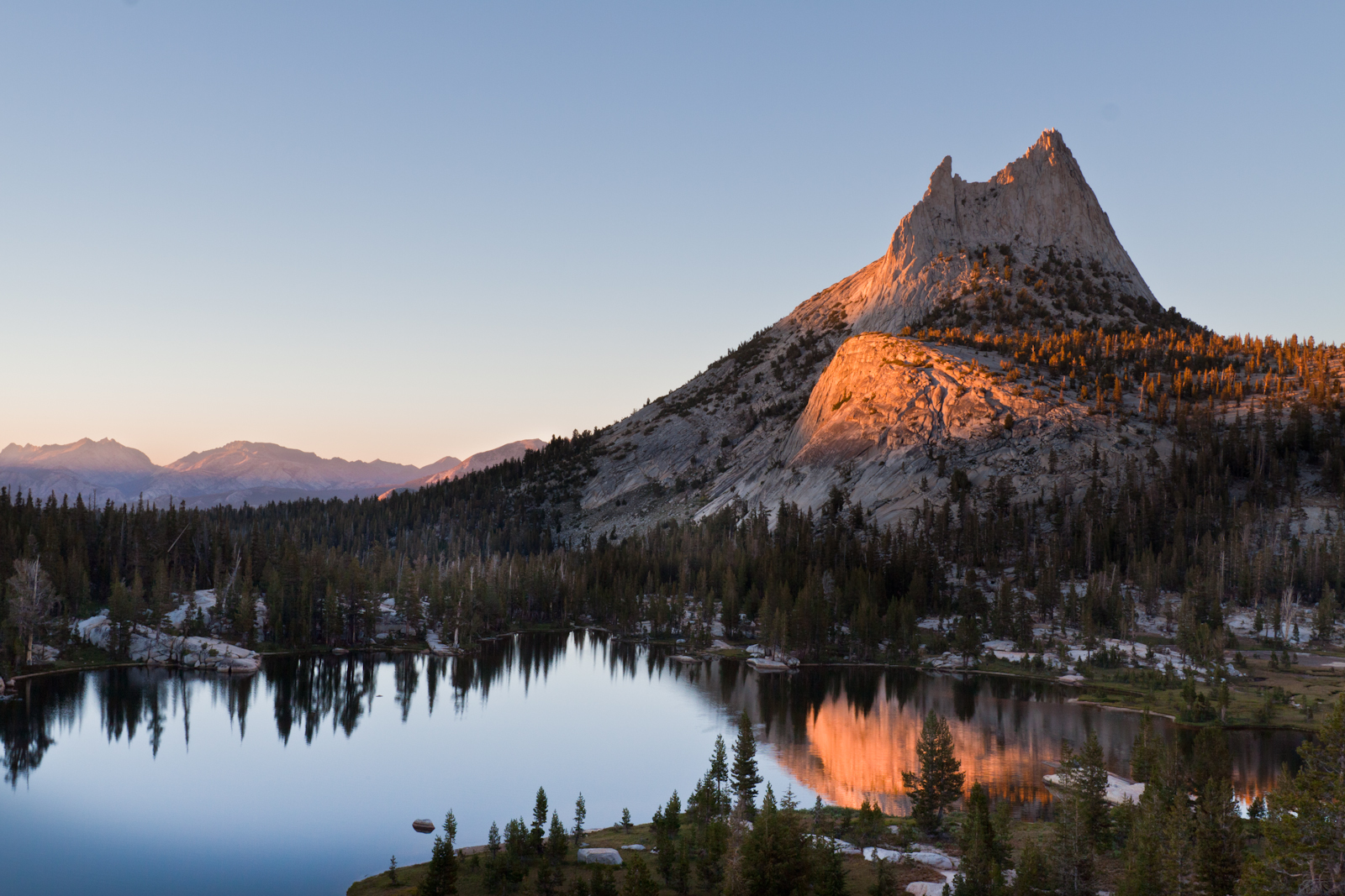
Hero photograph: The Clouds Rest arete, with Half Dome behind it. The summit of Half Dome is 1,090 feet lower than the ground in the foreground. by Jimmy Harris, licensed under CC BY 2.0.