Moderate
Tuolumne Meadows to Yosemite Valley Trail [CLOSED]
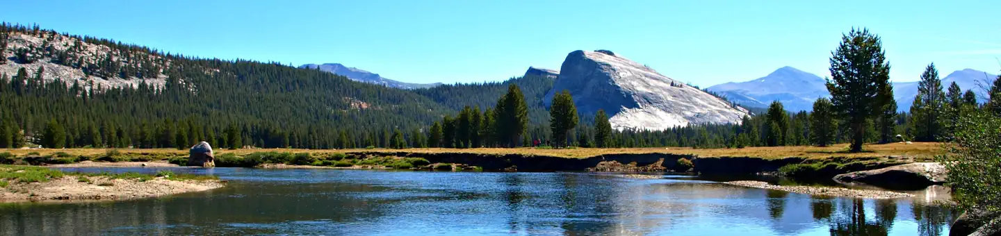
Yosemite Valley, California
27.2 mi
Distance
4,288 ft
Elev. Gain
10h 9m
Est. Time
0.0
0 Reviews
About This Trail
The hike from TuolumneMeadows to the valley starting at Tenaya lake is strenuous, but it allows you to stop at the high Sierra camp as well. The hike can be completed in 2 days each way with an overnight stop at Merced Lake, or can be extended to 4 days with extra nights at Little Sierra Camp and Half Dome. It takes about 2000 feet of elevation to get to the elevation you are currently at, and hiking almost 15 miles on granite can become quite hard on your feet. It is a great way to escape the crowds and see all the park has to offer, and you can go on this trek alone.
Trail Details
Point to Point
Route Type
Dirt
Surface
No Dogs
Dog Policy
Yes
Kid Friendly
No
Permit Required
Elevation Profile
Min:1,234 ft
Max:3,053 ft
1,307 ft
2,720 ft
Reviews
No reviews yet
Be the first to share your experience and help others plan their visit.
Trail Conditions
Trail Conditions
Unknown
Updated Unknown
No recent condition reports. Be the first to share what you see on the trail.
![Ireland Lake Trail [CLOSED]](https://www.nps.gov/common/uploads/structured_data/3C873CC3-1DD8-B71B-0B076FC2806DF140.jpg?width=800&quality=80)
In this park
Other trails in Yosemite National Park

Half Dome
California
3.2 km1,463 mgain
Expert

Mirror Lake Loop
California
6.2 km30 mgain
Easy
Yosemite Falls Trail
California
4.8 km823 mgain
Difficult

Four Mile Trail
California
7.7 km975 mgain
Difficult
Upper Yosemite Falls Trail
California
11.6 km1,575 mgain
Difficult
Four Mile Trail
California
14.8 km2,058 mgain
Difficult
Stay nearby
Campgrounds near this trail
 Reservable
Tuolumne Meadows Lodge
0.3 mi away · CA
- Reservable
Tuolumne Meadows Campground
0.7 mi away · CA
Reservable
Tuolumne Meadows Campground - TEMP CLOSED through 2023
2.8 mi away · CA
Upper Lyell Canyon Footbridge Backcountry Campsite
2.8 mi away · CA
Young Lakes
4.1 mi away · CA
Vogelsang High Sierra Camp
5.7 mi away · CA
Similar length
Similar trails in California
Mount Whitney Trail
California
36.2 km4,357 mgain
Difficult
Mount Baldy via Devil's Backbone Trail
California
22.5 km1,798 mgain
Difficult
Big Pine Lakes Trail
California
23.0 km1,245 mgain
Difficult
Happy Isles, Vernall Falls, Half Dome, Tenaya Lake, and Mirror Lakes Loop [CLOSED]
California
48.6 km3,379 mgain
Difficult
Heaton Flat Trail to Iron Mountain
California
29.0 km2,267 mgain
Difficult
Sespe River Trail to Willett Hot Springs
California
31.9 km1,093 mgain
Moderate