No photos yet
Official sources & verification
Managed by National Recreation Area
Source of truth
- Agency source page
The page our published rules and notes are derived from.
Managing agency
- National Recreation Area
Find offices, alerts, and current orders for this agency.
Verify by phone or mail
- Operator:435-587-1518
- Email:utmtmail@blm.gov
- Address:UT
About
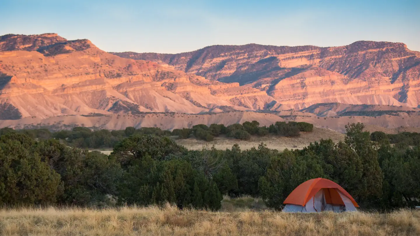
Imported descriptionThe four main canyons of this WSA are up to 700 feet deep. The canyons meander somewhat and contain numerous rock fins, alcoves, pinnacles, step-like pour offs on the canyon floors, and impressive natural arches. The canyons widen and become more shallow at the southern end of the WSA. Approximately 60 percent (28,000 acres) of the WSA is rated as outstanding for scenic quality. Fish Creek WSA includes land extensively occupied by Ancestral Puebloan dwellers from about200 A.D. to 1300 A.D. The Hole in the Rock Trail, the route followed by the Mormon settlers in 1879 to 1880, forms most of this unit's southern boundary.
The pioneers camped at Snow Flat Spring Cave and built The Twist, a narrow twisting road through the rocks from the mesa down to the Comb Wash area.
Source: recreation.gov
Reviews
No reviews yet
Be the first to share your experience and help others plan their visit.
Hunting in this park
Hunting is generally prohibited in this National Park Service unit
Verify current park-specific rules with the National Park Service before planning any hunt. See NPS regulations
Within ~100 miles
Parks near Fish Creek Canyon
Nat'l Recreation Area
Park
Road Canyon
Utah
Nat'l Recreation Area
Park
South Mule Canyon
Utah
Nat'l Recreation Area
Park
North Mule Canyon
Utah
Nat'l Recreation Area
Park
Mule Canyon
Utah
National Monument
Park
Bears Ears National Monument
Utah
2,125 sq mi
National Monument
Park
Bears Ears National Monument - Indian Creek SRMA
Utah
Same state
More parks in Utah

Featured
National Park
Park
Arches National Park
Utah
120 sq mi

Featured
National Park
Park
Bryce Canyon National Park
Utah
56 sq mi

Featured
National Park
Park
Zion National Park
Utah
230 sq mi
Nat'l Recreation Area
Park
18 Road - North Fruita Desert
Utah

Nat'l Recreation Area
Park
Anasazi State Park Museum
Utah

Nat'l Recreation Area
Park
Antelope Island State Park
Utah
recreation area
Park
Armijo Route
Utah
National Forest
Park
Ashley National Forest
Utah
2,160 sq mi
Spot an error in our data on Fish Creek Canyon?