Nat'l Recreation Area
Official sources & verification
Managed by National Recreation Area
Source of truth
- Agency source page
The page our published rules and notes are derived from.
Managing agency
- National Recreation Area
Find offices, alerts, and current orders for this agency.
Verify by phone or mail
- Operator:307-578-5900
- Email:BLM_WY_Cody_WYMail@blm.gov
- Address:MT
About
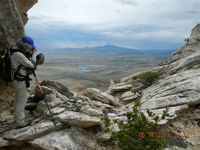
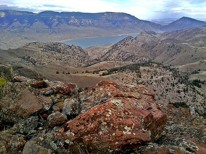
Imported descriptionThis horseback riding and hiking trail winds for five miles through BLM-managed public lands and state lands to Bald Ridge in the Shoshone National Forest. The elevation ranges from 4,880’-8,400’. Spectacular views of the Clarks Fork of the Yellowstone River to the west and of Heart Mountain to the east await you. Pronghorn, mule deer, moose, elk, and grizzly and black bears may be encountered along this trail. Waterfowl are often found at the lakes near the trailhead and soaring raptors are often sighted. The trail is steep and arduous requiring good physical condition of both humans and horses. The trail is marked by trail signs and then rock cairns as it winds up Bald Ridge. The middle and upper portions are not marked or constructed; users must pick their own route up the mountain. BLM-administered public lands in the Bald Ridge area are closed to human presence from January 1 - April 30 each year to protect the wintering big game. This is grizzly bear country, so, be bear aware!
Source: recreation.gov
Reviews
No reviews yet
Be the first to share your experience and help others plan their visit.
Hunting in this park
Hunting is generally prohibited in this National Park Service unit
Verify current park-specific rules with the National Park Service before planning any hunt. See NPS regulations
Within ~100 miles
Parks near Bald Ridge Trail
Same state
More parks in Montana
Featured
National Forest
Park
Flathead National Forest
Montana
3,758 sq mi

Featured
National Park
Park
Glacier National Park
Montana
1,583 sq mi
Nat'l Recreation Area
Park
Anita Reservoir
Montana

recreation area
Park
Axolotl Lakes
Montana
National Forest
Park
Beaverhead-Deerlodge National Forest
Montana
5,250 sq mi
Nat'l Recreation Area
Park
Benton Lake National Wildlife Refuge
Montana
Nat'l Recreation Area
Park
Benton Lake Wetland Management District
Montana
National Battlefield
Park
Big Hole National Battlefield
Montana
Spot an error in our data on Bald Ridge Trail?