Thru-hike planner
Tahoe Rim Trail
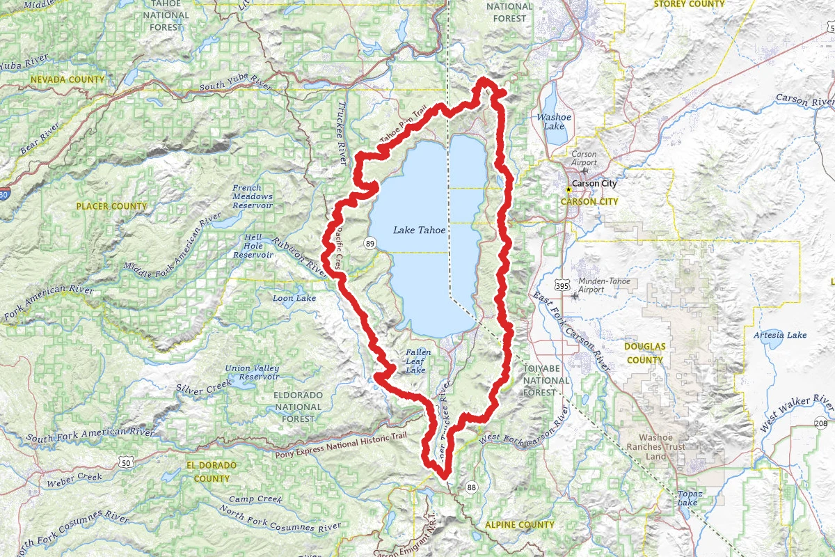
Thru-hike planner
Tahoe Rim Trail
166.6-mile thru-hike planner: permits, resupply and the places along the route

- Markers
- 70
- Resources
- 1
- Distance
- 166.6 mi
- Elevation
- —
- Markers
- 70
- Resources
- 1
- Distance
- 166.6 mi
- Elevation
- —
Notes
Permits and official resources
Straight from the agencies and the trail's managing association. Rules and permit systems change, so check these pages before you go.
Permits
- Desolation Wilderness permits, incl. TRT Thru-Hike Permit (Zone 46) USDA Forest Service, Eldorado National Forest
- Desolation Wilderness Permit on Recreation.gov USDA Forest Service (Recreation.gov)
- Lake Tahoe Basin campfire restrictions (stove use needs a California Campfire Permit) USDA Forest Service, Lake Tahoe Basin Management Unit
- Spooner Lake & Backcountry, Lake Tahoe Nevada State Park (backcountry camping rules) Nevada Division of State Parks
- TRTA permits and regulations (all TRT permits in one place) Tahoe Rim Trail Association
Plan your hike
- Tahoe Rim Trail (LTBMU trail page) USDA Forest Service, Lake Tahoe Basin Management Unit
- Tahoe Rim Trail (Humboldt-Toiyabe trail page) USDA Forest Service, Humboldt-Toiyabe National Forest
- Desolation Wilderness (LTBMU) USDA Forest Service, Lake Tahoe Basin Management Unit
- Backpacking and thru-hiking FAQ Tahoe Rim Trail Association
- Water sources by segment Tahoe Rim Trail Association
- Maps and trail segment information Tahoe Rim Trail Association
- Re-supply information (post offices, package pickup, trailhead towns) Tahoe Rim Trail Association
- Transportation (transit, shuttles, rides to trailheads) Tahoe Rim Trail Association
- Trailhead parking (overnight lots by segment) Tahoe Rim Trail Association
- Current trail conditions Tahoe Rim Trail Association
- Leave No Trace on the TRT Tahoe Rim Trail Association
- 165 Mile Club (register a completed loop) Tahoe Rim Trail Association
- Desolation Wilderness food and refuse storage order (bear canisters) USDA Forest Service, Lake Tahoe Basin Management Unit
Who to call
- Tahoe Rim Trail Association(775) 298-4485info@tahoerimtrail.orgPO Box 3267 Stateline, NV 89449
- Lake Tahoe Basin Management Unit Forest Supervisor's Office (Desolation east-side walk-in permits)USDA Forest Service — Lake Tahoe Basin Management Unit(530) 543-260035 College Drive South Lake Tahoe, CA 96150
- Placerville Ranger District, Eldorado NF (Desolation west-side walk-in permits)USDA Forest Service — Eldorado National Forest530-647-54154260 Eight Mile Road, Camino, CA 95709
- Eldorado National Forest Supervisor's OfficeUSDA Forest Service — Eldorado National Forest(530) 622-5061100 Forni Road Placerville, CA 95667
- Carson Ranger District, Humboldt-Toiyabe NFUSDA Forest Service — Humboldt-Toiyabe National Forest775-882-27661536 South Carson Street, Carson City, NV 89801
- Spooner Lake & Backcountry, Lake Tahoe Nevada State ParkNevada Division of State Parks775-749-5980slsp@parks.nv.govP.O. Box 6116 Incline Village, NV 89452
- Lake Tahoe Nevada State Park officeNevada Division of State Parks(775) 831-0494
- Recreation.gov call center (Desolation Wilderness reservations)USDA Forest Service — Eldorado National Forest1-877-444-6777
Books for the trail
- Tahoe Rim Trail (opens in new tab)Guidebook · Tim Hauserman · Wilderness Press (AdventureKEEN) · 4th edition (2020)The whole trail in 8 sections plus side trips, each with difficulty, highlights and driving directions; the publisher notes the association endorses it.
- Tahoe Rim Trail Pocket Atlas (opens in new tab)Maps · Erik Asorson · Blackwoods Press · 2nd editionA 2-ounce pocket book of topo maps with campsites and water marked, plus a resupply guide with maildrops, town maps and transit info.
Links go to the publisher or the trail association. Check for the current edition.
Checkpoints
- 2
Tahoe Meadows Trailhead (common start)
The TRT trailhead on the Mt. Rose Highway (Highway 431), at the north end of the 24.1-mile segment to Spooner Summit, at about 8,740 feet. Overnight parking is allowed, but the lot is small and fills early on weekends; more parking is along the highway. Camping or sleeping at trailheads is prohibited, so don't plan to sleep in the lot before you start. Water is easy here: the association lists reliable creeks along the Tahoe Meadows Interpretive Loop and reliable Ophir Creek half a mile south. Between here and Tunnel Creek Road bikes are advised to ride the TRT only on even-numbered calendar days, so expect them on those days.
Landmarks (39)
Markers (70)
Trails (1)
Reviews
No reviews yet
Be the first to share your experience and help others plan their visit.