State Park
Allegheny Wild and Scenic River
Irvine, PA
Pricing varies — check with the operator
Verify with the state park system
State parks set their own rules and reservation systems. Fire bans, road closures, and operating dates change seasonally — check the state park website before traveling.
Pricing
Pricing varies — check with the operator0.0
0 Reviews
Official sources & verification
Managed by State Park
Verify by phone or mail
- Address:Irvine, PA
About
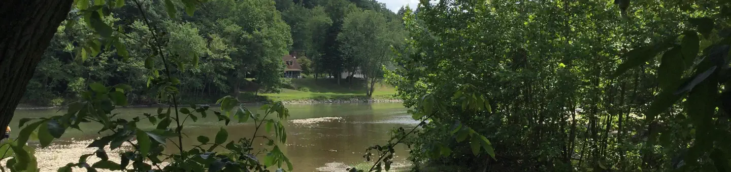
In 1992 (Public Law 102-271) added 87 miles of the Allegheny River to the National Wild & Scenic River System classified as Recreational. The goal is to protect the existing outstanding and remarkable values and preserve a free-flowing condition for present and future generations. This designation applies to the following three sections: 7 miles from below Kinzua Dam to Route 6 bridge in Warren 48 miles from Buckaloons Campground to Alcorn Island (by Oil City), and 32 miles from south of Franklin to Emlenton. The corridor boundary runs along the plateau ridge on both sides and has extensive areas of privately owned lands with many homes and seasonal recreational residences along the shoreline. Public access is good generally from both sides and few hazards make this an ideal river for novice and family canoeing. Oak forests predominate along steep side slopes and there is wooded-riverine habitat in some of the floodplains. It contains the seven Allegheny Wilderness Islands often used by boaters for dispersed camping and fishing. The Allegheny Islands Wilderness contains seven islands stretched between Buckaloons and Tionesta along the Allegheny Wild and Scenic River. The islands are popular for dispersed camping, exploration, and viewing scenery and wildlife. They are mostly vegetated with fine riverine forests of sycamore, silver maple, shagbark hickory, and green ash. Dense grasses and other thick vegetation make access limited. There are no developed trails or other facilities on the islands. The Allegheny River is one of the primary tributaries to the Ohio River. It joins with the Monongahela River to form the Ohio River at the "Point" in Pittsburgh, PA. The Allegheny starts in Pennsylvania, near Cobb Hill, meanders into New York into Cattaraugus County, near Salamanca, before heading back into Pennsylvania northeast of Warren. The course of the river forms much of the northwestern boundary of the Allegheny National Forest before reaching Franklin where the river turns southeast. Within the borders of the Allegheny National Forest the river is fed by Kinzua Creek, Conewango Creek, Brokenstraw Creek, Tionesta Creek, Oil Creek and French Creek. The Clarion River joins the Allegheny near Kittanning.
Reviews
No reviews yet
Be the first to share your experience and help others plan their visit.
Pet Policy
No pets allowed
Campground Rules
- No campfires allowed
Within ~30 miles
Trails near Allegheny Wild and Scenic River
Trail
Anders Run Trail Loop
Pennsylvania
1.6 mi295 ftgain
Moderate

Trail
Tanbark Trail
Pennsylvania
6.9 mi1,188 ftgain
Moderate
Trail
Slater Run Trail
Pennsylvania
5.9 mi781 ftgain
Moderate
Trail
Hickory Creek Wilderness Trail
Pennsylvania
12.4 mi1,634 ftgain
Expert
Trail
Magee Trail
Pennsylvania
2.9 mi732 ftgain
Moderate
Trail
Tom's Run and Ironwood Loops Trails
Pennsylvania
5.1 mi587 ftgain
Moderate
Nearby Campgrounds

Spot an error in our data on Allegheny Wild and Scenic River?