Status unknown — verify before visiting
We don't have current condition data for this trail. Check with the land manager before you go.

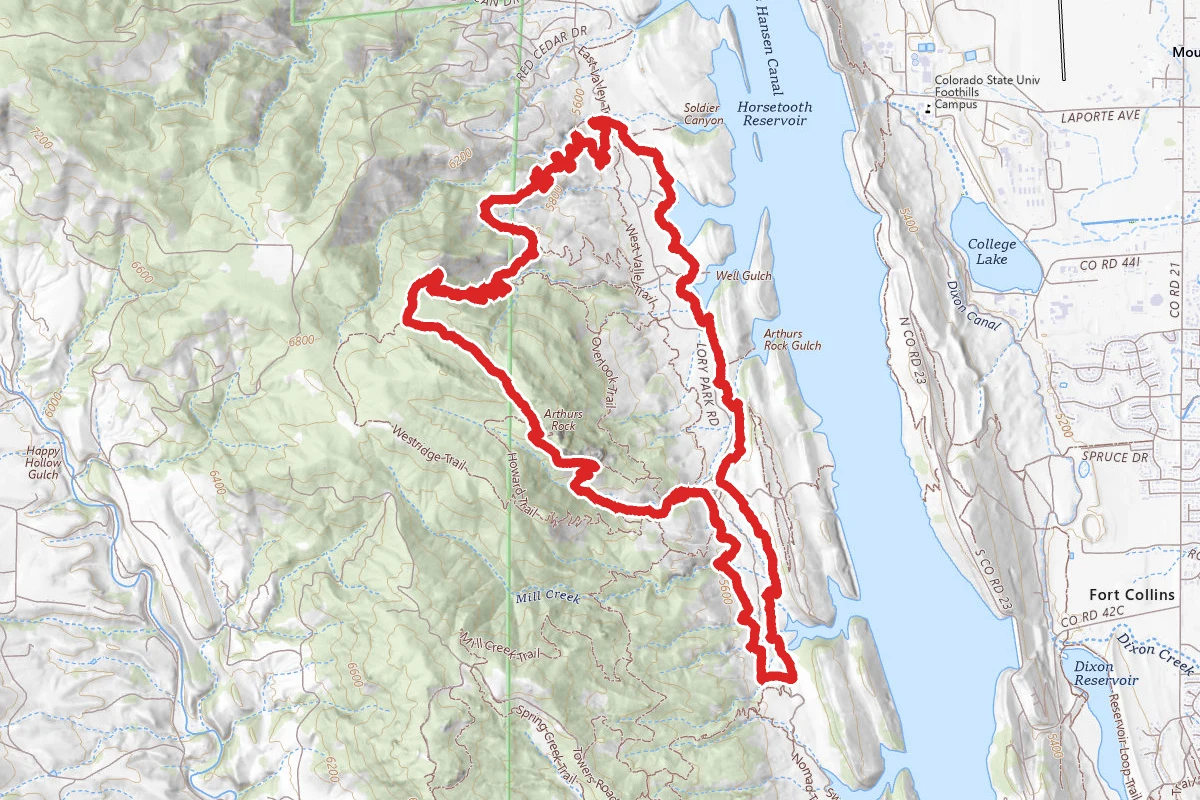
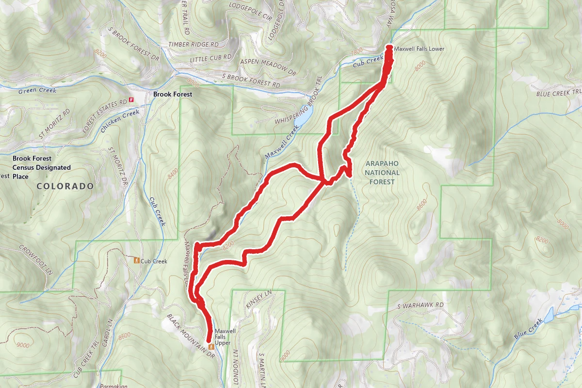
8.1 mi
Distance
2,415 ft
Elev. Gain
3h 30m
Est. Time
Out & Back
Route Type
Difficult
Difficulty
About This Trail
Imported descriptionFrom Wikipedia
Source: Wikipedia — text licensed CC BY-SA 4.0. Verify trail conditions and seasonal closures with the managing agency before you go.
Trail Conditions
Trail Conditions
We have no current condition data for this trail. Check with the operator before you go, and submit a report below if you've been recently.
No recent condition reports. Be the first to share what you see on the trail.
Elevation Profile
Trail Details
- Route Type
- Out & Back
- Surface
- Dirt
Official sources & verification
We don't have curated agency sources for this trail in our cache yet. Outdoors is not the permitting authority — confirm conditions, permits, and access with the managing agency before you go. If you know who manages this trail, please tell us.
Reviews
No reviews yet
Be the first to share your experience and help others plan their visit.
Legacy import — verify before navigating
Path geometry came from our pre-launch legacy database. Routes have not yet been re-verified against the operator and may differ from the actual trail.
Hunt context
This trail crosses hunting units
During hunting seasons, wear blaze orange and check regulations — see the Colorado hunting page
Nearby Trails
More trails near Timber Trail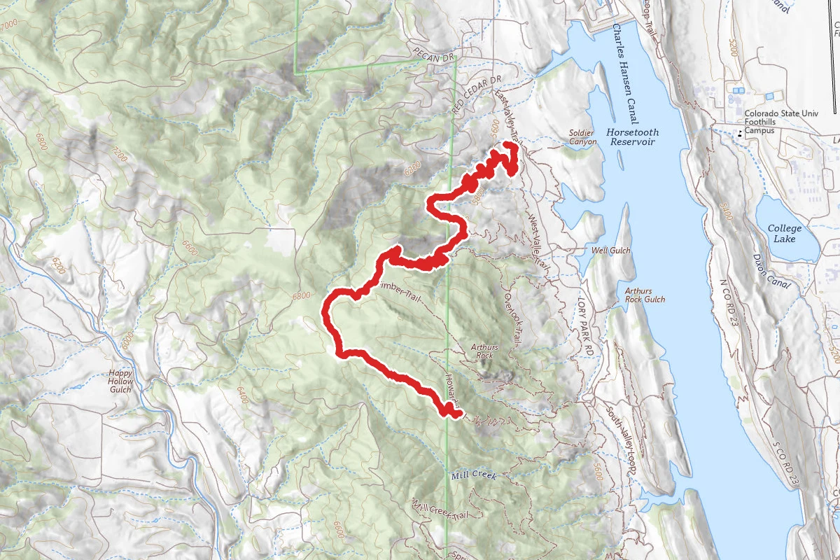
Westridge Trail Via Timber Trail
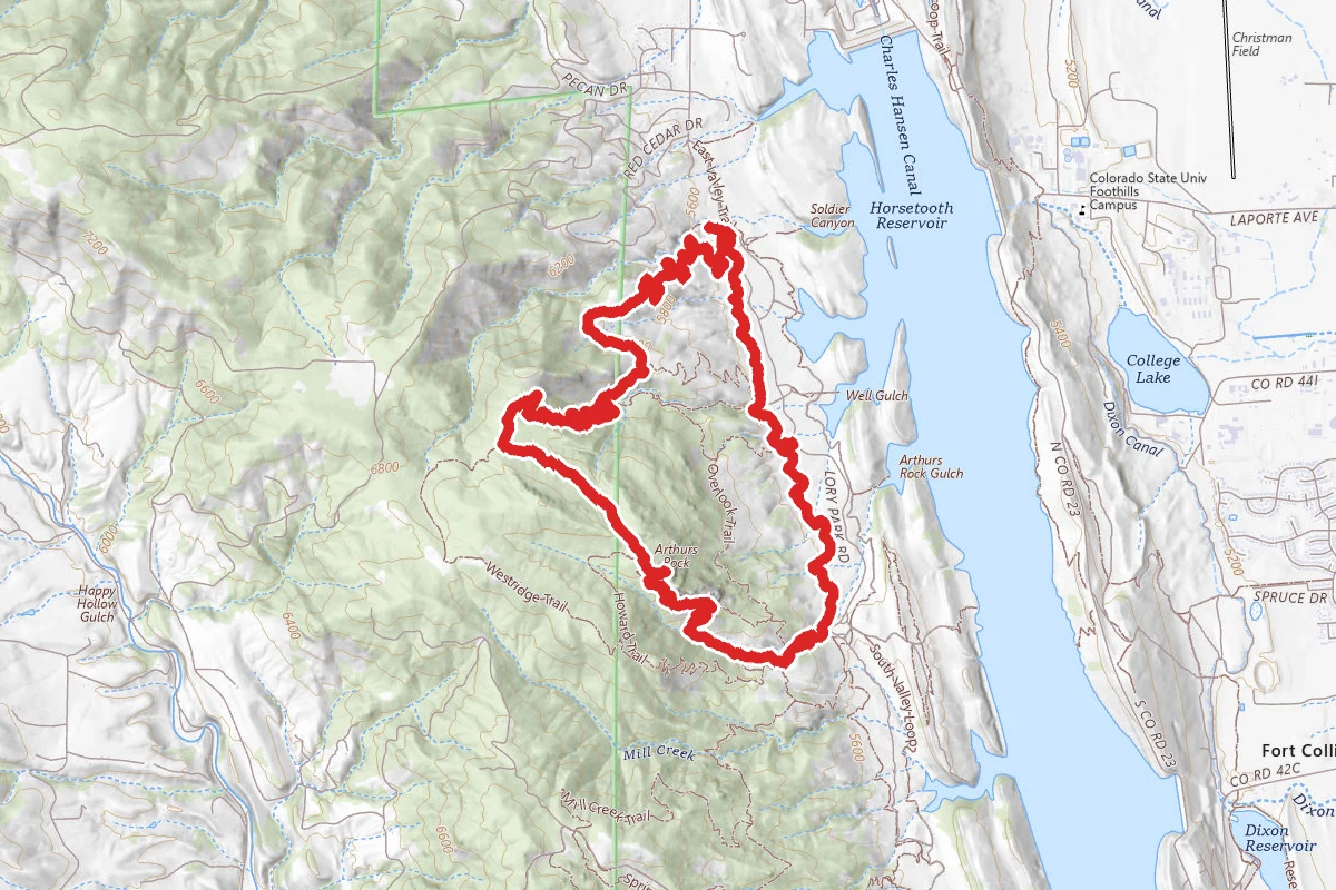
Timber Trail, Arthur's Rock, West Valley Loop
Timber Trail, Kimmons Trail and West Valley Trail Loop
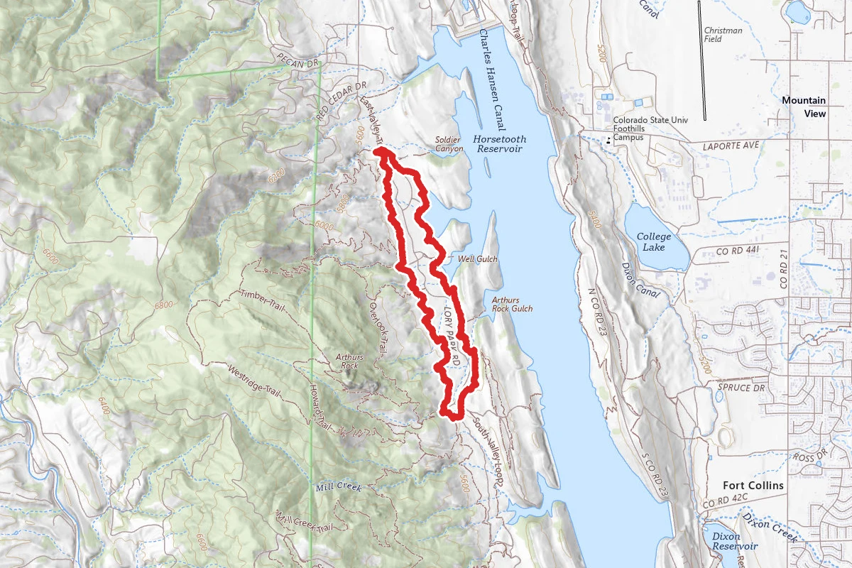
East & West Valley Trails
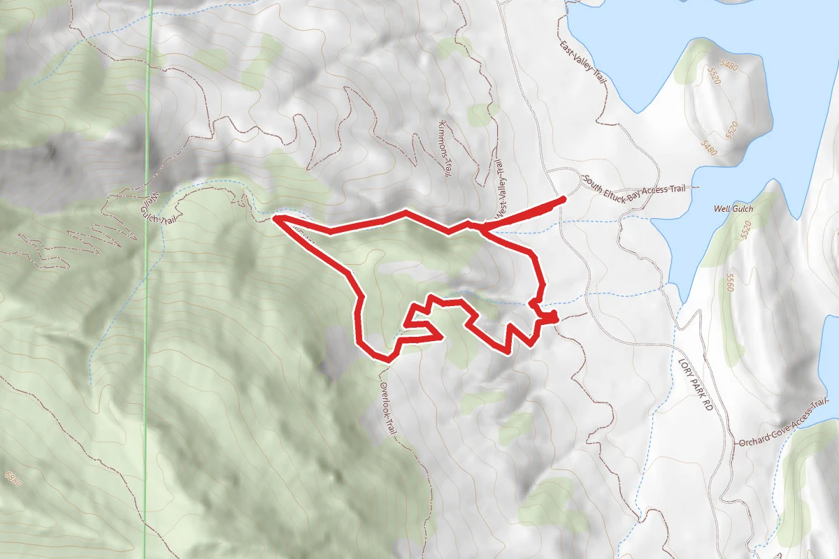
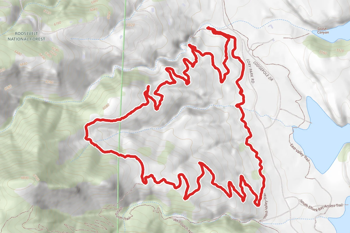
Well Gulch Natural Trail
Lory State Park Loop Trail
Stay nearby
Campgrounds near this trail
Lory State Park Backcountry Camping
0.1 mi away · CO
- Reservable
Larimer County Park Horsetooth Reservoir Campground
1.1 mi away · CO
- Reservable
Horsetooth Reservoir
1.4 mi away · CO
Horsetooth Mountain - Backcountry Site 2
4 mi away · CO
- Reservable
Horsetooth Resevoir Campground
4.2 mi away · CO
- Reservable
Fort Collins Lakeside KOA
4.4 mi away · CO
Similar length
Similar trails in Colorado
.jpg/1280px-Just_keep_climbing..._(26525368969).jpg)
Sky Pond Trail
Colorado

Flattop Mountain Trail
Colorado

Chasm Lake Trail
Colorado
Chavez and Beaver Brook Trail Loop
Colorado
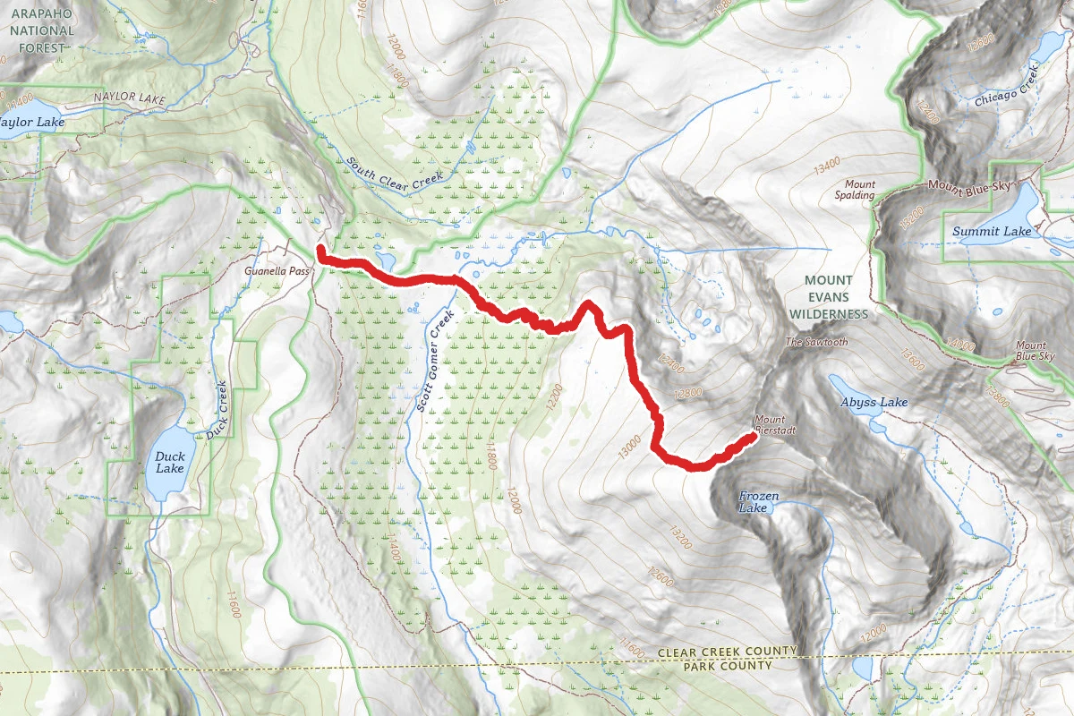
Mount Bierstadt Trail
Colorado
Maxwell Falls Lower Trail
Colorado