No photos yet
Official sources & verification
Managed by National Recreation Area
Source of truth
- Agency source page
The page our published rules and notes are derived from.
Managing agency
- National Recreation Area
Find offices, alerts, and current orders for this agency.
Verify by phone or mail
- Operator:(435) 542-3461
- Email:utrfmail@blm.gov
- Address:UT
About
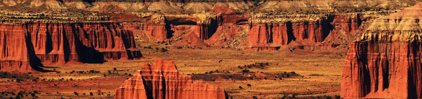
Imported descriptionOne of the more unique views in all of Utah is found by hiking up and onto South Caineville Mesa. This is a somewhat strenuous hike and exposes hikers to some very steep sidehills. The views are worth it. The eroding mountains and mesa's have cut ravines that fan out dramatically at the base. The trail is about two and a half miles long to the top of the Mesa where there is a register box to sign in. Some might be satisfied with reaching the top, but while you are there, it'd be worth the time to walk south across the Mesa to see the old rock cabin that was built by some of the earliest ranchers.
Source: recreation.gov
Reviews
No reviews yet
Be the first to share your experience and help others plan their visit.
Hunting in this park
Hunting is generally prohibited in this National Park Service unit
Verify current park-specific rules with the National Park Service before planning any hunt. See NPS regulations
Within ~100 miles
Parks near South Caineville Mesa Trail
recreation area
Park
Cathedral Valley Scenic Backway
Utah
Nat'l Recreation Area
Park
Factory Butte Recreation Area
Utah
Nat'l Recreation Area
Park
North Caineville Mesa Trail
Utah
Nat'l Recreation Area
Park
Mt. Ellen-Blue Hills
Utah
Nat'l Recreation Area
Park
Burro Wash
Utah

National Park
Park
Capitol Reef National Park
Utah
378 sq mi
Same state
More parks in Utah

Featured
National Park
Park
Arches National Park
Utah
120 sq mi

Featured
National Park
Park
Bryce Canyon National Park
Utah
56 sq mi

Featured
National Park
Park
Zion National Park
Utah
230 sq mi

Nat'l Recreation Area
Park
18 Road - North Fruita Desert
Utah

Nat'l Recreation Area
Park
Anasazi State Park Museum
Utah

Nat'l Recreation Area
Park
Antelope Island State Park
Utah
recreation area
Park
Armijo Route
Utah
Nat'l Recreation Area
Park
Ashley National Forest
Utah
Spot an error in our data on South Caineville Mesa Trail?