No photos yet
Official sources & verification
Managed by National Recreation Area
Source of truth
- Agency source page
The page our published rules and notes are derived from.
Managing agency
- National Recreation Area
Find offices, alerts, and current orders for this agency.
Verify by phone or mail
- Operator:(435) 542-3461
- Email:utrfmail@blm.gov
- Address:UT
About
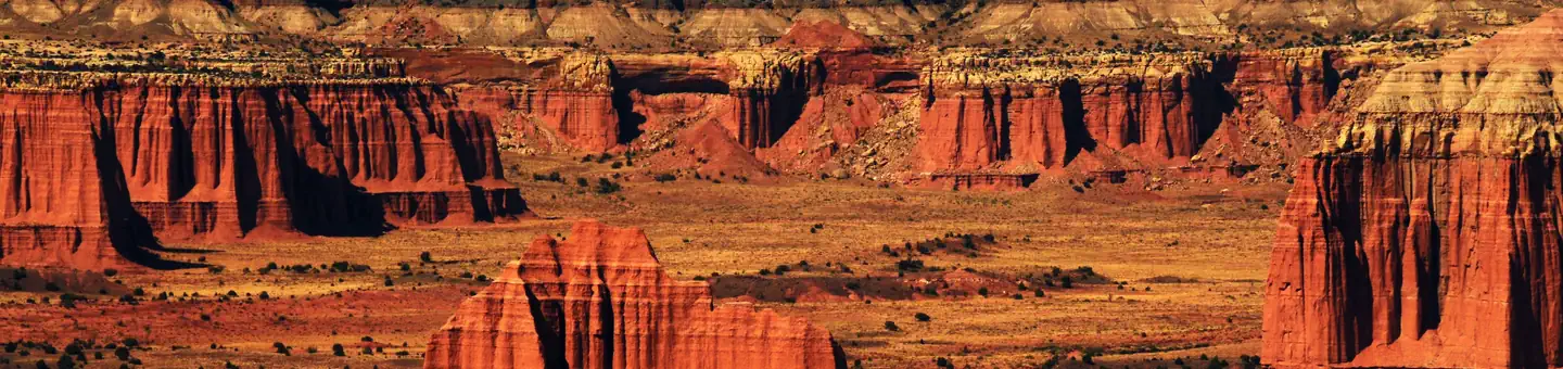
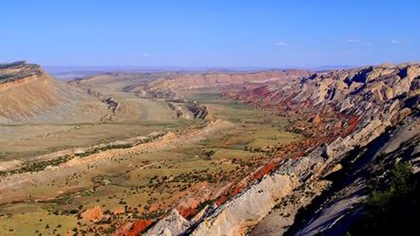
Imported descriptionThe trail ascends over 1300 feet to the top of the mesa. Along the way it runs along the spines of the Mancos badlands up into the Ferron sandstone cap on the mesa itself. The trail is marked by cairns. The hike takes about 1 hour to 1 1/2 hours each way and is about 2 miles long. Near the top of the trail there are several names scratched in the rock from early explorers and ranchers. Once at the top, there is a register box to sign in. Views from the top of the mesa are unparalleled. A second trail to the top of North Caineville Mesa starts along State Route 24 near the "old cement truck" in Caineville. There are no developed facilities in this area.
Source: recreation.gov
Reviews
No reviews yet
Be the first to share your experience and help others plan their visit.
Hunting in this park
Hunting is generally prohibited in this National Park Service unit
Verify current park-specific rules with the National Park Service before planning any hunt. See NPS regulations
Within ~100 miles
Parks near North Caineville Mesa Trail
Nat'l Recreation Area
Park
Factory Butte Recreation Area
Utah
Nat'l Recreation Area
Park
South Caineville Mesa Trail
Utah
recreation area
Park
Cathedral Valley Scenic Backway
Utah
Nat'l Recreation Area
Park
Mt. Ellen-Blue Hills
Utah
Nat'l Recreation Area
Park
Burro Wash
Utah
Nat'l Recreation Area
Park
Capitol Reef National Park
Utah
Same state
More parks in Utah

Featured
National Park
Park
Arches National Park
Utah
120 sq mi

Featured
National Park
Park
Bryce Canyon National Park
Utah
56 sq mi

Featured
National Park
Park
Zion National Park
Utah
230 sq mi
Nat'l Recreation Area
Park
18 Road - North Fruita Desert
Utah

Nat'l Recreation Area
Park
Anasazi State Park Museum
Utah

Nat'l Recreation Area
Park
Antelope Island State Park
Utah
recreation area
Park
Armijo Route
Utah
National Forest
Park
Ashley National Forest
Utah
2,160 sq mi
Spot an error in our data on North Caineville Mesa Trail?