No photos yet
Official sources & verification
Managed by National Recreation Area
Source of truth
- Agency source page
The page our published rules and notes are derived from.
Managing agency
- National Recreation Area
Find offices, alerts, and current orders for this agency.
Verify by phone or mail
- Operator:(520) 258-7200
- Email:BLM_AZ_TFOWEB@blm.gov
- Address:AZ
About
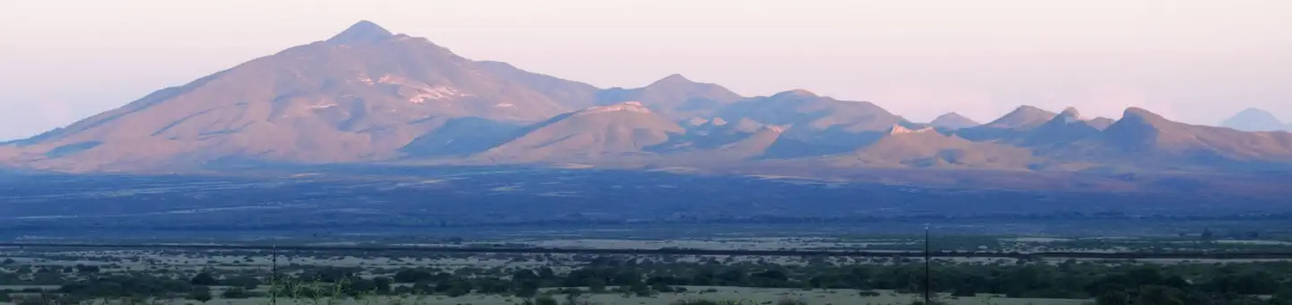
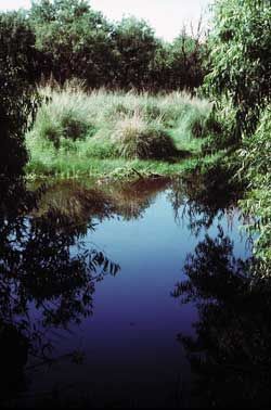
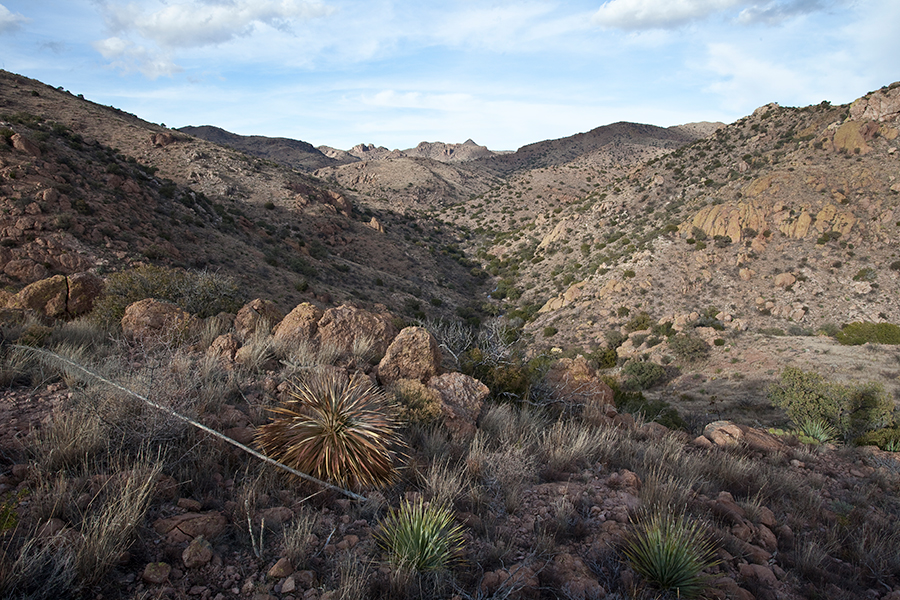
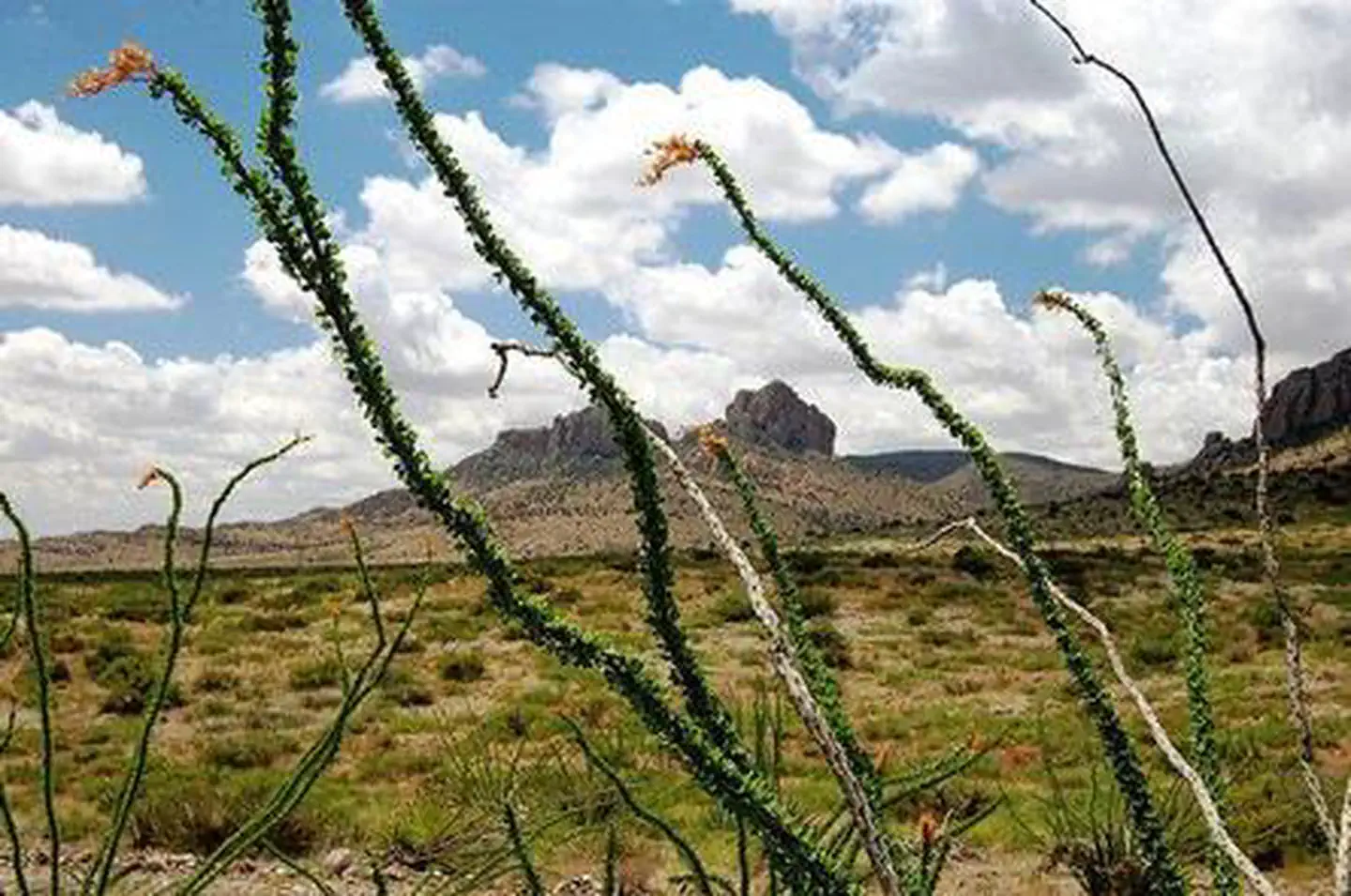
Imported descriptionThe San Pedro riparian area, containing about 40 miles of the upper San Pedro River, was designated by Congress as a National Conservation Area (NCA) on November 18, 1988. The primary purpose for the designation is to protect and enhance the desert riparian ecosystem, a rare remnant of what was once an extensive network of similar riparian systems throughout the Southwest.Many recreational opportunities are available within the NCA. Three of the most popular sites are:Murray Springs Clovis Site, a significant archaeological site that contains an undisturbed stratigraphic record of the past 40,000 years. Excavations were conducted by the University of Arizona from 1966 to 1971. People first arrived in this area 11,000 years ago. They belonged to what we now call the Clovis Culture and were the earliest known people to have inhabited North America. Named after the distinctive and beautifully crafted Clovis spear points they made, they were expert hunters of the large mammals of the last Ice Age. An interpretive trail leads visitors through the site. From Sierra Vista, take Arizona Route 90 east six miles to Moson Road. Turn left and go about 1.2 miles to the signed turnoff to Murray Springs. Park your vehicle and proceed by foot down the access road to the trail leading to the Murray Springs Clovis Site. The access road leading to the Murray Springs trail is currently closed to vehicle traffic.The Spanish Presidio Santa Cruz de Terrenate is the most intact remaining example of a once-extensive network of similar presidios. These fortresses marked the northern extension of New Spain into the New World. Only a stone foundation and a few remaining adobe wall remnants mark the location of an isolated and dangerous military station. From Fairbank on Arizona Route 82, drive approximately 2 miles west on Route 82, turn right on the Kellar Ranch Road and travel approximately 3 miles to the trailhead. Hike about 2 miles to the ruins and interpretive displays.The San Pedro House, located 9 miles east of Sierra Vista on Arizona Route 90, is a popular trailhead for birdwatchers, hikers, and mountain bikers. The Friends of San Pedro operate a bookstore and information center.
Source: recreation.gov
From Wikipedia
The San Pedro Riparian National Conservation Area contains nearly 57,000 acres (23,000 ha) of public land in Cochise County, Arizona, between the international border with Mexico and St. David, Arizona. The riparian area, where some 40 miles (64 km) of the upper San Pedro River meanders, was, through the efforts of congressman Jim Kolbe, designated by Congress as a Riparian National Conservation Area on November 18, 1988, and assigned to the protection of the U.S. Bureau of Land Management (BLM).
Source: Wikipedia — text licensed CC BY-SA 4.0. Verify alerts and operational details with the managing agency below.
Reviews
No reviews yet
Be the first to share your experience and help others plan their visit.
Hunting in this park
Hunting is generally prohibited in this National Park Service unit
Verify current park-specific rules with the National Park Service before planning any hunt. See NPS regulations
Within ~100 miles
Parks near San Pedro Riparian National Conservation Area
Nat'l Recreation Area
Park
Coronado National Memorial
Arizona
Nat'l Recreation Area
Park
Leslie Canyon National Wildlife Refuge
Arizona
conservation area
Park
Las Cienegas National Conservation Area
Arizona
National Forest
Park
Coronado National Forest
Arizona
2,781 sq mi
Nat'l Recreation Area
Park
San Bernardino National Wildlife Refuge
Arizona
Nat'l Recreation Area
Park
Baker Canyon Wilderness Study Area
Arizona
Same state
More parks in Arizona

Featured
National Park
Park
Grand Canyon National Park
Arizona
1,878 sq mi

Nat'l Recreation Area
Park
Agua Fria National Monument
Arizona
Nat'l Recreation Area
Park
Alamo Hueco Mountains Wilderness Study Area
Arizona
Nat'l Recreation Area
Park
Alamo Lake
Arizona
Nat'l Recreation Area
Park
Apache Box Wilderness Study Area
Arizona
Nat'l Recreation Area
Park
Apache-Sitgreaves National Forest
Arizona
National Forest
Park
Apache-Sitgreaves National Forests
Arizona
4,313 sq mi
Nat'l Recreation Area
Park
Arizona National Scenic Trail
Arizona
Spot an error in our data on San Pedro Riparian National Conservation Area?