No photos yet
Official sources & verification
Managed by National Recreation Area
Source of truth
- Agency source page
The page our published rules and notes are derived from.
Managing agency
- National Recreation Area
Find offices, alerts, and current orders for this agency.
Verify by phone or mail
- Operator:208-879-6200
- Email:BLM_ID_ChallisOffice@blm.gov
- Address:ID
About
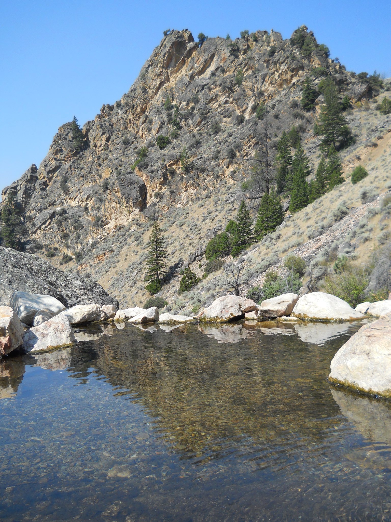
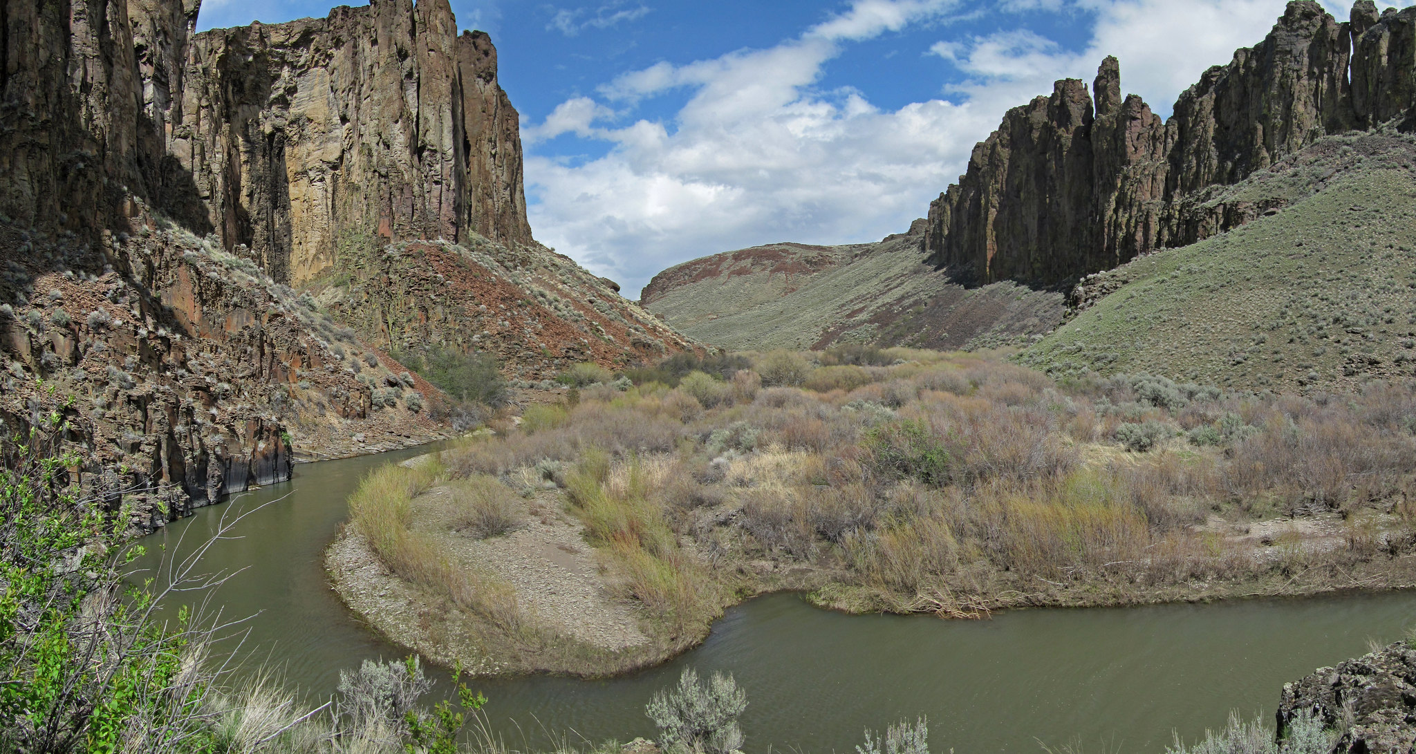
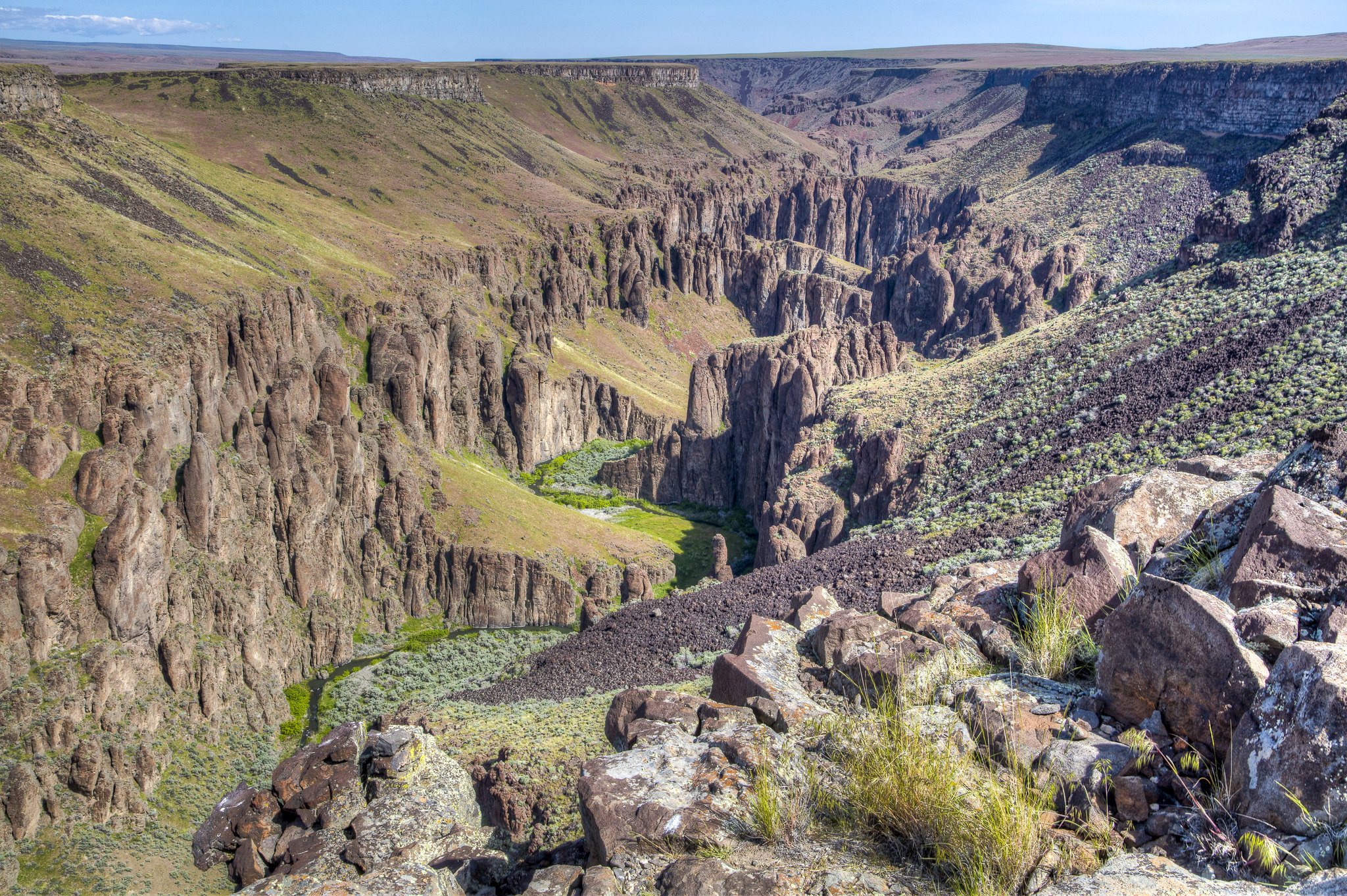
Imported descriptionOverviewThe Upper Salmon River (Stanley to North Fork, Idaho) provides a variety of boating and river-based recreational opportunities. This upper section is unique in its combination of easy access and backcountry scenic values. Dozens of wildlife and bird species depend on this river for its clean water and robust riparian zones for survival. The river also supports three separate species of anadromous fish, including Chinook Salmon, Sockeye Salmon, and Steelhead. Towns along the Upper Salmon River include Stanley, Clayton, Challis, Ellis, Salmon, and North Fork, Idaho with Highways 75 and 93 running parallel to the river. The river provides opportunities for rafting, floating, fishing, hot springs, camping, picnicking, and wildlife watching. Visitors can expect to see Bald Eagles, Deer, Elk, or Bighorn Sheep while recreating on the Upper Salmon River. The Headwaters to Torrey's HoleThe headwaters of the Upper Salmon begins in the Sawtooth National Recreation Area (NRA) managed by the U.S. Forest Service. This sections contains Class I to IV rapids. Boaters are required to use designated put-ins and take-outs in the Sawtooth NRA. The section of river from the Sawtooth Hatchery (Mile 0) to Torrey's Hole (Mile 21.4) has an annual seasonal closure. Please contact the USFS Sawtooth National Recreation Area for more information at (208) 727-5000.Torrey's Hole to Challis BridgeThis next section runs through the BLM-Challis Field Office managed public lands and water, from Torrey's Hole (Mile 21.4) to Challis Bridge Recreation Site (Mile 58.5). This section contains Class I and II rapids, and various river access sites. River access sites along this section include Torrey's Hole, South Butte, East Fork/Spud Creek, Deadman Hole, Bayhorse, and Challis Bridge. Please contact the BLM-Challis Field Office for more information at (208) 879-6200.Challis Bridge to Kilpatrick This section contains to run through the BLM-Challis Field Office managed public lands and water from Challis Bridge (Mile 58.5) to Kilpatrick (Mile 94.7). This section contains class I and II rapids, and various river access sites. River access sites along this section include Challis Bridge, Challis Hot Springs, Pennal Gulch, Tappans, Watts Bridge, Cottonwood, Ellis, Deer Gulch, Cronk's Canyon, McKim Creek, and Kilpatrick. Please contact the BLM-Challis Field Office for more information at (208) 879-6200.Kilpatrick to North ForkThis final section of the Upper Salmon River runs through the BLM-Salmon Field Office managed public lands and waters from Kilpatrick (Mile 94.7) to North Fork (Mile 148.6). This section contains Class I rapids and various river access sites. River access sites along this section include Kilpatrick, Elk Bend, Waddington Creek, Camp Creek, Elevenmile, Eightmile, Shoup Bridge, Salmon Island Park, Carmen Bridge, Morgan Bar, Tower Rock, Red Rocks, Bobcat Gulch, and North Fork.Please contact the BLM-Salmon Field Office for more information at (208) 756-5400.River and Boat Ramp EtiquetteGet in and out of boat ramps as quickly as possible.Park vehicles away from loading areas.Give other boaters plenty of space.Steer clear of fishing lines.Keep noise levels low when floating by other parties.Avoid disturbing wildlife.Minimum Impact CampingPack out all trash.Bring extra drinking water.Use a fire pan or blankets for campfires.Do not cut or destroy standing live or dead vegetation.When possible, use vault toilets at recreation sites, or a portable toilet system that is watertight.
Source: recreation.gov
Reviews
No reviews yet
Be the first to share your experience and help others plan their visit.
Hunting in this park
Hunting is generally prohibited in this National Park Service unit
Verify current park-specific rules with the National Park Service before planning any hunt. See NPS regulations
Within ~100 miles
Parks near Salmon River
Nat'l Recreation Area
Park
Kilpatrick Day Use Area
Idaho
recreation area
Park
Morgan Creek Recreation Site
Idaho
National Forest
Park
Salmon-Challis National Forest
Idaho
6,619 sq mi
Nat'l Recreation Area
Park
Goldbug Hot Springs
Idaho
Nat'l Recreation Area
Park
Challis Foothills Trail System
Idaho
Nat'l Recreation Area
Park
Elevenmile Day Use Area
Idaho
Same state
More parks in Idaho
Nat'l Recreation Area
Park
Anderson Ranch Reservoir Boat Ramps
Idaho
Wilderness Area
Park
Appendicitis Hill Wilderness Study Area
Idaho

recreation area
Park
Arrowrock Reservoir
Idaho
Nat'l Recreation Area
Park
Balanced Rock
Idaho
Nat'l Recreation Area
Park
Battle Creek Wild and Scenic River
Idaho
Nat'l Recreation Area
Park
Bear Den Butte Wilderness Study Area
Idaho

Nat'l Recreation Area
Park
Beaverhead-Deerlodge National Forest
Idaho
Nat'l Recreation Area
Park
Big Jacks Creek Wild and Scenic River
Idaho
Spot an error in our data on Salmon River?