Nat'l Recreation Area
Official sources & verification
Managed by National Recreation Area
Source of truth
- Agency source page
The page our published rules and notes are derived from.
Managing agency
- National Recreation Area
Find offices, alerts, and current orders for this agency.
Verify by phone or mail
- Operator:928-348-4400
- Email:BLM_AZ_SFOWEB@blm.gov
- Address:AZ
About
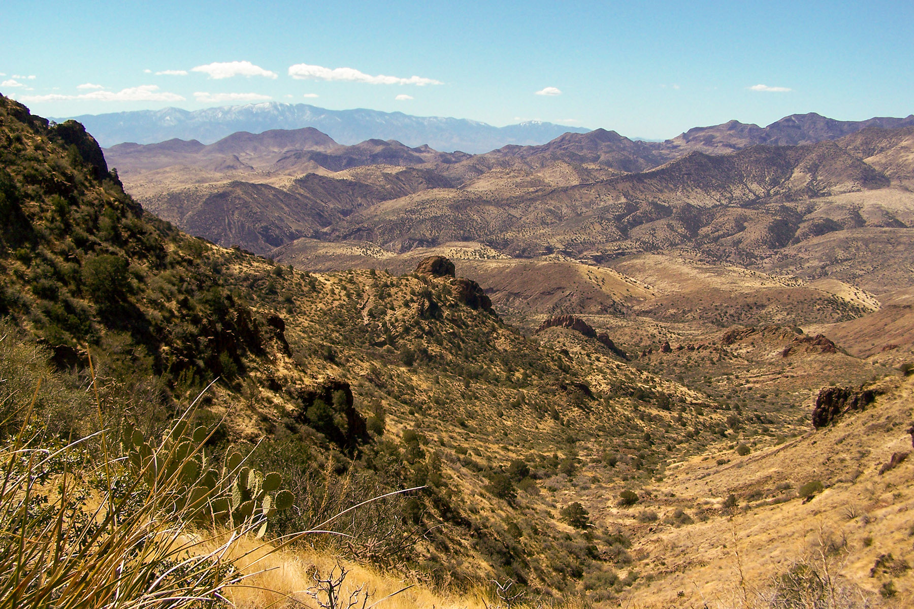
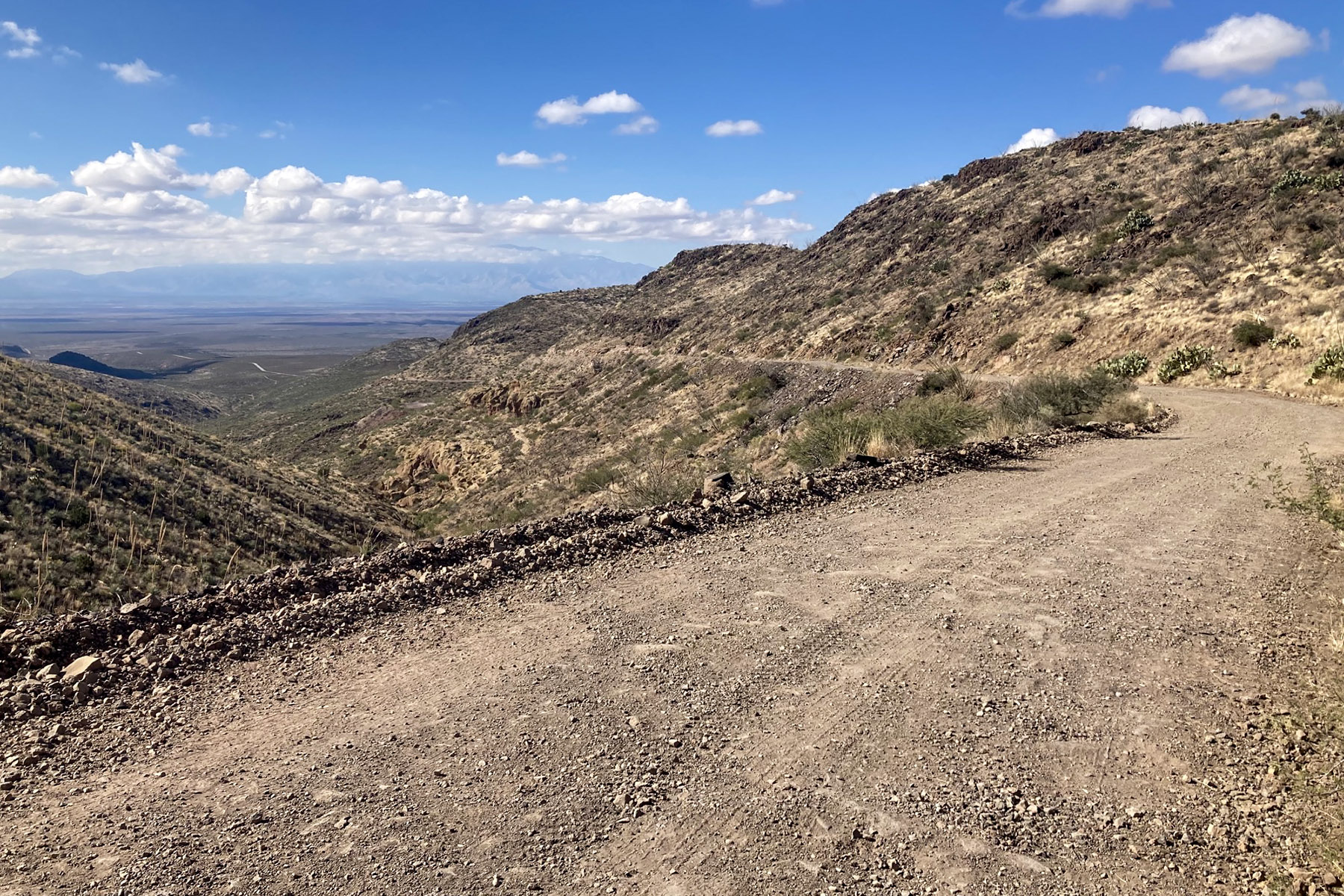
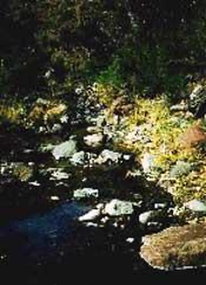
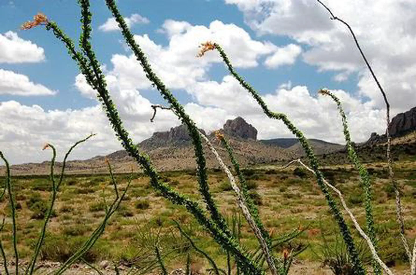
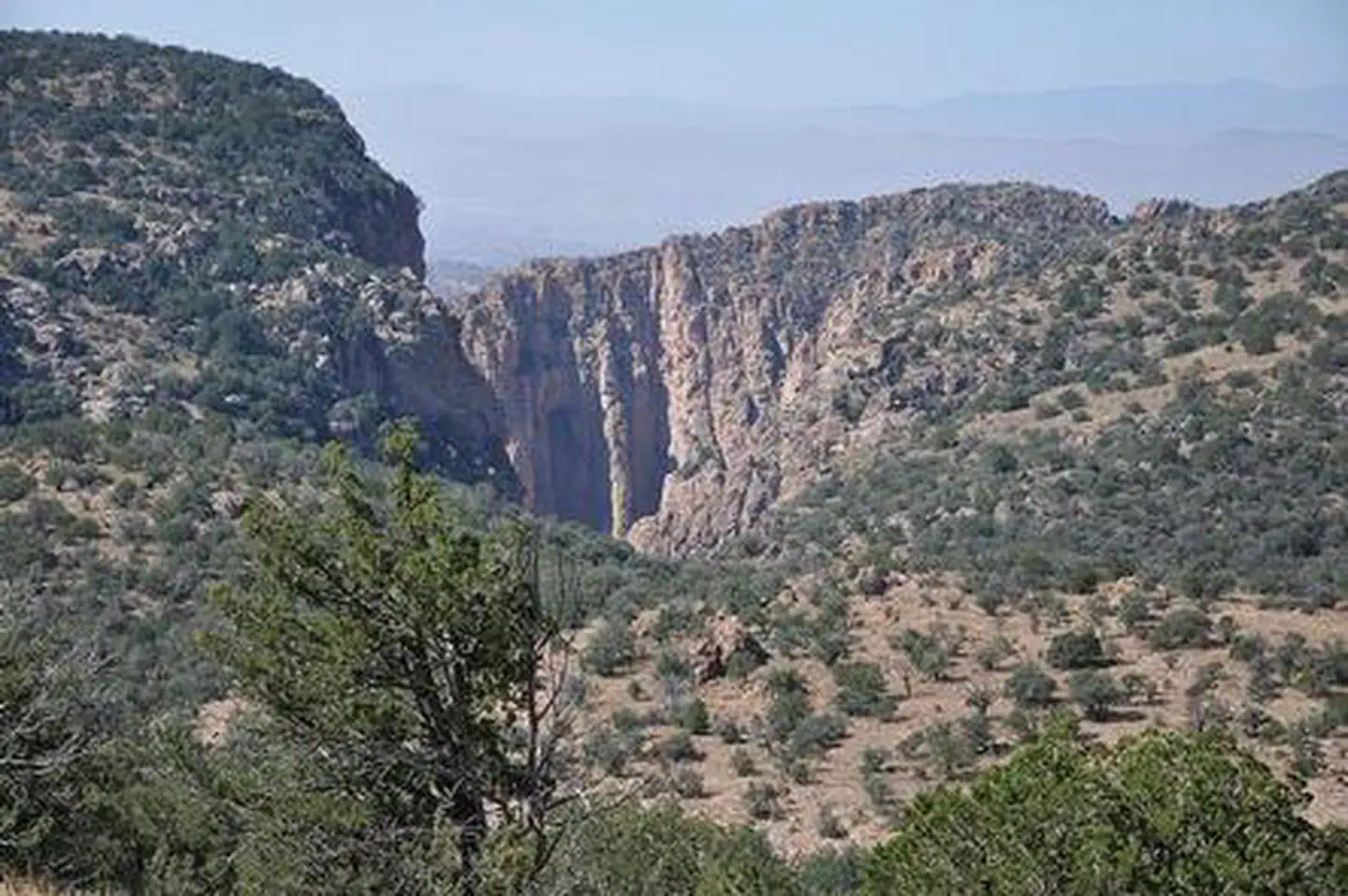
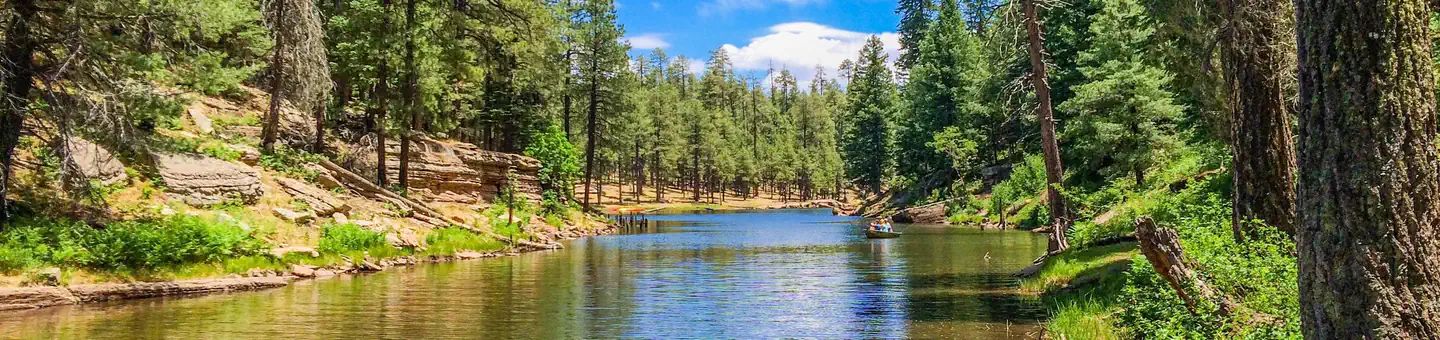
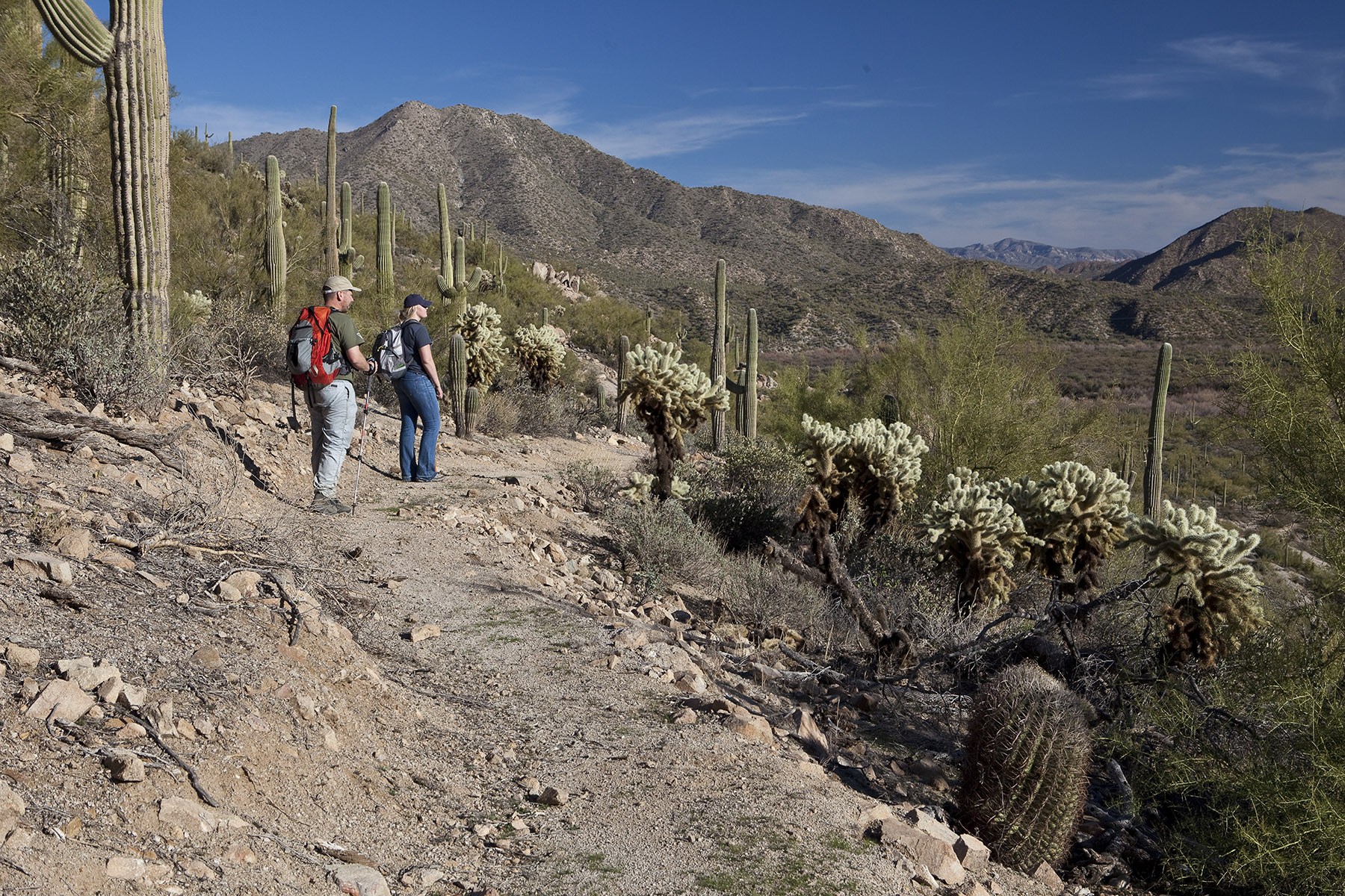
Imported descriptionThe Safford-Morenci Trail is an 18-mile historic backcountry route that offers a rugged and remote adventure through eastern Arizona. Climbing from 3,700 to 6,200 feet, the trail crosses the Gila Mountains and Turtle Mountain, showcasing desert vistas and riparian corridors.Constructed in 1874, the trail was once a vital supply route for ranchers and farmers transporting goods to the booming Clifton-Morenci mining district. Its use declined in the early 1900s with the development of automobile roads, leaving behind remnants of the original pack trail and historic ruins that hikers can still discover today.The trail has a mixed-use designation with non-motorized and motorized sections, although its more popular for hiking and backpacking. The majority of the trail is designated for non-motorized use and hikers should maintain caution on motorized sections for vehicle traffic. Highlights along the trail are the riparian habitat at Bonita Creek, the red-walled slot canyon at Midnight Canyon, and the views atop the pass near Turtle Mountain. In 2025, trail maintenance was performed from the west trailhead towards Johnny Creek Road and from East Bonita Rim Road to the reservation boundary. This is a moderate to difficult backcountry trail requiring strong navigation skills. Always pack extra water, check weather conditions before your trip, and practice wildlife safety. Carry detailed topographic maps, a compass, and a GPS device, as signage is minimal and route finding can be challenging.Portions of the trail cross mixed land ownership, so permits are required: an Arizona State Trust Land permit for a short section and a San Carlos Apache Tribal permit for the segment on tribal land. See ‘Fees’ section below for details.If visitors are looking for a much longer hike, the Grand Enchantment Trail (GET) follows the Safford-Morenci Trail for part of its route. The GET runs 730 miles between Phoenix and Albuquerque. Its route was mapped by a long-distance hiker but is not recognized by any official authority. It draws a few dozen backpackers through this area a year.Hours and SeasonsThe trail is best explored in fall through spring, when temperatures are cooler and conditions are more favorable for hiking. The trail is open all year and at all hours of the day.Features and ServicesDrinking Water: The Bonita Creek’s clear, cool water is inviting for a soak, but must be treated before drinking due to human, cattle, and wildlife activity upstream. Carry plenty of water with you.Toilets: No toilet facilities are located at trailheads or along the trail. Practice Leave No Trace ethics when it comes to disposal of human waste.Cell Phone and Internet: Cell phone and internet coverage is not reliable and should not be depended on for emergency communications.Pets: Service animals are legally permitted anywhere that visitors can go along this trail. Other non-service pets must be under the physical control of their owner at all times. Nearby Attractions and Amenities: No amenities exist in the nearby area. Attractions are the Gila Box RNCA, Bonita Creek, Eagle Creek, and Pueblo Devol Cliff Dwelling.Safety and ConditionsYou are responsible for your own safety. Call 911 to contact local law enforcement, obtain emergency services, or report a fire. There is no first aid available.Winter travelers should be prepared for possible snow at higher elevations. Water sources along the route are extremely limited, with Bonita Creek being the primary reliable source. Always treat water before drinking. The trail’s remote nature means visitors should plan for self-sufficiency and be aware of local wildlife, including bears and mountain lions, particularly near riparian areas. Anticipate cattle along the way as this trail crosses many active grazing allotments. Expect potential hazards such as venomous animals, extreme heat or cold, and flash floods. Be prepared for weather changes and stay informed on alerts. Have the appropriate gear, food, and water.
Source: recreation.gov
Reviews
No reviews yet
Be the first to share your experience and help others plan their visit.
Hunting in this park
Hunting is generally prohibited in this National Park Service unit
Verify current park-specific rules with the National Park Service before planning any hunt. See NPS regulations
Within ~100 miles
Parks near Safford-Morenci Trail

Nat'l Recreation Area
Park
Gila Box Riparian National Conservation Area
Arizona
Nat'l Recreation Area
Park
Black Hills Back Country Byway
Arizona

Nat'l Recreation Area
Park
Canyon Overlook Picnic Area
Arizona
Nat'l Recreation Area
Park
Dankworth Village
Arizona
Nat'l Recreation Area
Park
Fishhooks Wilderness
Arizona
Nat'l Recreation Area
Park
North Santa Teresa Wilderness
Arizona
Same state
More parks in Arizona

Featured
National Park
Park
Grand Canyon National Park
Arizona
1,878 sq mi

Nat'l Recreation Area
Park
Agua Fria National Monument
Arizona
Nat'l Recreation Area
Park
Alamo Hueco Mountains Wilderness Study Area
Arizona
Nat'l Recreation Area
Park
Alamo Lake
Arizona
Nat'l Recreation Area
Park
Apache Box Wilderness Study Area
Arizona
Nat'l Recreation Area
Park
Apache-Sitgreaves National Forest
Arizona
National Forest
Park
Apache-Sitgreaves National Forests
Arizona
4,313 sq mi
Nat'l Recreation Area
Park
Arizona National Scenic Trail
Arizona
Spot an error in our data on Safford-Morenci Trail?