No photos yet
Official sources & verification
Managed by National Park Service
Source of truth
- Agency source page
The page our published rules and notes are derived from.
Managing agency
- National Park Service
Find offices, alerts, and current orders for this agency.
Verify by phone or mail
- Operator:208-373-4000
- Email:blm_id_infoaccesscenter@blm.gov
- Address:ID
About
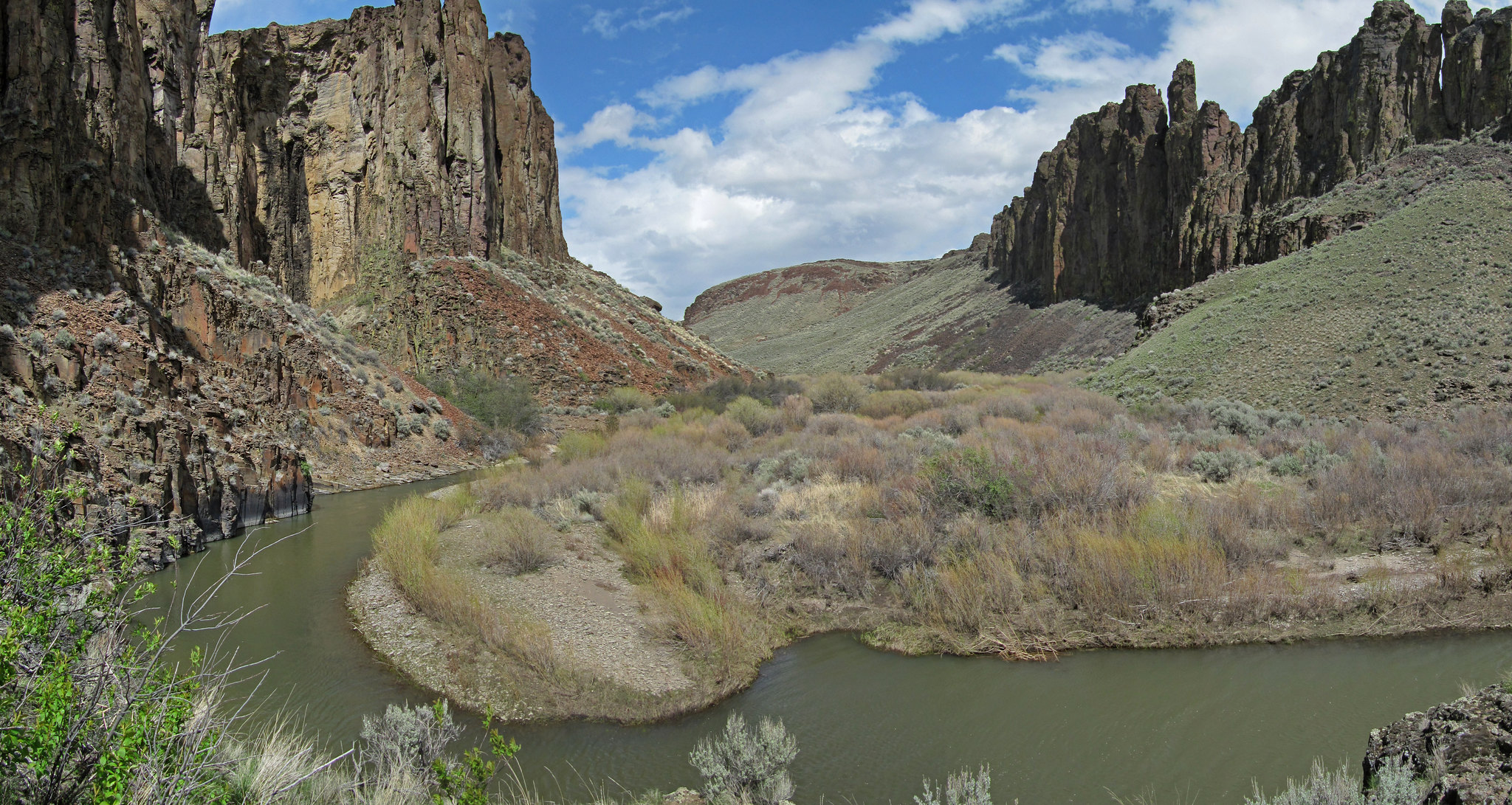
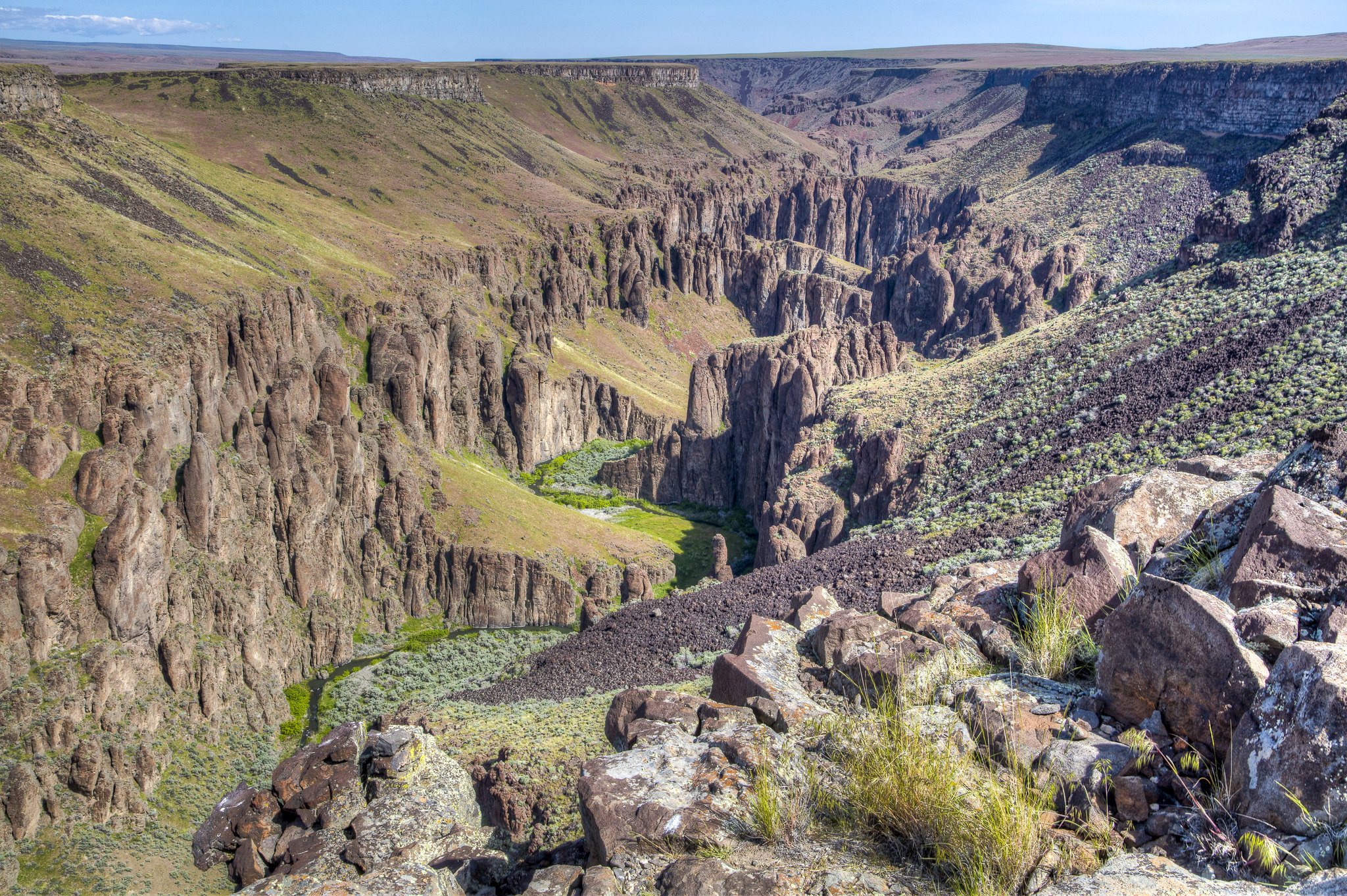
Imported descriptionThe Oregon Trail Scenic Byway follows the main Oregon Trail from the crossing of the Snake River near Glenns Ferry to Bonneville Point, southeast of Boise. Part 1 of the byway is a loop drive that takes you to the south side of the Snake River to view the Three Island Crossing location from the bluffs above the river, then ends on the north side of the river at Three Island Crossing State Park interpretive center. Parts 2 and 3 take county roads to follow the Oregon Trail from Glenns Ferry to Bonneville Point. Oregon Trail ruts are visible along much of this route. Several locations allow access for hiking and horseback riding on the Oregon Trail. The main Oregon Trail from Three Island Crossing to Boise was the primary route utilized by the emigrants for the first 10 years of the trail. Those emigrants who could not cross the Snake River were forced to follow the south side of the Snake River on a route known as the South Alternate. Freight and stage roads to the railroad in northern Utah utilized much of the Oregon Trail for many years. The Oregon Trail continued to be used long after the building of the railroads across southern Idaho, even into the early 1900s. The total distance of the byway is 89 miles. Allow eight hours to complete the trip from Boise, including time to visit the Three Island Crossing State Park interpretive center and to explore the Oregon Trail at the various access points along the way. All of the byway roads are paved or good gravel roads. High clearance vehicles may be required to access the trail off the byway. Four-wheel drive is not needed for the byway, but please stay off the access roads if they are wet or muddy.
Source: recreation.gov
From Wikipedia
The Oregon Trail was a 2,170-mile (3,490 km) east–west, large-wheeled wagon route and emigrant trail in North America that connected the Missouri River to valleys in Oregon Territory. The eastern part of the Oregon Trail crossed what is now the states of Kansas, Nebraska, and Wyoming. The western half crossed the current states of Idaho and Oregon.
Source: Wikipedia — text licensed CC BY-SA 4.0. Verify alerts and operational details with the managing agency below.
Reviews
No reviews yet
Be the first to share your experience and help others plan their visit.
Hunting in this park
Hunting is generally prohibited in this National Park Service unit
Verify current park-specific rules with the National Park Service before planning any hunt. See NPS regulations
Within ~100 miles
Parks near Oregon National Historic Trail
National Monument
Park
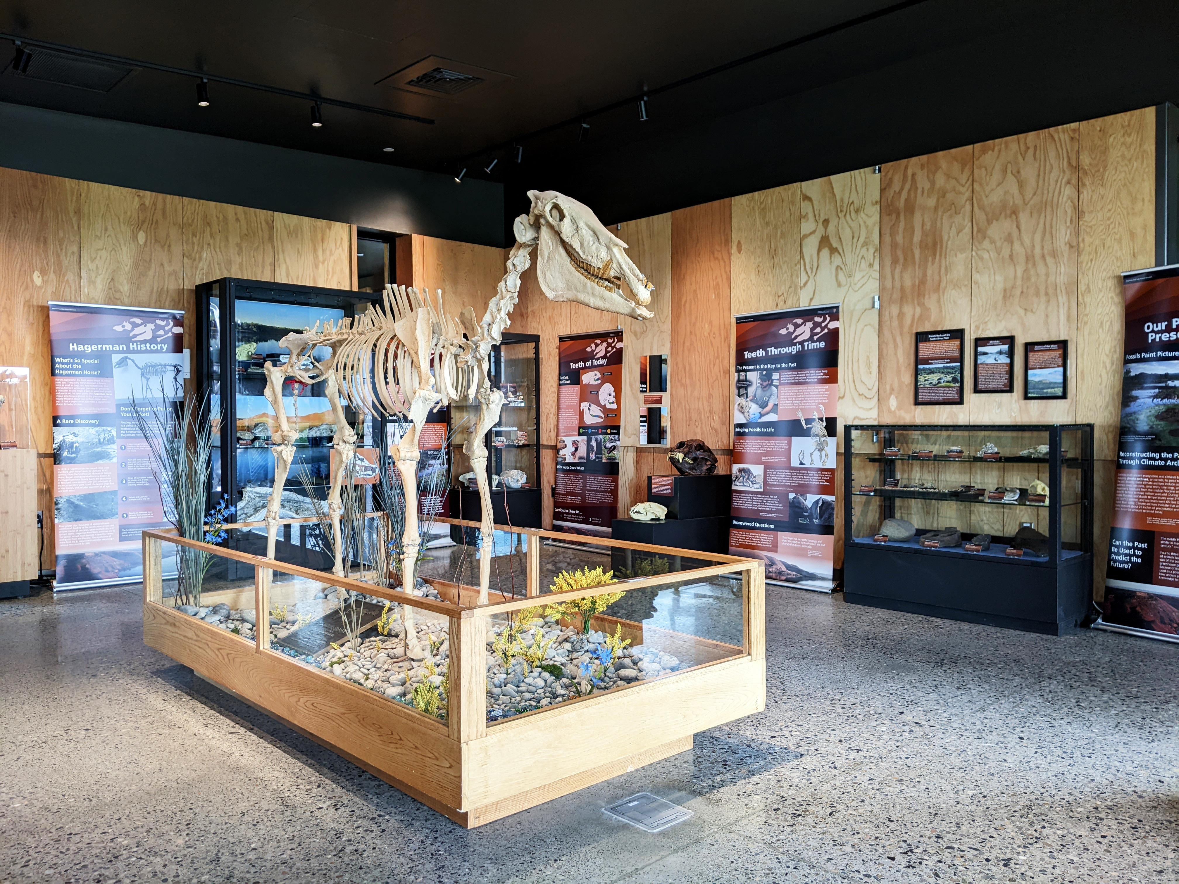
Hagerman Fossil Beds National Monument
Idaho
Wilderness Area
Park
King Hill Creek Wilderness Study Area
Idaho
Nat'l Recreation Area
Park
Balanced Rock
Idaho
Nat'l Recreation Area
Park
Gooding City of Rocks West Wilderness Study Area
Idaho
Nat'l Recreation Area
Park
Deer Creek Wilderness Study Area
Idaho
Nat'l Recreation Area
Park
Gooding City of Rocks East Wilderness Study Area
Idaho
Same state
More parks in Idaho
Nat'l Recreation Area
Park
Anderson Ranch Reservoir Boat Ramps
Idaho
Wilderness Area
Park
Appendicitis Hill Wilderness Study Area
Idaho

recreation area
Park
Arrowrock Reservoir
Idaho
Nat'l Recreation Area
Park
Battle Creek Wild and Scenic River
Idaho
Nat'l Recreation Area
Park
Bear Den Butte Wilderness Study Area
Idaho

Nat'l Recreation Area
Park
Beaverhead-Deerlodge National Forest
Idaho
Nat'l Recreation Area
Park
Big Jacks Creek Wild and Scenic River
Idaho
Nat'l Recreation Area
Park
Big Jacks Creek Wilderness Area
Idaho
Spot an error in our data on Oregon National Historic Trail?