Nat'l Recreation Area
Official sources & verification
Managed by National Recreation Area
Source of truth
- Agency source page
The page our published rules and notes are derived from.
Managing agency
- National Recreation Area
Find offices, alerts, and current orders for this agency.
Verify by phone or mail
- Operator:661-391-6000
- Email:BLM_CA_Web_BK@blm.gov
- Address:CA
About
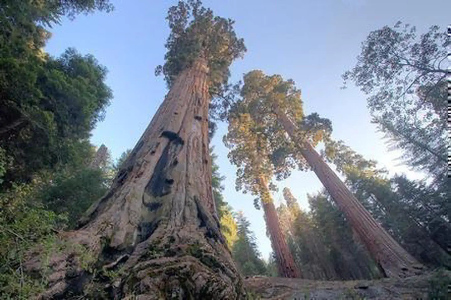
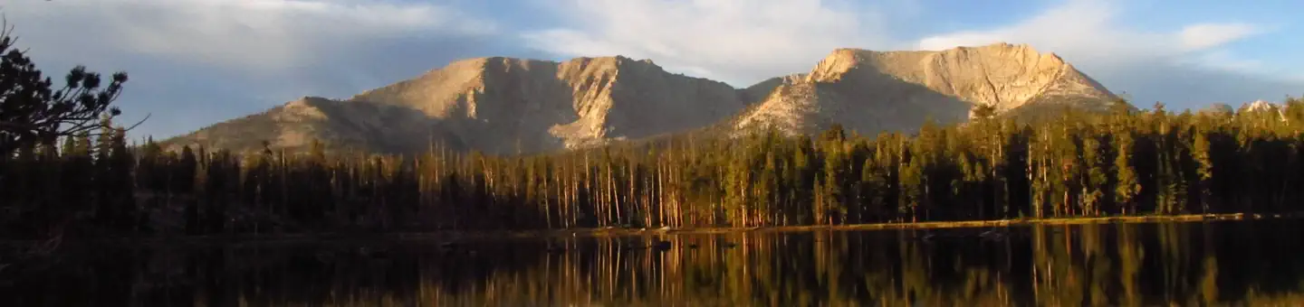
Imported descriptionOverviewNestled in the heart of the Sierra Nevada foothills, Case Mountain offers a stunning natural escape for outdoor enthusiasts. Also known as Salt Creek to many locals, the Recreation area has miles of Non Motorized trails that wind through oak woodlands, chaparral, and scenic ridgelines. Case Mountain Extensive Recreation Management Area (ERMA) contains the only Giant Sequoia Grove complex managed by the Bureau of Land Management. The complex is comprised of six distinct sequoia grove units, which total about 444 acres. Whether you're seeking a peaceful stroll or an activity with more challenging terrain, there is something here for every skill level. Adventurers can enjoy breathtaking views of the surrounding Sierra Nevada peaks and the Tule River Valley. The area's rich flora and fauna make it an ideal spot for photography, birdwatching, and connecting with nature. From the upper elevations, visitors are treated to panoramic vistas and sweeping views. Case Mountain is accessible and enjoyable year-round, with different seasons offering unique experiences. Be advised of all weather conditions and prepare accordingly. All public access to Case Mountain ERMA is non-motorized.Recreation OpportunitiesBiking - On designated trails, this area is a popular spot for downhill mountain bikingWildlife/Scenic Viewing & Photography - Enjoy the natural beauty of the landscape and the critters that inhabit itHorseback Riding - Trailer staging is located at the Craig Ranch parking lotFishing and Hunting - With valid licenses and in compliance with state and local regulationsCamping - Dispersed camping is permitted past a 3/4 mile radius from the trailhead (see map)Facilities DescriptionTrail Heads begin at the terminus of Craig Ranch Road and Skyline Drive.Popular TrailsSkyline Trail (Lower Loop)Distance: 2 mi (3.5 km)Time: 1 hourElevation Gain: 300 ft (100 m)Difficulty: EasyA lower elevation hike that is short and scenic. The popular loop offers great views of the surroundinglandscapes with charming bridges over the creek and many places to stop for a picnic.This trail isperfect for a leisurely hike and a great escape for all skill levels.Salt Creek Falls (Lower Waterfall)Distance: 4.5 miTime: 2 hoursElevation Gain: 800 ftDifficulty: ModerateFollows Craig Ranch Road for a portion of the way and cuts down and across the valley at the lower waterfall.This hike is for experienced hikers due to steep grades on the southern portion. Please be aware of bikes andother users on the trail, especially as it narrows to single-track.Salt Creek Falls (Upper Waterfall)Distance: 6 miTime: 3 hoursElevation Gain: 1500 ftDifficulty: StrenuousSimilar to the lower waterfall, this hike continues up to Holland Corral for beautiful panoramic views of the valley. Itis longer than the lower falls and a higher elevation climb, so take caution with steep grades and carry water.Additional InformationParking area hours are from 6am to 8pm dailySPEED LIMIT 15 MPH, Craig Ranch Road and Skyline Drive are residential areasOvernight camping prohibited in Twin PondsOvernight parking prohibitedMotorized Use prohibited
Source: recreation.gov
Reviews
No reviews yet
Be the first to share your experience and help others plan their visit.
Hunting in this park
Hunting is generally prohibited in this National Park Service unit
Verify current park-specific rules with the National Park Service before planning any hunt. See NPS regulations
Within ~100 miles
Parks near Case Mountain Extensive Recreation Management Area
Nat'l Recreation Area
Park
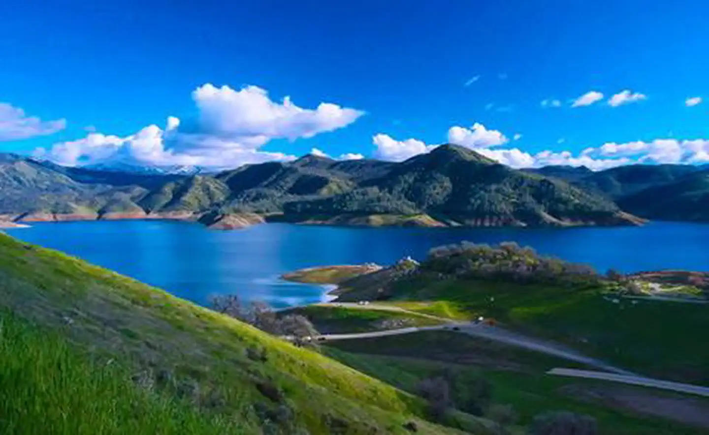
Kaweah Lake
California
wildlife refuge
Park
Blue Ridge National Wildlife Refuge
California

Featured
National Park
Park
Sequoia National Park
California
631 sq mi
Nat'l Recreation Area
Park
Sequoia & Kings Canyon National Parks
California
National Forest
Park
Sequoia National Forest
California
1,865 sq mi
National Park
Park
Kings Canyon National Park
California
722 sq mi
Same state
More parks in California

Featured
National Park
Park
Death Valley National Park
California
5,326 sq mi
Featured
National Forest
Park
Inyo National Forest
California
2,974 sq mi

Featured
National Park
Park
Joshua Tree National Park
California
1,242 sq mi

Featured
National Park
Park
Redwood National and State Parks
California
217 sq mi
Featured
National Forest
Park
Shasta-Trinity National Forest
California
3,438 sq mi

Featured
National Park
Park
Yosemite National Park
California
1,190 sq mi
Nat'l Recreation Area
Park
California

Wilderness Area
Park
Agua Tibia Wilderness
California
Spot an error in our data on Case Mountain Extensive Recreation Management Area?