
National Seashore
Official sources & verification
Managed by National Seashore
Source of truth
- Agency source page
The page our published rules and notes are derived from.
Managing agency
- National Seashore
Find offices, alerts, and current orders for this agency.
Verify by phone or mail
- Operator:(386) 428-3384
- Email:cana_interpretation@nps.gov
- Address:FL
About
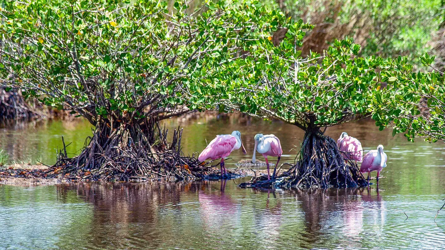
The Canaveral National Seashore (CANA) is a National Seashore located between New Smyrna Beach and Titusville, Florida, in Volusia and Brevard Counties. The park, located on a barrier island, was created on January 3, 1975, by an act of Congress. The park is split between Brevard and Volusia counties, with 9 miles of the seashore in Brevard County, and 15 miles of the seashore in Volusia County. CANA consists of 24 miles of beaches, dunes, mangrove wetlands, and a large portion of the Mosquito Lagoon. The Canaveral National Seashore is also the longest expanse of undeveloped land along the East Coast of Florida. The Canaveral National Seashore is home to more than 1,000 plant species and 310 bird species. CANA occupies 57,662 acres (23,335 ha). There are 3 major beach sections in the seashore. The southern section is Playalinda Beach, the middle section is Klondike Beach, and the northern section is Apollo Beach.
Source: Wikipedia — text licensed CC BY-SA 4.0. Verify alerts and operational details with the managing agency below.
Reviews
No reviews yet
Be the first to share your experience and help others plan their visit.
Hunting in this park
Hunting is generally prohibited in this National Park Service unit
Verify current park-specific rules with the National Park Service before planning any hunt. See NPS regulations
Within ~100 miles
Parks near Canaveral National Seashore
Merritt Island National Wildlife Refuge
Florida
ParkNat'l Recreation Area

St. Johns National Wildlife Refuge
Florida
Parkwildlife refuge

Lake Woodruff National Wildlife Refuge
Florida
Parkwildlife refuge
Archie Carr National Wildlife Refuge
Florida
Parkwildlife refuge

Guana Tolomato Matanzas National Estuarine Research Reserve
Florida
ParkNat'l Recreation Area
Ocala National Forest
Florida
606 sq mi
ParkNational Forest
Same state
More parks in Florida

Featured
Everglades National Park
Florida
2,358 sq mi
ParkNational Park
Apalachicola National Forest
Florida
901 sq mi
ParkNational Forest

Arthur R. Marshall Loxahatchee National Wildlife Refuge
Florida
Parkwildlife refuge
Big Cypress National Preserve
Florida
ParkNat'l Recreation Area

Biscayne National Park
Florida
270 sq mi
ParkNational Park
Caloosahatchee National Wildlife Refuge
Florida
Parkwildlife refuge
Castillo de San Marcos National Monument
Florida
ParkNational Monument

Cedar Keys National Wildlife Refuge
Florida
Parkwildlife refuge
Spot an error in our data on Canaveral National Seashore?