State Park
Tellico River Area
Tellico Plains, TN
Pricing varies — check with the operator
Verify with the state park system
State parks set their own rules and reservation systems. Fire bans, road closures, and operating dates change seasonally — check the state park website before traveling.
Pricing
Pricing varies — check with the operator0.0
0 Reviews
Official sources & verification
Managed by State Park
Verify by phone or mail
- Address:Tellico Plains, TN
About
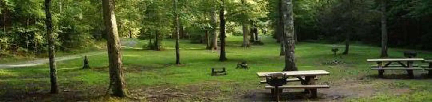
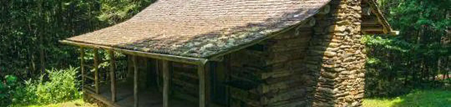
The Bald River Falls area of the Cherokee National Forests has a lot to offer. The Indian Boundary Recreation Area is also located there. Fishing for brown, rainbow and brook trout is excellent in the remote wilderness surrounding three rivers. The National Scenic Byway Cherohala Skyway is a 43-mile route that winds between Tellico Plains, Tennessee and Robbinsville, North Carolina. The Donley Cabin is a historic place to stay and check out the structures of the CCC. The trail leads to the area of the Benton MacKaye. The Indian Boundary Recreation Area is just off the Cherohala Skyway. The map of Tellico River Area is called the Tellico River Area Guide.
Reviews
No reviews yet
Be the first to share your experience and help others plan their visit.
Amenities
Flush Toilets
Picnic Tables
Pet Policy
No pets allowed
Campground Rules
- No campfires allowed
Within ~30 miles
Trails near Tellico River Area
Trail
Panther Branch Trail
Tennessee
4.1 mi696 ftgain
Moderate
Trail
Bald River Trail
Tennessee
8.9 mi1,998 ftgain
Difficult
Trail
North River Trail
Tennessee
1.2 mi423 ftgain
Moderate
Trail
Laurel Branch Trail
Tennessee
5.2 mi1,309 ftgain
Moderate
Trail
Whigg Ridge Trail
Tennessee
6.4 mi2,290 ftgain
Difficult
Trail
Sycamore Trail from Pheasant Field to Mud Gap Road
North Carolina
11.3 mi2,490 ftgain
Difficult
Nearby Campgrounds

Spot an error in our data on Tellico River Area?