State Park
Snowy Mountain Range
Geyser, MT
Pricing varies — check with the operator
Verify with the state park system
State parks set their own rules and reservation systems. Fire bans, road closures, and operating dates change seasonally — check the state park website before traveling.
Pricing
Pricing varies — check with the operator0.0
0 Reviews
Official sources & verification
Managed by State Park
Verify by phone or mail
- Address:Geyser, MT
About
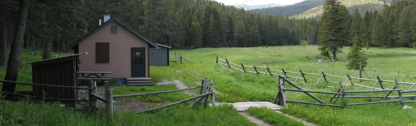
[](http://www.fs.usda.gov/Internet/FSE_MEDIA/fseprd499859.jpg) The Snowies is the farthest east geographic area and is primarily in Fergus County with smaller portions in Golden Valley County. The geographic area includes both the Big and Little Snowy Mountain ranges. The Snowies display prominent changes in elevation accentuated by surrounding grassland, high plains, and foothill savanna. The Little Snowy Mountain range has a rich cultural history, beginning with first peoples then homesteading. Today, large ranches maintain the open character of the area. Pine Grove Cemetery continues to be the final resting place for early Euro-American occupants. The Little Snowies are separated from the Big Snowies by a subtle break in topography. It is characterized by foothills that are partially forested with mostly ponderosa pine. In general, the country is semi-arid and dominated by grassy vegetation. Landform is rolling with slopes that are gentle to flat, except where creeks have dissected them. Creeks within the Little Snowies are small and often run dry during the summer months. The major drainages are Willow Creek and the North Fork of Pole Creek, both of which drain south to the Musselshell River. More information on the Snowy Mountains Brochure of hiking opportunities in the Crystal Lake area. Bears may frequent the area; keep all food out of sight in approved containers and remove all food from area after eating. Mandatory food storage is required.
Reviews
No reviews yet
Be the first to share your experience and help others plan their visit.
Pet Policy
No pets allowed
Campground Rules
- No campfires allowed
Within ~30 miles
Trails near Snowy Mountain Range
Trail
Plane Crash Trail
Montana
14.2 mi4,715 ftgain
Expert
Trail
Highwood Mountains Loop Trail
Montana
14.6 mi3,625 ftgain
Expert
Trail
Highwood Baldy Trail
Montana
6.1 mi3,209 ftgain
Difficult
Trail
Thain Creek Campground
Montana
3.0 mi787 ftgain
Moderate
Trail
Windy Mountain Loop
Montana
8.8 mi2,572 ftgain
Difficult
Trail
Sluice Boxes Trail
Montana
2.8 mi348 ftgain
Moderate
Hunt context
Hunting units around this campground
During hunting seasons, wear blaze orange and check regulations — see the Montana hunting page
Nearby Campgrounds

Spot an error in our data on Snowy Mountain Range?