
1 / 4
State Park
Juniper Lake Group
Lassen Volcanic National Park · MINERAL, CA
Verify with the state park system
State parks set their own rules and reservation systems. Fire bans, road closures, and operating dates change seasonally — check the state park website before traveling.
Pricing
Check official pricing0.0
0 Reviews
Official sources & verification
Managed by State Park
Managing agency
- Lassen Volcanic National Park — official page
Park unit page with alerts and visitor information.
Verify by phone or mail
- Address:MINERAL, CA
About
Overview
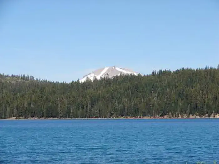
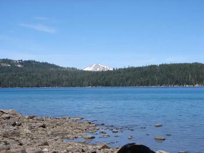
Juniper Lake Group Campground (elevation 6,800 feet) is a remote, rustic facility in the southeastern part of Lassen Volcanic National Park. It is on the eastern shore of Juniper Lake, a popular swimming spot, and offers a fantastic view of Lassen Peak, the largest volcano in the park, towering at 10,457 feet.Recreation
The main trailheads for Horseshoe Lake, Snag Lake and the interior of the park are within the facility. The Mount Harkness Trail ascends to a historic fire tower that is still in use. Juniper Lake is popular for canoeing, kayaking and swimming; Motorized boating is not permitted.Facilities
This is a tent-only facility with two group sites. Drinking water is not available. It is connected to the rest of Juniper Lake Campground, which is all first-come, first-served. Access is via a 13-mile road (seven miles gravel, six miles roughly paved). For more information visit Campgrounds of Lassen Volcanic.Natural Features
The national park is known for its volcanic history, as well as its diversity of plants and animals. It contains 300 active volcanic domes and many hydrothermal features, such as mud pots and steam vents, some of which are close to the campground. Lassen Peak is the southernmost active volcano in the Cascades, and the second-most recent volcano to erupt in the lower 48 of the United States before Mount Saint Helens in 1980.
Lassen National Park boasts over 700 species of flowering plants and 250 species of vertebrates, including birds, mammals, reptiles and fish. The park is at the junction of the Cascade Mountains, the Sierra Nevada Mountains and the Great Basin, thus providing many unique habitats.
Directions:
From the Red Bluff (I.5), drive east on state HWY 36 approximately 70 miles to Chester. Turn left at fire station immediately after crossing Feather River Bridge (watch for National Park Service sign on right) continue approximately 13 miles follow signs to Juniper Lake Campground and Group Campsite Area. Campground access is via paved and dirt road, last 6 miles is narrow, rough and dusty dirt road.
Reviews
No reviews yet
Be the first to share your experience and help others plan their visit.
Pet Policy
No pets allowed
Campground Rules
- No campfires allowed
Individual Sites (2)
In this park
Trails at Lassen Volcanic National Park
Within ~30 miles
Trails near Juniper Lake Group
Trail
Mount Harkness Loop Trail
California
5.7 mi1,640 ftgain
Difficult
Trail
Juniper Lake to Butte Lake Loop
California
22.0 mi5,584 ftgain
Expert
Trail
Juniper Lake, Cinder Cone, Red Cinders Loop
California
23.8 mi5,394 ftgain
Expert
Trail
Jakey Lake Trail
California
5.9 mi1,175 ftgain
Moderate
Trail
Juniper Lake Loop Trail
California
6.8 mi1,220 ftgain
Moderate
Trail
Terminal Geyser & Boiling Springs Lake
California
5.7 mi1,319 ftgain
Moderate
Hunt context
Hunting units around this campground
During hunting seasons, wear blaze orange and check regulations — see the California hunting page
Nearby Campgrounds

Spot an error in our data on Juniper Lake Group?