BLM
Cache Creek Natural Area
Verify with the local BLM field office
BLM site amenities, road access, and fire restrictions are managed by the local field office. Conditions change with weather and season — confirm before traveling.
Pricing
Check official pricing0.0
0 Reviews
Official sources & verification
Managed by Bureau of Land Management
Source of truth
- Agency source page
The page our published rules and notes are derived from.
Managing agency
- Berryessa Snow Mountain National Monument — official page
Park unit page with alerts and visitor information.
Verify by phone or mail
- Operator:(707) 468-4000
- Email:BLM_CA_Web_UK@blm.gov
About
OverviewThis secluded, hilly expanse of oak woodlands, grasslands, and chaparral is a combination of over 70,000 acres of BLM managed lands and 4,700 acres of State and County lands. The Natural Area is traversed by Cache Creek, with its year-round water flow. Elevation ranges from 3200 feet atop Brushy Sky High, down to 600 feet in the eastern end of Cache Creek along State Route 16. Showcasing the area is about 35 miles of the main fork of Cache Creek and 2.5 miles of the north fork.The Cache Creek Natural Area is a primitive area, closed to motorized vehicles. There are no developed campgrounds or facilities. Non-hunting (target) shooting is not allowed. Instead, the area is managed to improve habitat for wildlife and rare plants, to protect cultural resource values, and to offer primitive recreation opportunities, including wildlife viewing, river running, hiking, equestrian use, hunting and fishing. On October 17, 2006, President George W. Bush signed the Northern California Coastal Wild Heritage Act, designating approximately 27,245 acres within the Cache Creek Natural Area (CCNA) as the Cache Creek Wilderness Area. As a result of this designation, bicycles are not permitted within the designated Wilderness Area. Redbud Trail: From Interstate 5 at Williams, take Highway 20 west about 29 miles to the North Fork Cache Creek/Redbud Trailhead. The trailhead provides parking, maps and information for hiking and equestrian access.
(Or: From Clearlake Oaks, travel east on State Highway 20 for 8 miles to the trailhead.Judge Davis Trail: From Interstate 5 at Williams, take Highway 20 west about 20 miles to mile marker 46.07. There is a parking lot on the south side of the highway. The trail parallels Highway 20 for the first 80 yards or so, then cuts back into the hills.
(Or: From Clearlake Oaks, travel east on State Highway 20 for 17 miles to the trailhead.)Cache Creek Ridge Trail: This trail can be accessed from two points.
Judge Davis Trailhead: From Interstate 5 at Williams, take Highway 20 west about 20 miles to mile marker 46.07. There is a parking lot on the south side of the highway. (Or: From Clearlake Oaks, travel east on State Highway 20 for 17 miles to the trailhead.)
Highway 16: From Interstate 5 at Williams, take State Highway 20 west for about 19 miles to its junction with State Highway 16. Travel south on Highway 16 for 7.0 miles to confluence of Bear Creek and Cache Creek. Limited parking is available on the west side of Hwy 16 at BLM gate. (Or: from Clearlake Oaks, go east on State Highway 20 to Highway 16 intersection, then follow directions above.)Cowboy Camp Loop Trail: From Interstate 5 at Williams, take State Highway 20 west for about 19 miles to its junction with State Highway 16. Travel south on Highway 16 for 1 mile. Parking lot is on the right. (Or: from Clearlake Oaks, go east on State Highway 20 to Highway 16 intersection, then follow directions above.)
Reviews
No reviews yet
Be the first to share your experience and help others plan their visit.
Within ~30 miles
Trails near Cache Creek Natural Area
Brushy Sky High Trail
California
4.3 mi1,883 ftgain
TrailDifficulty: Difficult
Cache Creek Ridge - Judge Davis Trail Connector
California
1.1 mi131 ftgain
TrailDifficulty: Easy
Redbud Trail
California
4.3 mi427 ftgain
TrailDifficulty: Moderate
Cache Creek Ridge Trail
California
4.4 mi387 ftgain
TrailDifficulty: Moderate
Ridge Spur Connector
California
0.3 mi
Trail
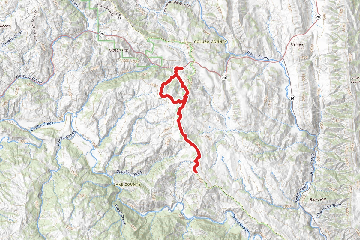
Cache Creek Wilderness Trail
California
9.8 mi2,198 ftgain
TrailDifficulty: Difficult
Hunt context
Hunting unit around this campground
During hunting seasons, wear blaze orange and check regulations — see the California hunting page
Nearby Campgrounds
Spot an error in our data on Cache Creek Natural Area?