State Park
Barren Fork Horse Camp
Stearns, KY
Pricing varies — check with the operator
Verify with the state park system
State parks set their own rules and reservation systems. Fire bans, road closures, and operating dates change seasonally — check the state park website before traveling.
Pricing
Pricing varies — check with the operator0.0
0 Reviews
Official sources & verification
Managed by State Park
Verify by phone or mail
- Address:Stearns, KY
About
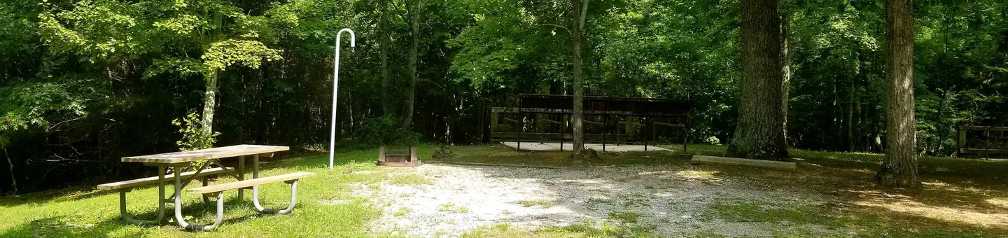
Barren Fork Horse Camp Map The Barren Fork Horse Camp, located on Stearns District of the Daniel Boone National Forest, is a popular campground for horseback riders who enjoy the forest setting. Several interconnecting trails provide miles of riding pleasure. Send Your Photos Make this page look nicer by submitting photos of your visit to Barren Fork Horse Camp. Learn more... View Guide with Map The campground offers 41 campsites that accommodate horse trailers and RVs up to 35 feet. Visitors can also enjoy fishing at a nearby pond. A picnic shelter at the campground is available for group-use. Area Trails: Arabian 622 (4 miles) and Canter 625 (2.75 miles) are close to the horse camp and connect with other trails such as the Sheltowee Trace National Recreation Trail Section 30(10 miles), Belgian 624 (3 miles), Flat Rock Ridge 616(1.5 miles), Draft 617 (.75 miles), Indian Creek 626 (1.75 miles) and North Flat Rock 627 (3 miles). Site history: The Barren Fork Horse Camp was once the site of a coal mining town operated by the Barren Fork Mining and Coal Company. The mining activities occurred from 1881 to 1935, producing what was considered some of the best quality low-sulfur coal in McCreary County at the time. Read more about Barren Fork Coal Camp (pdf) Nearby Facilities: Barren Fork Picnic Area
Reviews
No reviews yet
Be the first to share your experience and help others plan their visit.
Amenities
Flush Toilets
Potable Water
Accessible
Picnic Tables
Fire Rings
Trash Service
Cell Service
Pet Policy
Pets allowed on leash
Campground Rules
- Campfires generally permitted — verify current fire restrictions before lighting
Within ~30 miles
Trails near Barren Fork Horse Camp
Trail
Barren Fork Accessible Heritage Trail
Kentucky
0.6 mi59 ftgain
Easy
Trail
Indian Creek and North Flat Rock Trail
Kentucky
6.9 mi1,204 ftgain
Moderate
Trail
Yahoo Falls Trail
Kentucky
4.2 mi856 ftgain
Moderate
Trail
Lick Creek Trail
Kentucky
3.2 mi1,030 ftgain
Moderate
Trail
Buffalo Canyon Trail
Kentucky
5.8 mi1,112 ftgain
Moderate
Trail
Natural Arch Loop
Kentucky
1.4 mi397 ftgain
Easy
Nearby Campgrounds

Spot an error in our data on Barren Fork Horse Camp?