Status unknown — verify before visiting
We don't have current condition data for this trail. Check with the land manager before you go.
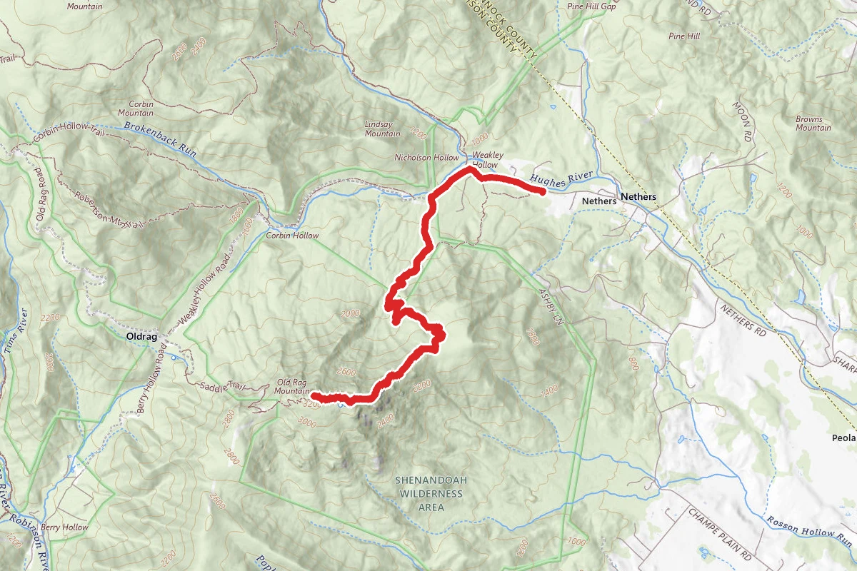
9.8 mi
Distance
2,648 ft
Elev. Gain
4h 29m
Est. Time
Out & Back
Route Type
Difficult
Difficulty
About This Trail
Imported descriptionTrail Conditions
Trail Conditions
We have no current condition data for this trail. Check with the operator before you go, and submit a report below if you've been recently.
No recent condition reports. Be the first to share what you see on the trail.
Elevation Profile
Trail Details
- Route Type
- Out & Back
- Surface
- Dirt
Official sources & verification
We don't have curated agency sources for this trail in our cache yet. Outdoors is not the permitting authority — confirm conditions, permits, and access with the managing agency before you go. If you know who manages this trail, please tell us.
Reviews
No reviews yet
Be the first to share your experience and help others plan their visit.
Legacy import — verify before navigating
Path geometry came from our pre-launch legacy database. Routes have not yet been re-verified against the operator and may differ from the actual trail.
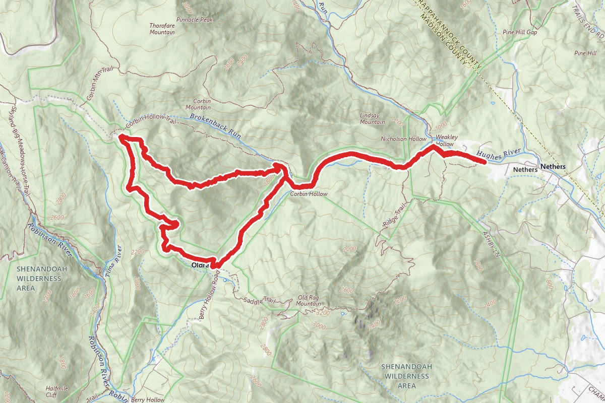
Nicholson Hollow to Corbin Cabin
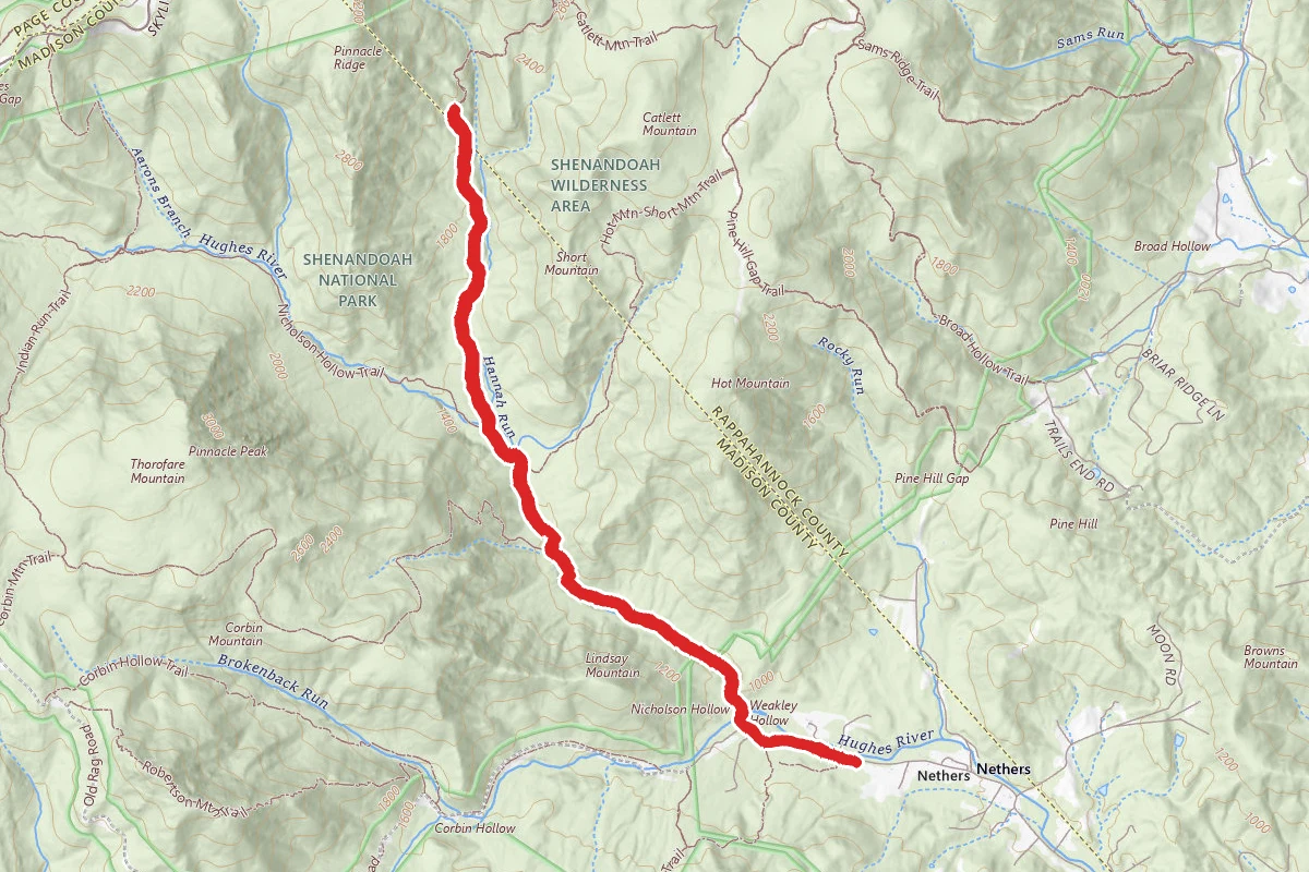
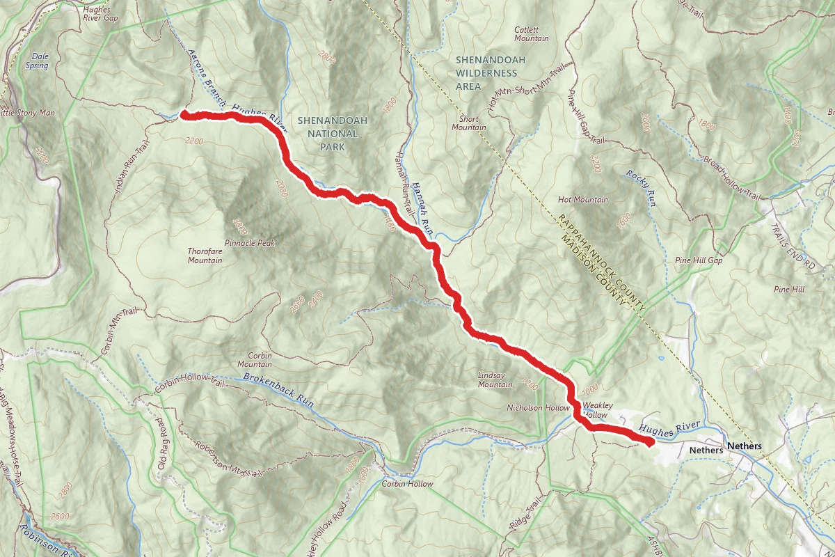
Nicholson Hollow and Hannah Run Trail
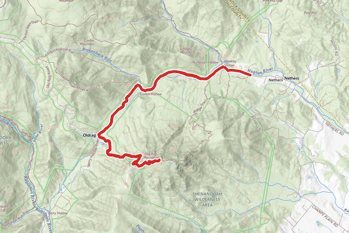
Robertson Mountain via Weakley Hollow and Old Rag Fire Roads
Ridge Trail to Old Rag Mountain
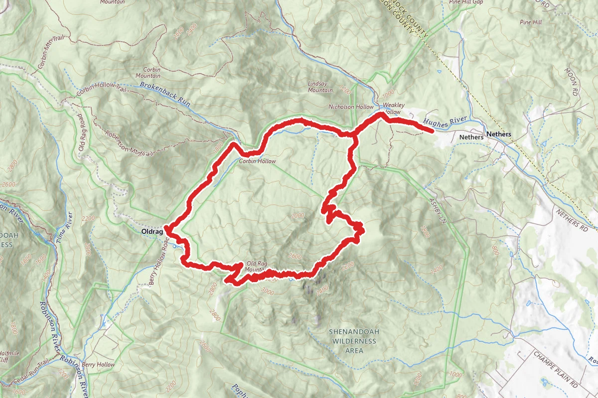
Old Rag Mountain Loop

Old Rag Mountain Loop
Stay nearby
Campgrounds near this trail
- Reservable
Shenandoah NP Backcountry - Old Rag Summit
2 mi away · VA
- Reservable
Graves Mountain Farm Campground
6 mi away · VA
- Reservable
Watercress Inn at Landon Farm
6.2 mi away · VA
- Reservable
Sawmill Cottage near Shenandoah National Park
6.2 mi away · VA
Pass Mountain Hut
7.5 mi away · VA
 Reservable
Big Meadows Campground - Shenandoah (va)
8.6 mi away · VA
Similar length
Similar trails in Virginia
Old Rag Mountain Loop
Virginia
Old Rag Mountain Loop
Virginia
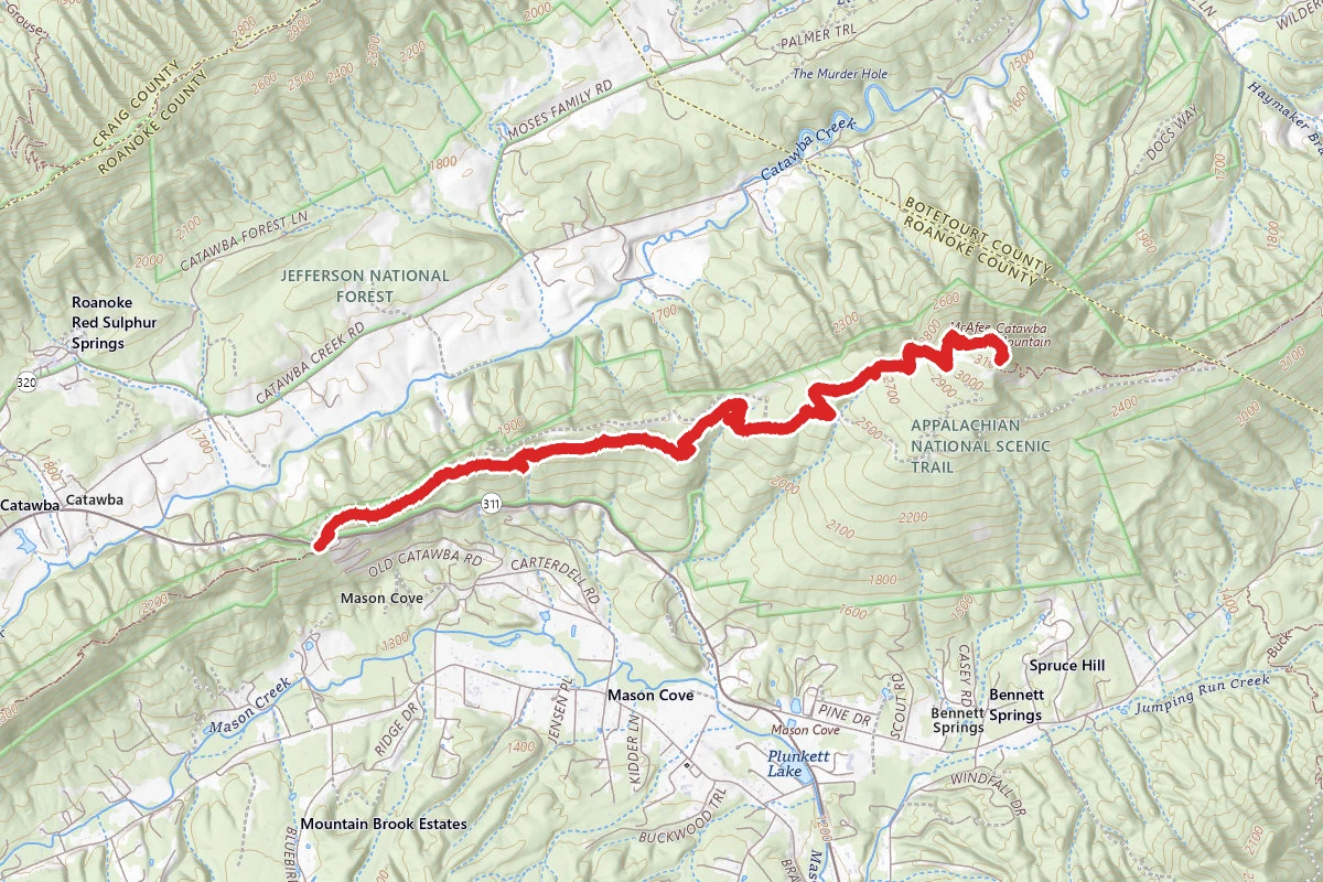
McAfee Knob via Appalachian Trail
Virginia
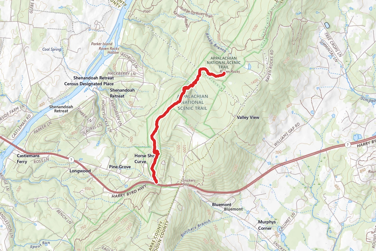
Raven Rocks via Appalachian Trail
Virginia
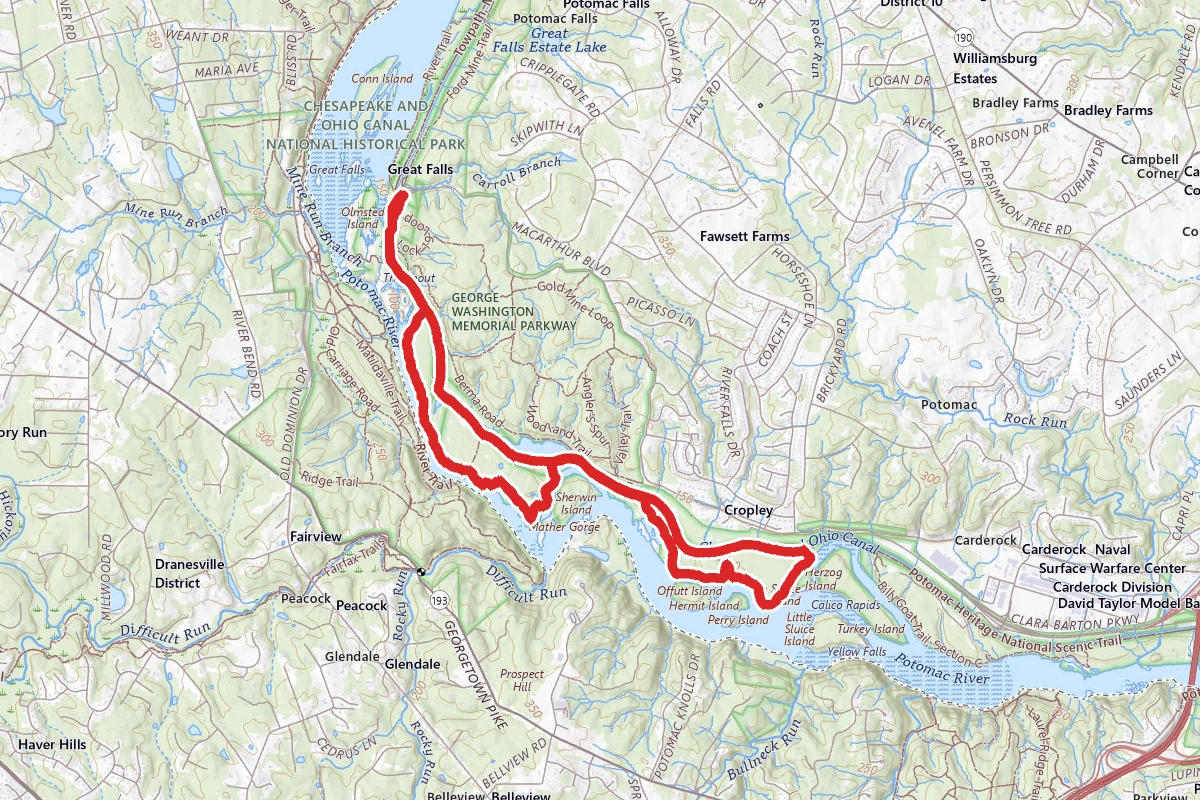
Billy Goat and Chesapeake and Ohio Canal Trail Loop
Virginia
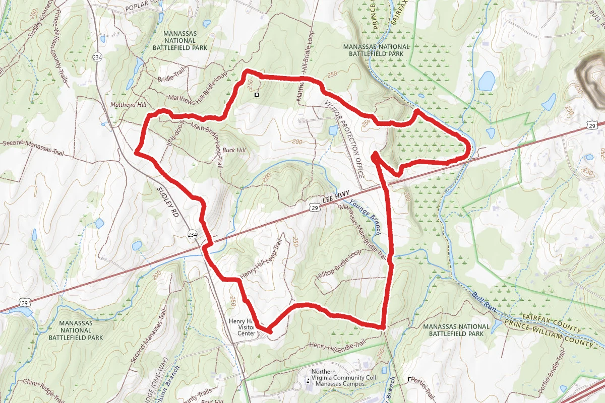
First Battle of Manassas Trail Loop
Virginia