1 / 3

Nat'l Recreation Area
Official sources & verification
Managed by National Recreation Area
Source of truth
- Agency source page
The page our published rules and notes are derived from.
Managing agency
- National Recreation Area
Find offices, alerts, and current orders for this agency.
Verify by phone or mail
- Operator:916-941-3101
- Email:BLM_CA_Web_ML@blm.gov
- Address:CA
About
Imported descriptionRemember your OUTDOOR ETHICS when enjoying your public lands. Please RECREATE RESPONSIBLY.
Overview
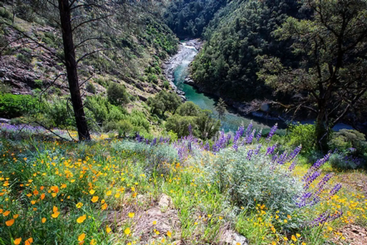
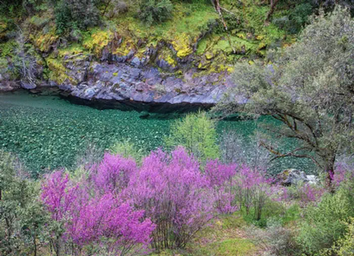
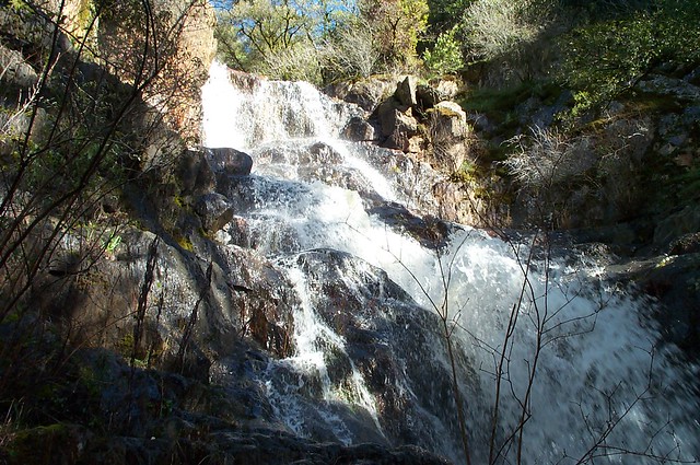
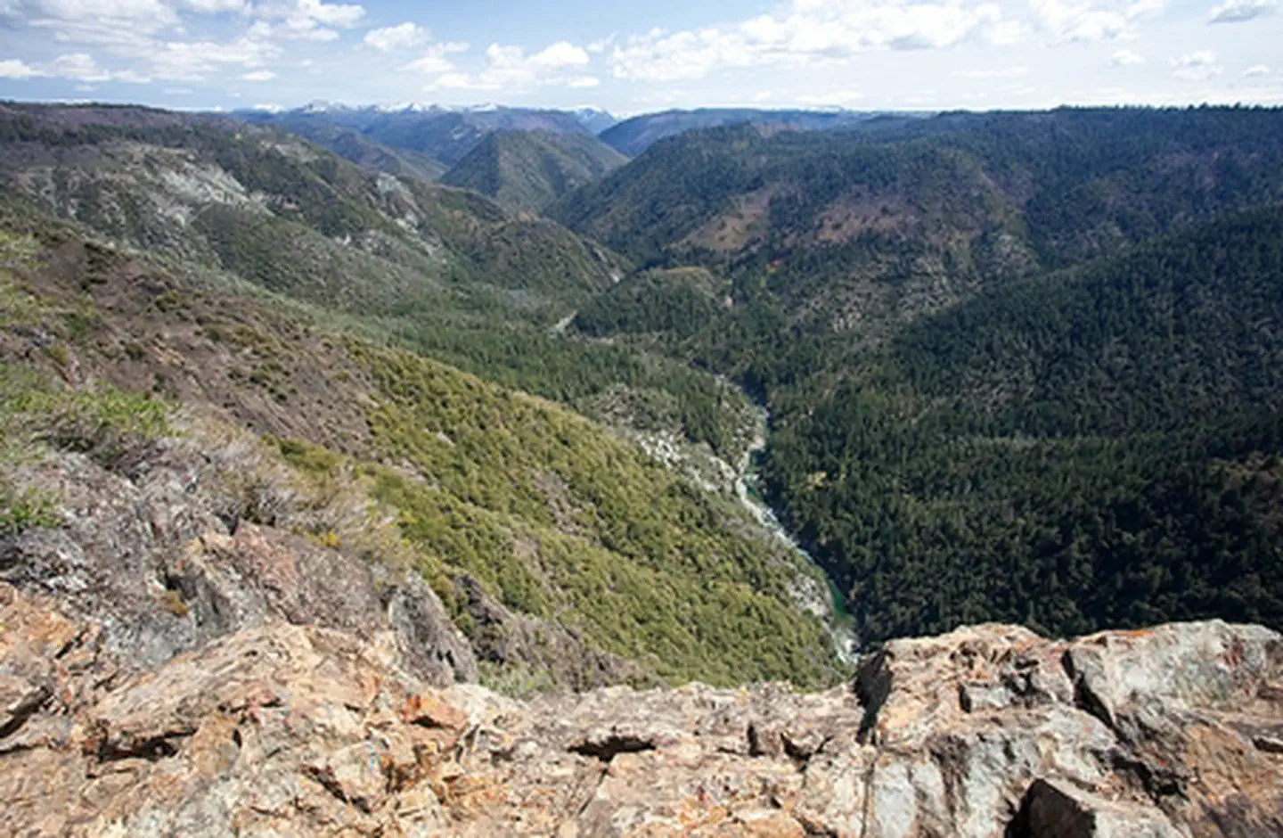
The North Fork American River lies within a deeply incised canyon with the river itself being 2,000 feet to 2,400 feet below the canyon rim. This segment of the river is a Congressionally-designated Wild River and a State-designated Wild Trout Stream. Features include scenic, recreation, cultural and water quality values. Ponderosa pine forest occupies much of the area with some steep hillsides occupied by oak woodland and chaparral. Historical features along the North Fork include the Stevens Trail, American View, and Cape Horn.
Visitors to the North Fork enjoy a semi-wilderness setting. River access is possible at the lower end near the Colfax-Iowa Hill bridge, or by a strenuous descent by trail from a few locations along the canyon rim. Trails leading to the North Fork are used by hikers, backpackers, pack and saddle stock users, gold panners, and by whitewater recreationists gaining access to the river at Euchre Bar. Whitewater rafting, hiking, backpacking, swimming, recreational gold panning, fishing, nature study and picnicking are among the most popular activities.
Whitewater recreation through this segment of river is Class V which means experts only, and only under certain conditions of flow. Typically, the whitewater run of the North Fork Wild River segment termed the “Giant Gap Run” is possible only during the spring and early summer.
Please note: This river is not recommended for the inexperienced boater.
Put-In: Euchre Bar - a two (2) mile walk from the trailhead
Take-Out: Iowa Hill-Colfax Bridge
River Class: IV-V
RECREATION SITE:
Stevens Trail
Hunting and Shooting Info - North Fork American River SRMA
All public lands located in MDM, T. 15 N., R. 9 E., Sec. 26 are CLOSED to target shooting.
Hunting is allowed, in accordance with State law, unless a specific area is signed CLOSED by the BLM.
NOTE: All California game species are regulated by the California Department of Fish and Wildlife (CDFW). Rules, regulations, and seasons are controlled by CDFW, and it is the hunter’s responsibility to verify and comply with proper species, seasons, zones, regulations, and legal location if hunting on public lands.
FGC 3004 – It is unlawful for any person to hunt or discharge while hunting, any firearm or other deadly weapon within 150 yards of any occupied dwelling house, residence, or other building or any barn or other outbuilding used in connection therewith. The 150 yard area is a "Safety Zone."
Helpful Links:
Where to Shoot
California Department of Fish & Wildlife
Hunting, Fishing and Recreational Shooting on Public Lands, BLM California
Return To: BLM, Mother Lode Field Office
Source: recreation.gov
From Wikipedia
The North Fork American River is the longest branch of the American River in Northern California. It is 88 miles (142 km) long from its source at the crest of the Sierra Nevada, near Lake Tahoe, to its mouth at Folsom Lake northeast of Sacramento. Prior to the construction of Folsom Dam the river was about 9 miles (14 km) longer making for a total length of 97 miles (156 km).
Source: Wikipedia — text licensed CC BY-SA 4.0. Verify alerts and operational details with the managing agency below.
Reviews
No reviews yet
Be the first to share your experience and help others plan their visit.
Hunting in this park
Hunting is generally prohibited in this National Park Service unit
Verify current park-specific rules with the National Park Service before planning any hunt. See NPS regulations
Within ~100 miles
Parks near North Fork American River
Nat'l Recreation Area
Park
Sugar Pine Reservoir
California
Nat'l Recreation Area
Park
South Yuba Recreation Area
California
National Forest
Park
Tahoe National Forest
California
1,362 sq mi

Nat'l Recreation Area
Park
Harry L. Englebright Lake
California
Nat'l Recreation Area
Park
American River North Middle South Forks
California
National Forest
Park
Eldorado National Forest
California
1,229 sq mi
Same state
More parks in California

Featured
National Park
Park
Death Valley National Park
California
5,326 sq mi
Featured
National Forest
Park
Inyo National Forest
California
2,974 sq mi

Featured
National Park
Park
Joshua Tree National Park
California
1,242 sq mi

Featured
National Park
Park
Redwood National and State Parks
California
217 sq mi

Featured
National Park
Park
Sequoia National Park
California
631 sq mi
Featured
National Forest
Park
Shasta-Trinity National Forest
California
3,438 sq mi

Featured
National Park
Park
Yosemite National Park
California
1,190 sq mi
Nat'l Recreation Area
Park
California
Spot an error in our data on North Fork American River?