No photos yet
Official sources & verification
Managed by National Recreation Area
Source of truth
- Agency source page
The page our published rules and notes are derived from.
Managing agency
- National Recreation Area
Find offices, alerts, and current orders for this agency.
Verify by phone or mail
- Operator:435-542-3461
- Email:utrfmail@blm.gov
- Address:UT
About
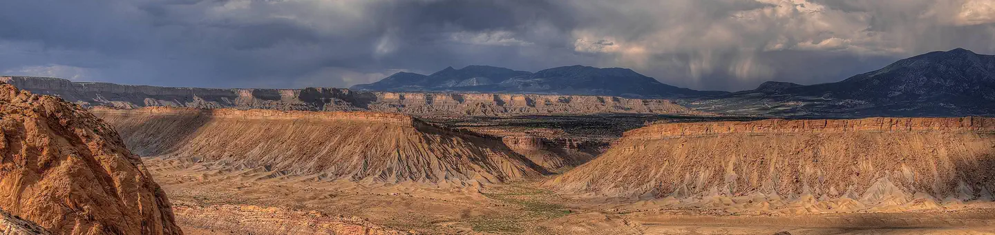
Imported descriptionThe WSA is dominated by Mt. Ellsworth and Mt. Holmes, two mountain peaks which are bodies of igneous rocks that intruded and deformed overlying sedimentary layers. In the northern and eastern portions of the area there are high, narrow mesas cut by deep canyons. Almost half the WSA is bare rock outcrop. Blackbrush and other shrubs are the dominant vegetative type in the remainder of the area.
Source: recreation.gov
From Wikipedia
The Little Rocky Mountains, also known as the Little Rockies, are a group of buttes, roughly 765 km2 in area, located towards the southern end of the Fort Belknap Indian Reservation in Blaine County and Phillips County in north-central Montana. Their highest summit is Antoine Butte.
Source: Wikipedia — text licensed CC BY-SA 4.0. Verify alerts and operational details with the managing agency below.
Reviews
No reviews yet
Be the first to share your experience and help others plan their visit.
Hunting in this park
Hunting is generally prohibited in this National Park Service unit
Verify current park-specific rules with the National Park Service before planning any hunt. See NPS regulations
Within ~100 miles
Parks near Little Rockies
Same state
More parks in Utah

Featured
National Park
Park
Arches National Park
Utah
120 sq mi

Featured
National Park
Park
Bryce Canyon National Park
Utah
56 sq mi

Featured
National Park
Park
Zion National Park
Utah
230 sq mi

Nat'l Recreation Area
Park
18 Road - North Fruita Desert
Utah

Nat'l Recreation Area
Park
Anasazi State Park Museum
Utah

Nat'l Recreation Area
Park
Antelope Island State Park
Utah
recreation area
Park
Armijo Route
Utah
National Forest
Park
Ashley National Forest
Utah
2,160 sq mi
Spot an error in our data on Little Rockies?