Official sources & verification
Managed by Recreation Area
Source of truth
- Agency source page
The page our published rules and notes are derived from.
Verify by phone or mail
- Operator:(208) 437-3133
- Address:WA
About
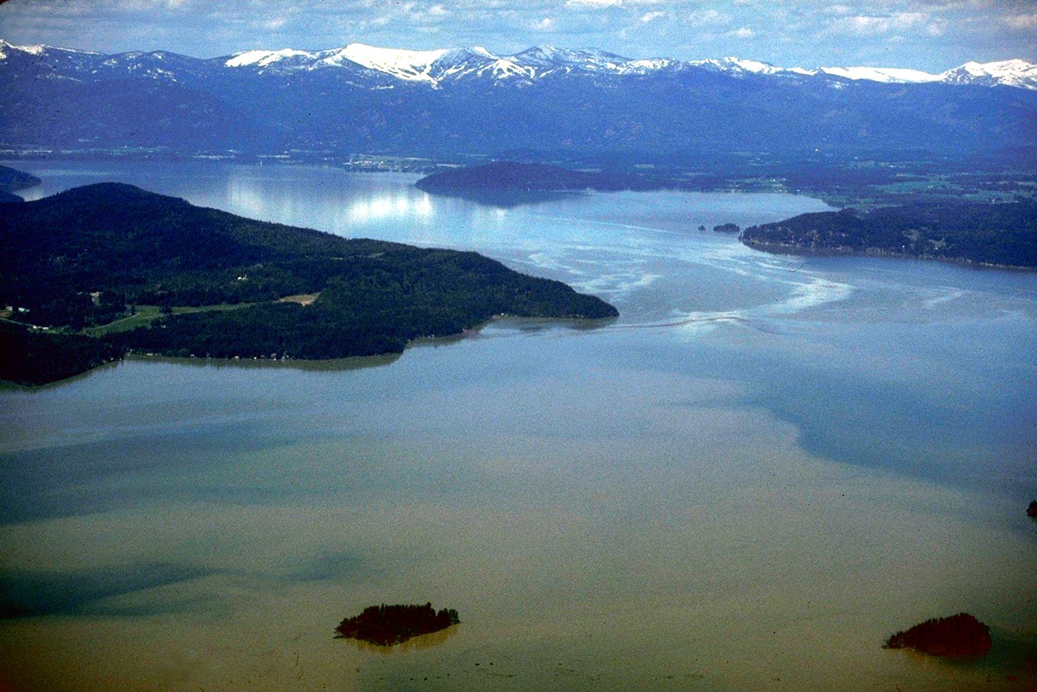
Lake Pend Oreille in the northern Idaho Panhandle is the largest lake in the U.S. state of Idaho and the 38th-largest lake by area in the United States, with a surface area of 148 square miles (380 km2). It is 69 kilometres (43 mi) long, and 1,152 feet (351 m) deep in some regions, making it the fifth-deepest in the nation and having a volume of 43,939,940 acre feet = 54 km3. The lake is fed by the Clark Fork River and the Pack River, and drains into the Pend Oreille River, as well as subsurfacely into the Spokane Valley–Rathdrum Prairie Aquifer.
It is surrounded by national forests and a few small towns, with the largest population on the lake at Sandpoint. The majority of the shoreline is non-populated and all but the southern tip of the lake is in Bonner County. The southern tip is in Kootenai County and is home to Farragut State Park, formerly the Farragut Naval Training Station during World War II, of which a small part is still active and conducts U.S. Navy acoustic underwater submarine research.
Source: Wikipedia — text licensed CC BY-SA 4.0. Verify alerts and operational details with the managing agency below.
Reviews
No reviews yet
Be the first to share your experience and help others plan their visit.
Hunting in this park
This park overlaps hunting units
During hunting seasons, wear blaze orange and check regulations — see the Idaho hunting page
Within ~100 miles
Parks near Lake Pend Oreille
Idaho Panhandle National Forests
Idaho
3,906 sq mi
ParkNational Forest
Kootenai National Wildlife Refuge
Washington
Parkwildlife refuge
Coeur d'Alene Lake
Washington
ParkNat'l Recreation Area
Selkirk Crest Wilderness Study Area
Washington
ParkNat'l Recreation Area
Popcorn Island
Washington
ParkNat'l Recreation Area
Kootenai National Forest
Montana
3,438 sq mi
ParkNational Forest
Same state
More parks in Washington

Featured
Mount Rainier National Park
Washington
369 sq mi
ParkNational Park

Featured
Olympic National Park
Washington
1,442 sq mi
ParkNational Park
Alpine Lakes Wilderness
Washington
616 sq mi
ParkWilderness Area
Banks Lake
Washington
ParkNat'l Recreation Area
Bennington Lake
Washington
ParkNat'l Recreation Area
Billy Clapp Lake
Washington
ParkNat'l Recreation Area

Billy Frank Jr. Nisqually National Wildlife Refuge
Washington
ParkNat'l Recreation Area
Boundary Reservoir Recreation Area
Washington
ParkNat'l Recreation Area
Spot an error in our data on Lake Pend Oreille?