No photos yet
Official sources & verification
Managed by National Recreation Area
Source of truth
- Agency source page
The page our published rules and notes are derived from.
Managing agency
- National Recreation Area
Find offices, alerts, and current orders for this agency.
Verify by phone or mail
- Operator:435-542-3461 and 435-636-3600
- Email:BLM_CA_Web_BI@blm.gov
- Address:UT
About
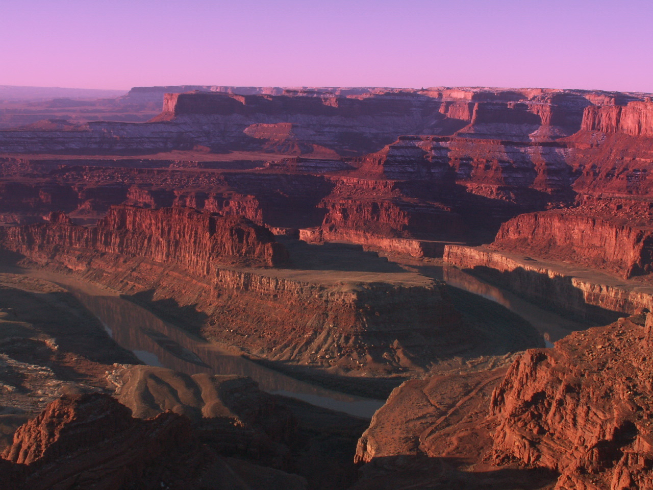
Imported descriptionThe area is elongated in a general curve around lower Horseshoe Canyon. The terrain in the study area consists of sandy flats and hilly areas between the canyons which are 1,000 feet deep where they join the Green River. The bottoms of the canyons are inaccessible in several places. The WSA includes approximately 20 miles of perennial streams, the majority of which is the Green River along the eastern boundary of the WSA. The canyons in the WSA expose many geologic strata. The upper reaches provide dramatic views of the twisted and carved character of the area including cliffs, knolls, alcoves, caves, and arches. Adjacent to the southwestern border and an extension of the Horseshoe Canyon drainage, are notable pictographs in the detached Horseshoe Canyon Unit of Canyonlands National Park. Within the Labyrinth Canyon drainage and WSA along the Green River is evidence of the early river explorers. A river register at Bowknot Bend records the passage of both famous and little known river runners.
Source: recreation.gov
Reviews
No reviews yet
Be the first to share your experience and help others plan their visit.
Hunting in this park
Hunting is generally prohibited in this National Park Service unit
Verify current park-specific rules with the National Park Service before planning any hunt. See NPS regulations
Within ~100 miles
Parks near Horseshoe Canyon (North)
Nat'l Recreation Area
Park
Jewell Tibbets Arch Trail
Utah
Nat'l Recreation Area
Park
Magnificent Seven (Mag 7) Trail System
Utah
Nat'l Recreation Area
Park
Whitewash Sand Dunes Open OHV Area and Trail System
Utah
State Park
Park
Dead Horse Point State Park
Utah

National Park
Park
Canyonlands National Park
Utah
527 sq mi
Nat'l Recreation Area
Park
Book Cliffs Mountain Browse
Utah
Same state
More parks in Utah

Featured
National Park
Park
Arches National Park
Utah
120 sq mi

Featured
National Park
Park
Bryce Canyon National Park
Utah
56 sq mi

Featured
National Park
Park
Zion National Park
Utah
230 sq mi

Nat'l Recreation Area
Park
18 Road - North Fruita Desert
Utah

Nat'l Recreation Area
Park
Anasazi State Park Museum
Utah
Nat'l Recreation Area
Park
Antelope Island State Park
Utah
recreation area
Park
Armijo Route
Utah
Nat'l Recreation Area
Park
Ashley National Forest
Utah
Spot an error in our data on Horseshoe Canyon (North)?