Nat'l Recreation Area
Official sources & verification
Managed by Bureau of Land Management
Source of truth
- Agency source page
The page our published rules and notes are derived from.
Managing agency
- Bureau of Land Management
Find offices, alerts, and current orders for this agency.
Verify by phone or mail
- Operator:702-515-5000
- Email:blm_nv_lvfo_goldbutte@blm.gov
- Address:NV
About
Imported descriptionOne of the first designated backcountry byways, the Gold Butte Back Country Byway travels through some of the most remote landscapes of southern Nevada.
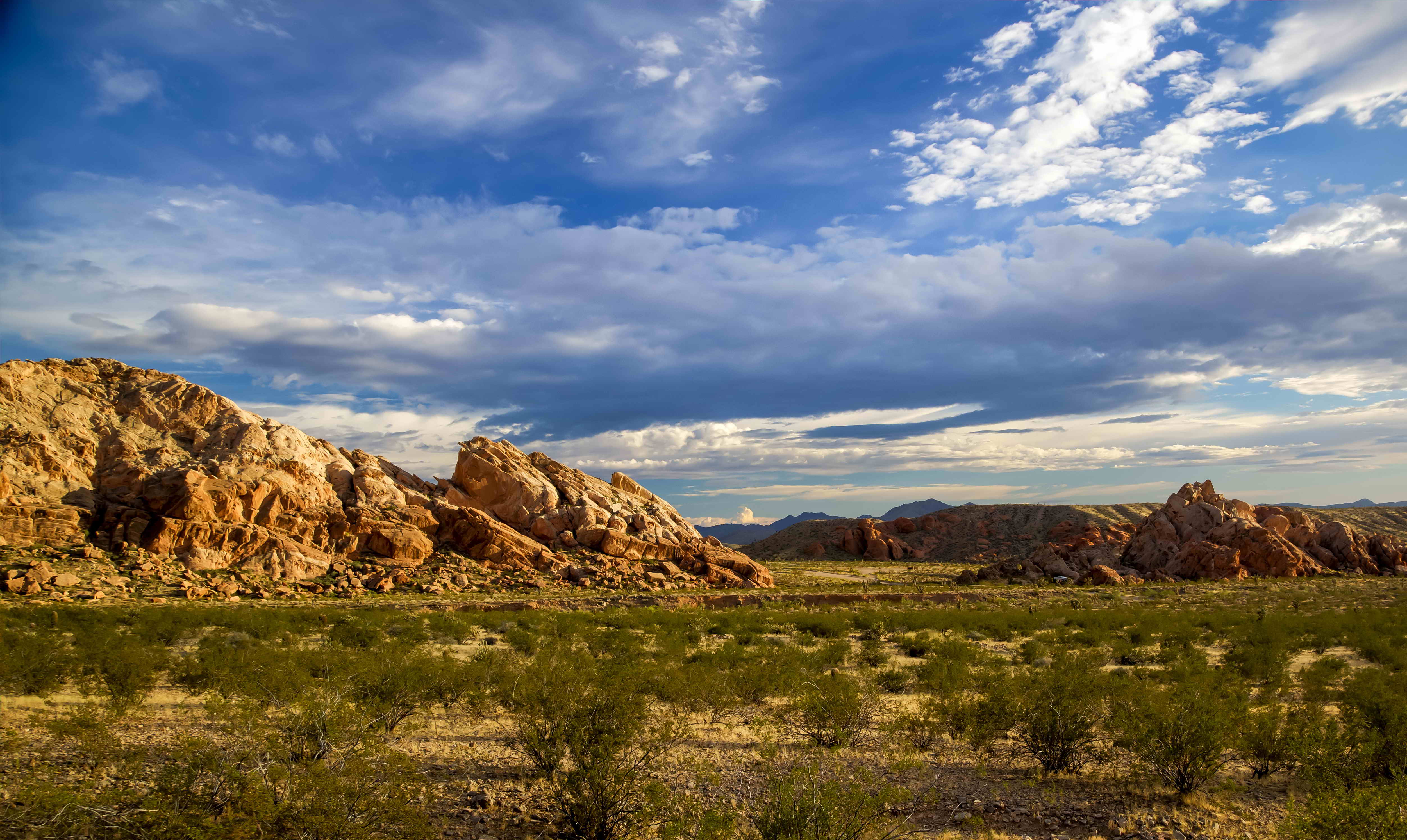
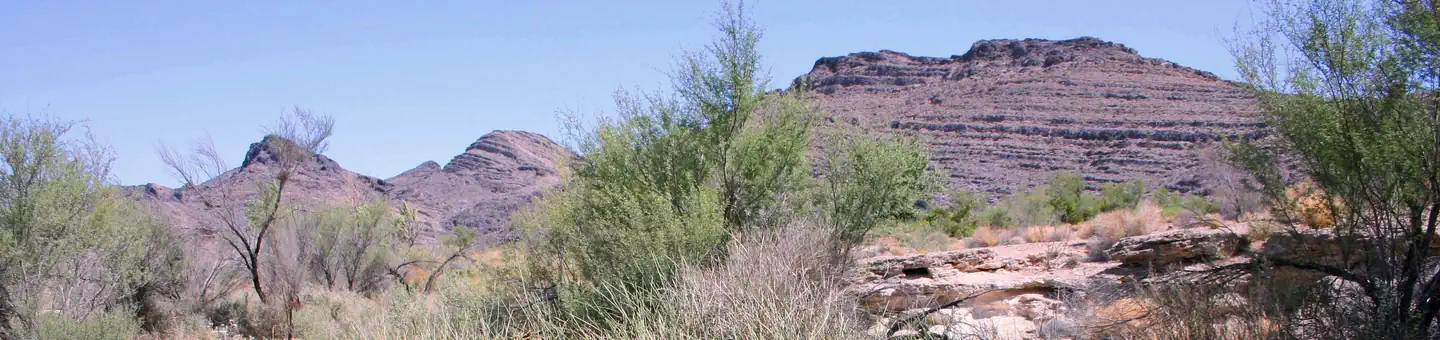
The Byway begins 90 miles northeast of Las Vegas and five miles south of Mesquite/Bunkerville on Interstate 15, exit 112. The 62-mile scenic loop is rugged and requires the use of sturdy tires and high-clearance vehicles. A drive on the Byway offers opportunities to observe desert wildlife, amazing sandstone formations, sinkholes, rock carvings, and vistas of adjacent Lake Mead and Valley of Fire. The historic mining town of Gold Butte, established in 1908, is along the route. The primary extractions from Gold Butte were copper, gold, lead and zinc. The last 20 miles of the byway (Gold Bute Wash Road and Mud Wash Road) should only be traveled by high-clearance vehicles. Primitive camping and hiking are available along the byway.
Along the Byway, at approximately 20 miles, you come to the Whitney Pocket area, a wall of sandstone decorated with various size pockets, shaped by millennia of water and wind erosion. As you venture further you will come across a 110-ft. sink hole called The Devil’s Throat. From here you can continue on the Byway where you may find amazing windswept rock formations, snowcapped mountains, and evidence of prehistoric and historic cultures.
Source: recreation.gov
From Wikipedia
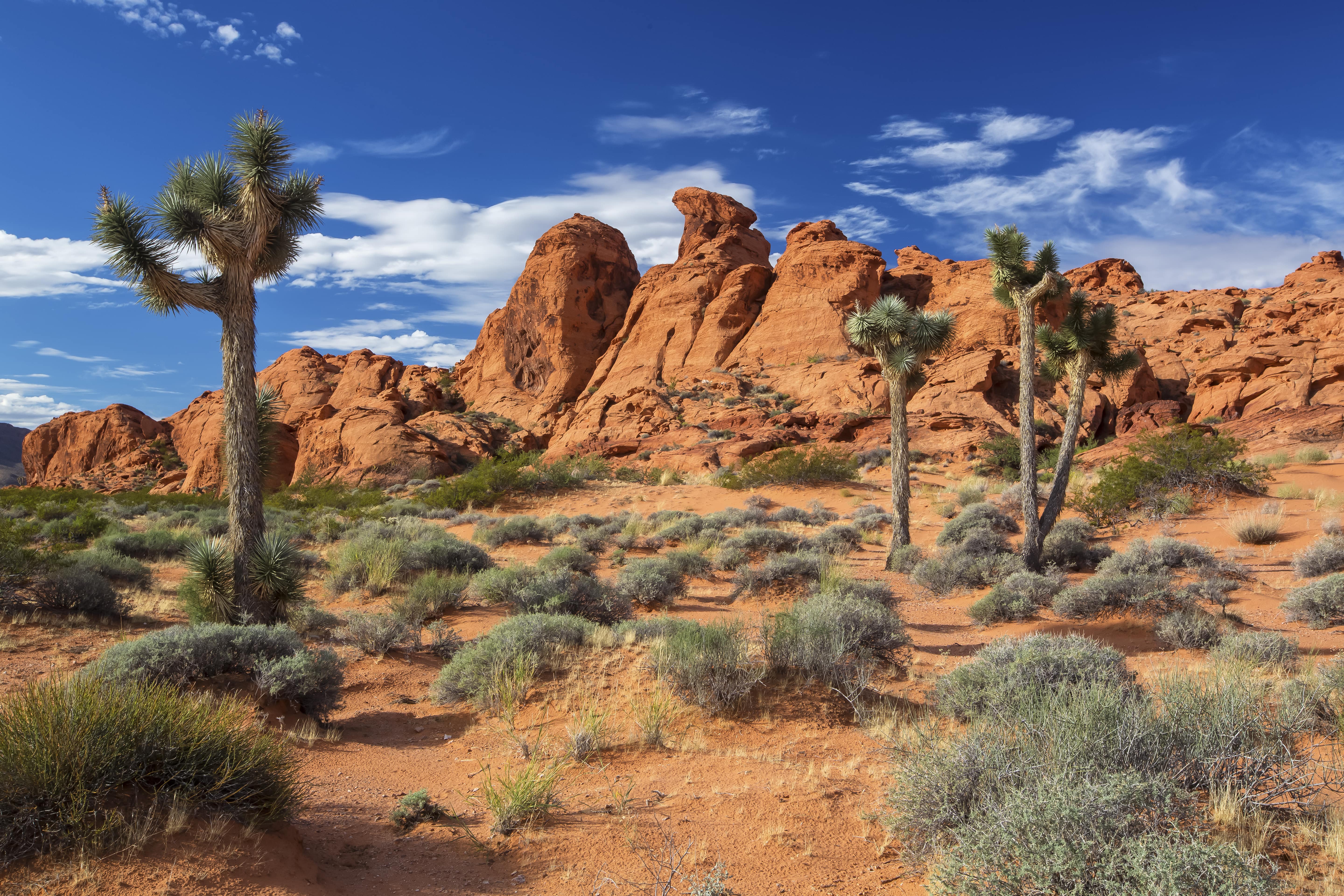
Little Finland is a scenic red rock area, located in a remote section of Clark County, Nevada, south of Mesquite, known for its red rock scenery and strangely-shaped, delicate rock formations. The landscape is similar to Valley of Fire State Park, which is about 20 miles (32 km) to the west, across Lake Mead. The rock formations are composed of red Aztec Sandstone, fossil sand dunes. Many of the features are small erosional fins, hence the name.
Source: Wikipedia — text licensed CC BY-SA 4.0. Verify alerts and operational details with the managing agency below.
Reviews
No reviews yet
Be the first to share your experience and help others plan their visit.
Hunting in this park
This park overlaps hunting units
During hunting seasons, wear blaze orange and check regulations — see the Nevada hunting page
Within ~100 miles
Parks near Gold Butte Back Country Byway
Nat'l Recreation Area
Park
Gold Butte National Monument
Nevada

Wilderness Area
Park
Paiute Wilderness
Nevada
Nat'l Recreation Area
Park
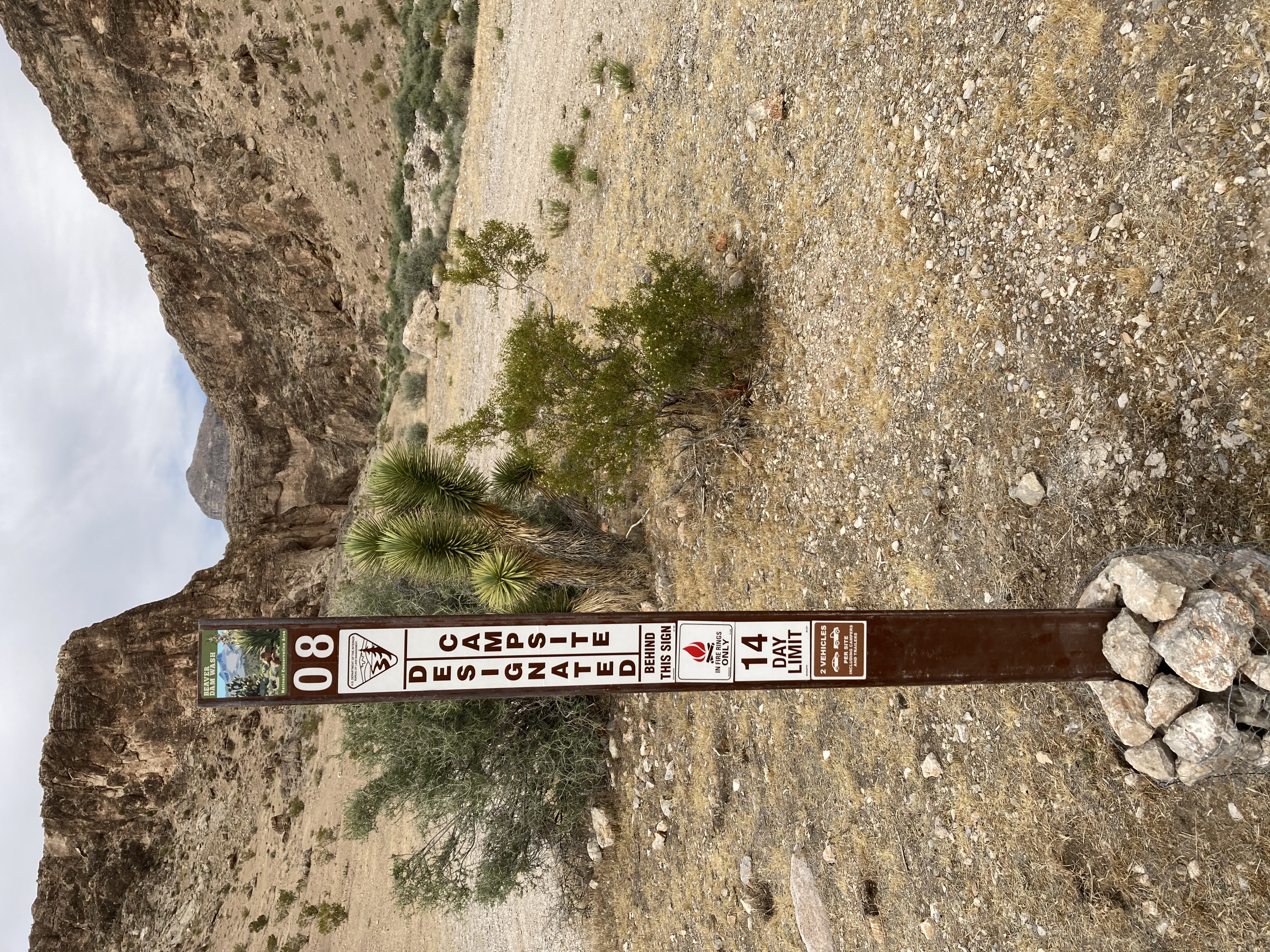
Beaver Dam Wash Designated Dispersed Camping Area
Nevada
Nat'l Recreation Area
Park
Moapa Valley National Wildlife Refuge
Nevada
Nat'l Recreation Area
Park
Sullivan Canyon Trail
Nevada
Nat'l Recreation Area
Park
Old Highway 91
Nevada
Same state
More parks in Nevada
Featured
National Forest
Park
Humboldt-Toiyabe National Forest
Nevada
9,828 sq mi
recreation area
Park
Afton Canyon
Nevada
Nat'l Recreation Area
Park
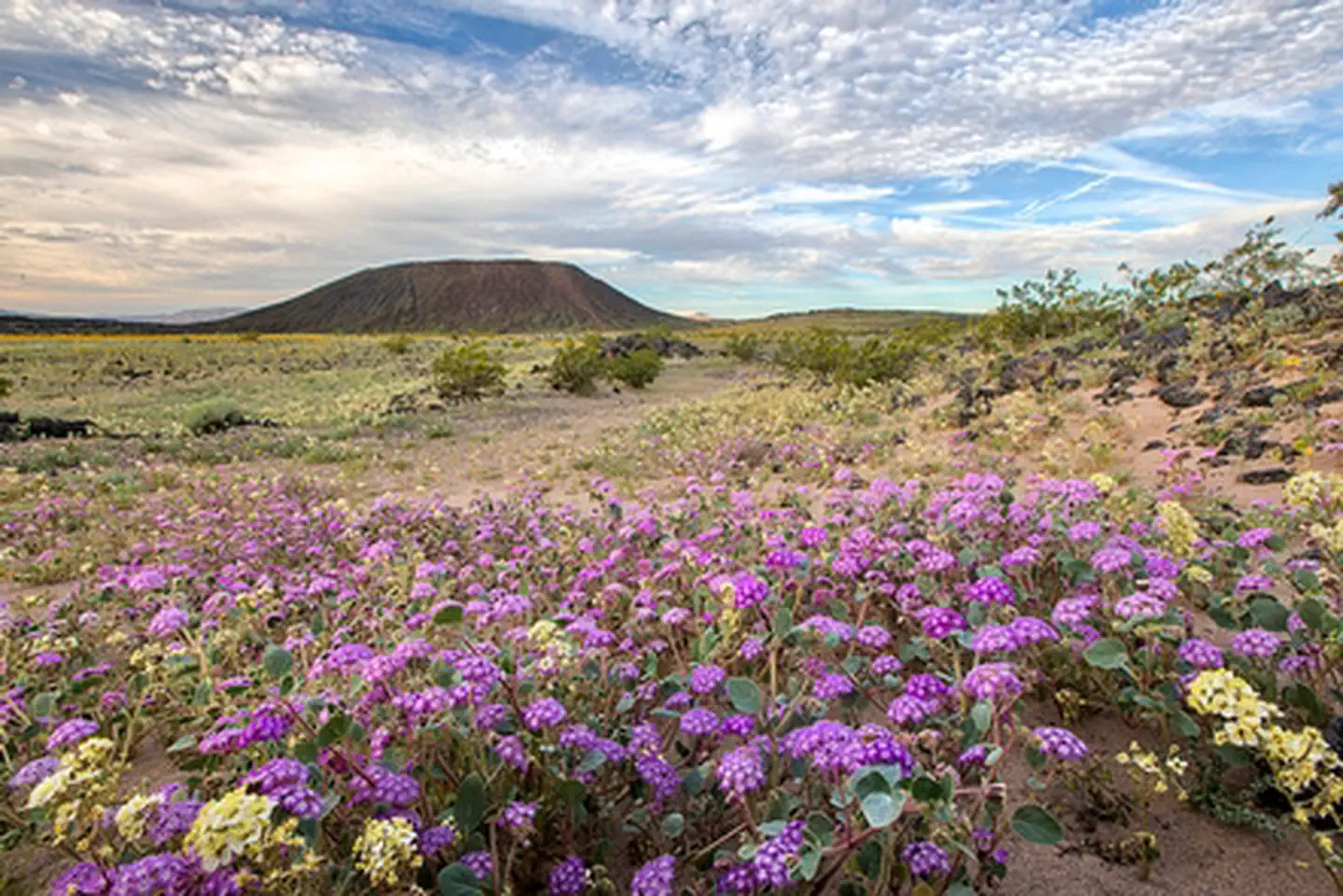
Amboy Crater National Natural Landmark
Nevada
Wilderness Area
Park
Arrow Canyon Wilderness
Nevada
Nat'l Recreation Area
Park
Arrowhead (Trails) Highway
Nevada
Nat'l Recreation Area
Park
Ash Meadows National Wildlife Refuge
Nevada
recreation area
Park
Barstow
Nevada
Wilderness Area
Park
Beauty Mountain Wilderness
Nevada
Spot an error in our data on Gold Butte Back Country Byway?